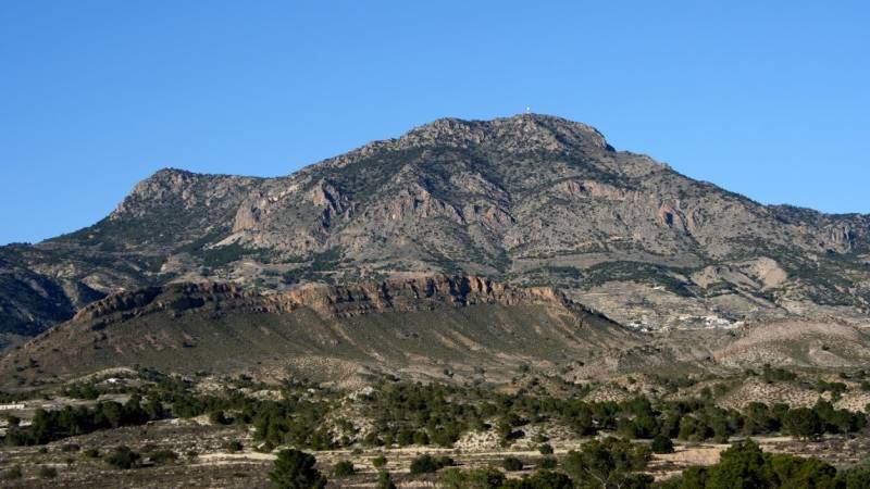
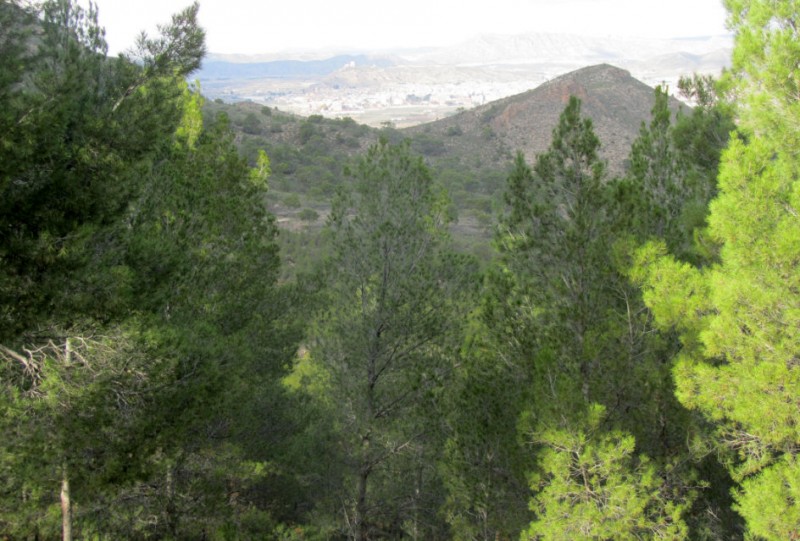
A protected Regional Park which has barely been altered by human activity over the millennia The Regional Park of the Sierra de la Pila is an area of 8,836 hectares in the north-east of the Region of Murcia, occupying parts of the municipalities of..
Read More
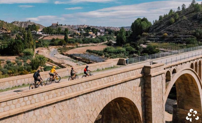
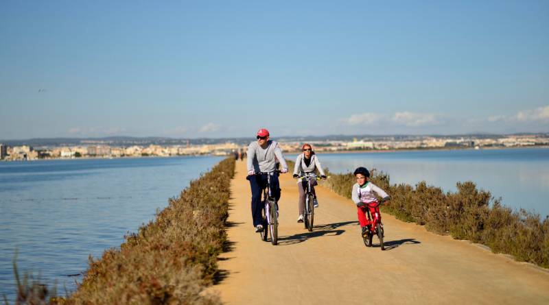
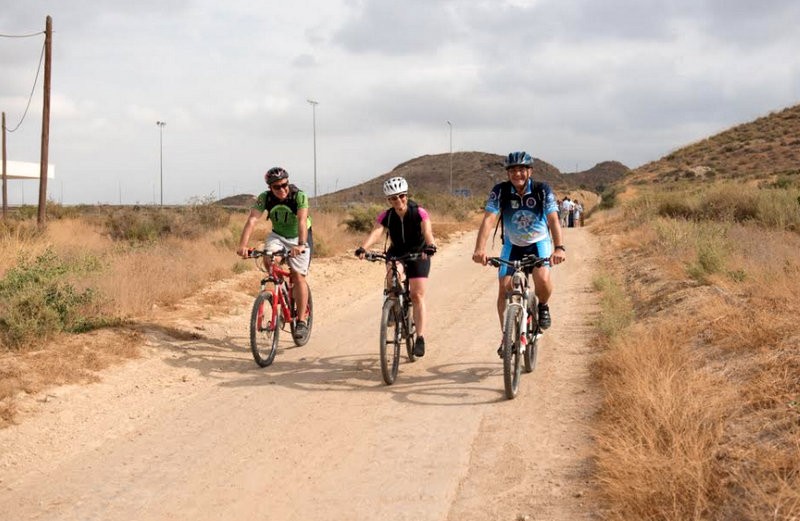
This Caravaca cycling tour follows part of the Camino de Levante pilgrimage route One of two recommended short cycling trips for beginners and families of all ages, this route follows the steps of the pilgrims who have come to Caravaca de la Cruz..
Read More
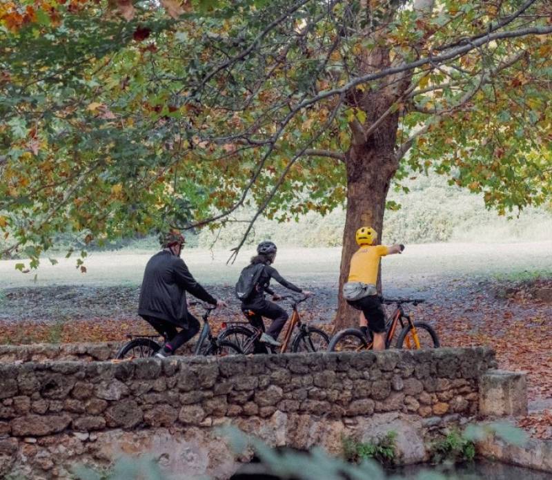
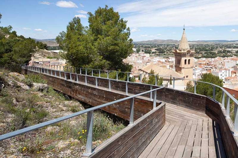
Enjoy monuments in the centre of Caravaca and the natural beauty spot of Las Fuentes del Marqués! This 14-kilometre circular cycling route, taking you to many of the most iconic locations in the holy city of Caravaca de la Cruz, is a very easy one..
Read More
An eco-friendly walking and cycling route at the western end of the Águilas coastline The network of “Senderos Azules” (Blue Trails) is an initiative promoted in Spain by ADEAC, the Association of Environmental and Consumer Education, to recognize..
Read More
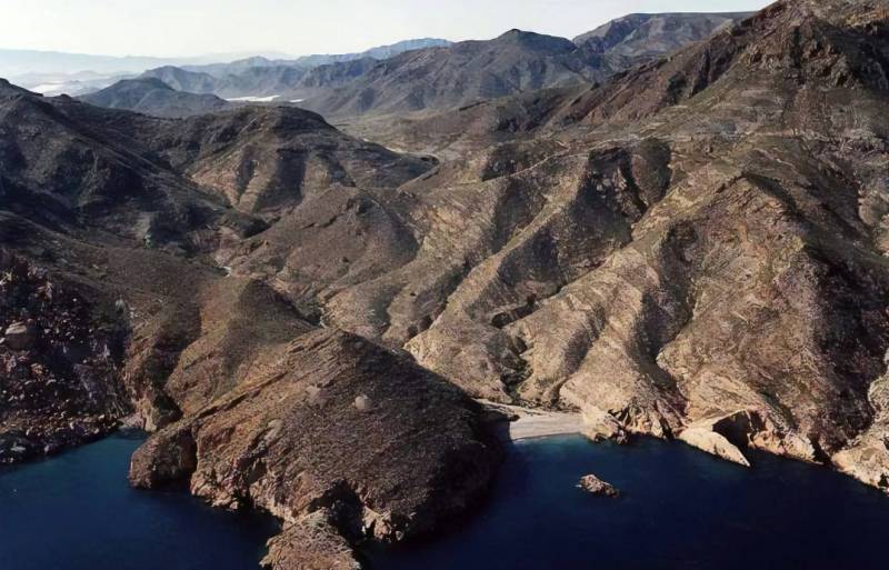
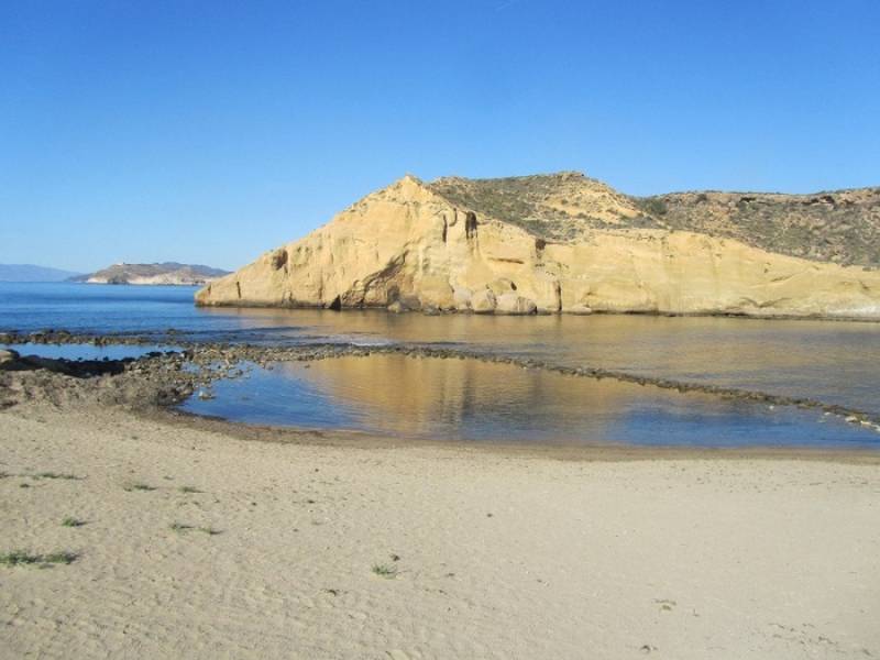
The destination for hikers is the charming little covers of Cala Bolete Grande and Cala Bolete Chico For most residents and visitors in Mazarrón Cabo Tiñoso is the headland protruding from the coastline in La Azohía, the eastern side of which looms..
Read More

A chance to learn about history and local wildlife on the fascinating coastline of Águilas The "Los Cocedores" Blue Trail in Águilas takes its name from the numerous pools in which esparto Grass was tried and treated prior to weaving in..
Read More

An eco-friendly walking and cycling route encompassing the three main bays of the Águilas coastline The network of “Senderos Azules” is an initiative promoted in Spain by ADEAC, the Association of Environmental and Consumer Education, to recognize..
Read More
A 2-hour walk on the environmentally friendly route along the seafront of Águilas town centre The network of “Senderos Azules” is an initiative promoted in Spain by ADEAC, the Association of Environmental and Consumer Education, to recognize..
Read More
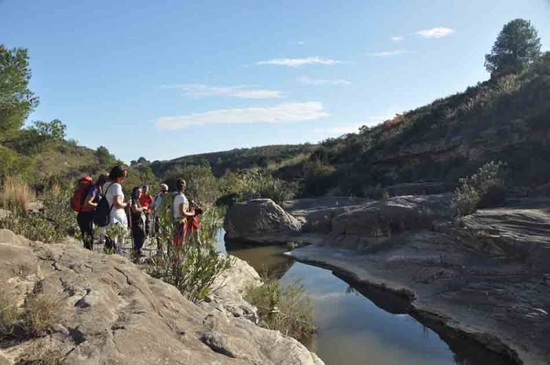
The 120-kilometre walk is open permanently and attracts thousands of religious pilgrims every seven years The Camino de Levante is a walking or cycling route which covers a distance of approximately 120 kilometres between Orihuela, in the south of..
Read More
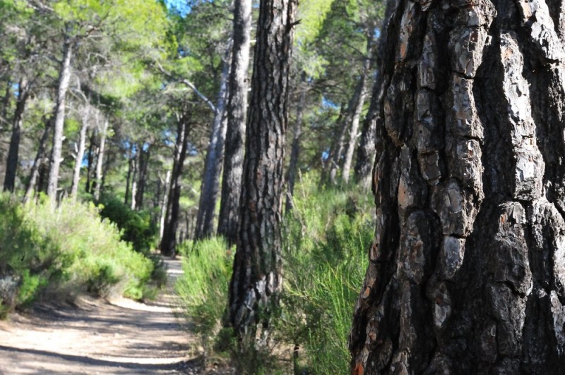
A 78-kilometre hiking and cycling route full of beautiful scenery and cultural and historical significance The Vía Verde del Noroeste (the Greenway of the North-west) is one of the most important ecological routes in the Region of Murcia and is also..
Read More
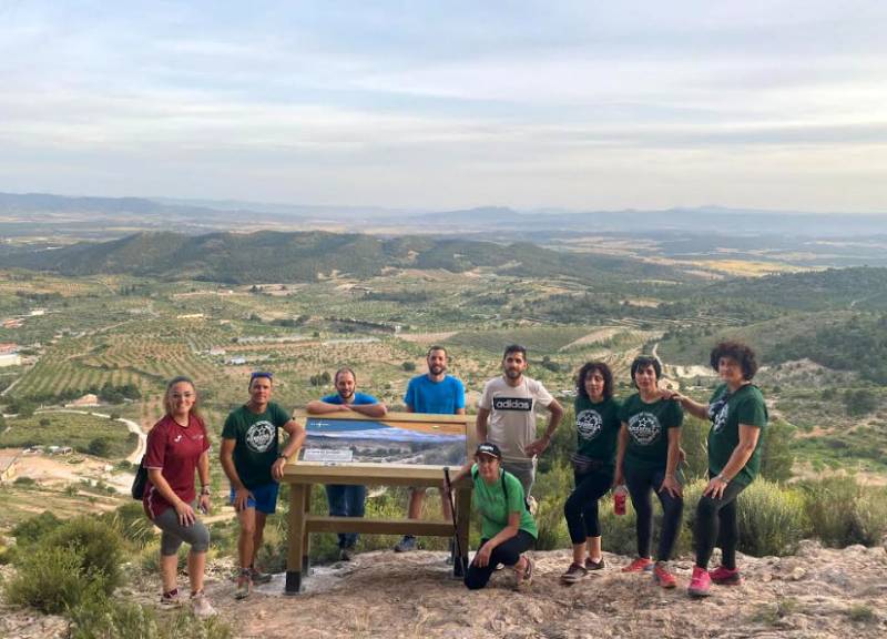
Fabulous views in the countryside on the wooden pasarelas or footbridges of Yecla The “Yecla Valora” project is one of the most ambitious and original undertaken in recent years by the Town Hall of Yecla, taking in unique sights and locations..
Read More
A 2-hour walk in the mountains the Sierra del Carche in southern Yecla The Sierra de las Pansas is a group of mountains on the north-eastern side of the Sierra del Carche which is separated from the main bulk of the higher ground by the gorges of..
Read More

The Vía Verde del Chicharra covers a distance of 31.6 kilometres The Vía Verde del Chicharra is a greenway which has been created, like many others, by making use of an old disused railway trackbed, this one running from Yecla in the north of the..
Read More
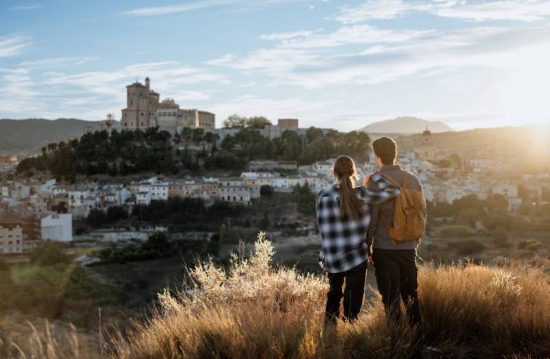
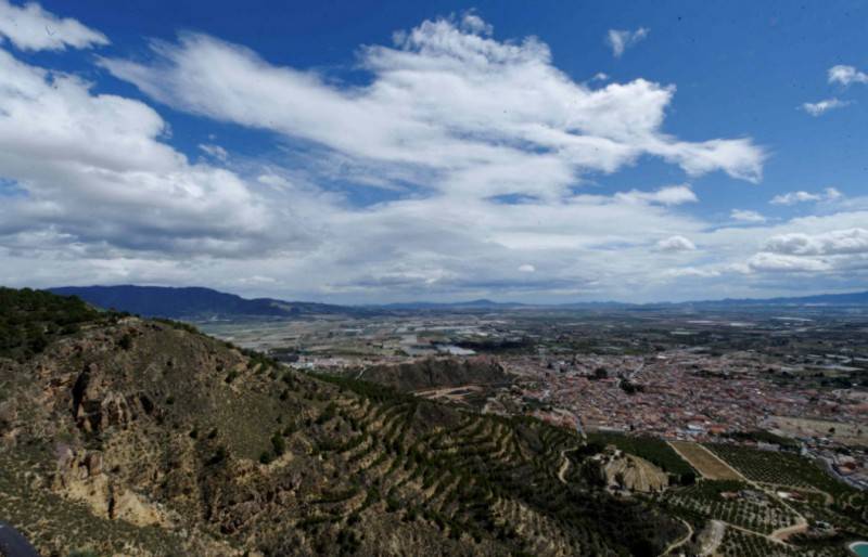
Caravaca and its neighbours Cehegín, Bullas, Calasparra and Bullas all offer a fascinating range of experiences to visitors The city of Caravaca de la Cruz is one of only 5 to have been awarded the status of “Holy Cities” by the Vatican and is..
Read More
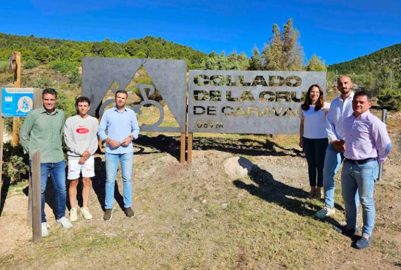
A stage of the Vuelta a España finishes on the Collado de la Cruz on September 3 The road which climbs to the Collado de la Cruz in Caravaca, a popular one with cyclists and the finishing point of the Tour of Spain stage which ends in Caravaca on..
Read More

A range of mountain and beach activities in Murcia designed to reduce stress and anxiety levels The Costa Cálida and the Region of Murcia are probably best-known to visitors for the climate, the beaches, the gastronomy, the landscape and the variety..
Read More
The route from Alhama includes the Sierra de la Muela and ends in the foothills of Sierra Espuña This hiking route from the centre of Alhama de Murcia (Jardín de los Patos) to the Mirador or viewing point of Gebas in the foothills of Sierra Espu..
Read More
A family-friendly 5-kilometre route in the Tierras Altas area of the vast municipality of Lorca This is a 5-kilometre walk in the environs of Áviles, a small village in the Tierras Altas area of the vast municipality of Lorca, which usually takes..
Read More
A 51-kilometre route in Lorca which reaches around 1,350 metres above sea level This is a 51.5-kilometre bike ride starting and ending in Áviles, a small village in the Tierras Altas area of the vast municipality of Lorca, reaching a maximum altitude..
Read More
A 13-kilometre route in Lorca which reaches around 1,350 metres above sea level This is a 13.5-kilometre walk in the environs of Áviles, a small village in the Tierras Altas area of the vast municipality of Lorca, which usually takes around 5 hours..
Read More
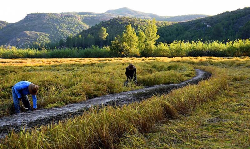
Calasparra is one of only three areas in Spain with Denomination of Origin status for locally grown rice Despite rice being one of the commonest foods on the planet it is a relatively rare sight to see the product being cultivated in Europe, but in..
Read More
Ideas for making the most of the green heart of Murcia in the mountains of Sierra Espuña If you count yourself as a lover of nature and of escaping the daily routine to breathe pure air and indulge in open-air sports, the Region of Murcia offers..
Read More
Easily manageable sections of the 7,560-km route which runs from Cádiz in south-western Spain to Athens and Cyprus! The Region of Murcia has long been a preferred destination for cycling holidays, the varied terrain attracting tourists from all over..
Read More
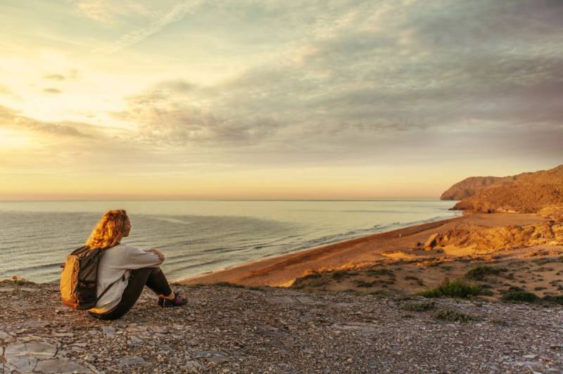
Great places to watch the sun go down in the Costa Cálida In the promotion of Murcia’s gastronomy the Region has been advertised as “The Region of 1,001 Tastes”, but it would be equally true to refer to it as “The Region of 1,001 Colours..
Read More
From the Costa Cálida in the south to the mountains of Jumilla, fabulous landscapes and fascinating sights! Throughout the Region of Murcia and the Costa Cálida there are countless attractive walking routes, popular with those exploring the..
Read More
A 14-kilometre route in Lorca which reaches 1,100 metres above sea level This 4-hour walking route is based in the village of Coy, one of the furthest north in the huge municipality of Lorca, about 850 metres above sea level on the southern slopes..
Read More
A family-friendly 6.8-kilometre route in Lorca which reaches 931 metres above sea level This family-friendly walking route is based in the village of Coy, one of the furthest north in the huge municipality of Lorca and is at about 850 metres above..
Read More
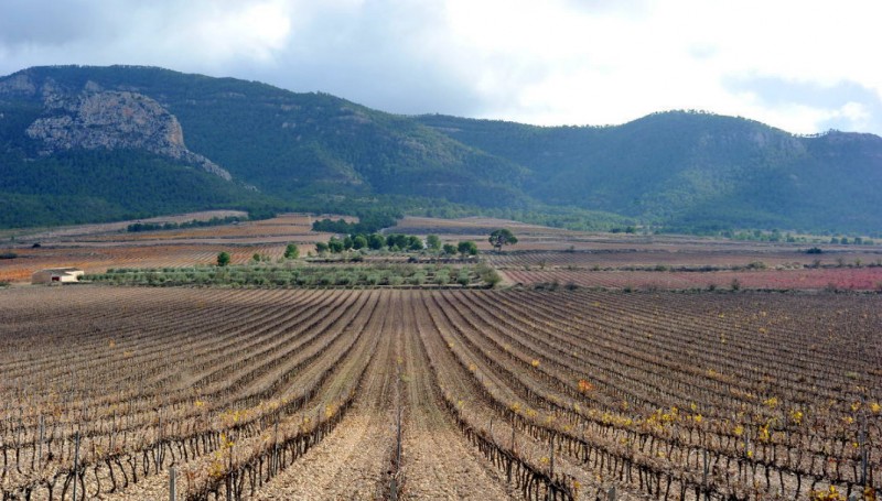
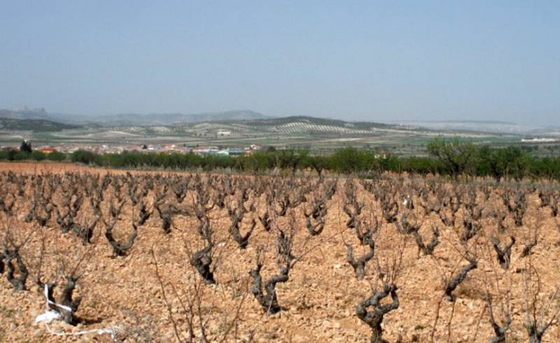
Dramatic scenery above the vineyards and salt mines of south-eastern Jumilla The regional park of Sierra del Carche occupies an area of 5,942 hectares, and includes the Cabezo de la Rosa – a saline diapir of great geological interest – and..
Read More
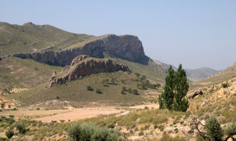
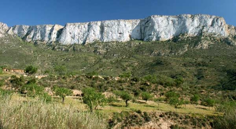
Prehistoric rock art and spectacular scenery in the mountains of Sierra de la Cingla The main walking routes in the mountains of Sierra de la Cingla, the ridge which runs along the northern side of the N-344 road between Jumilla and Yecla, are..
Read More
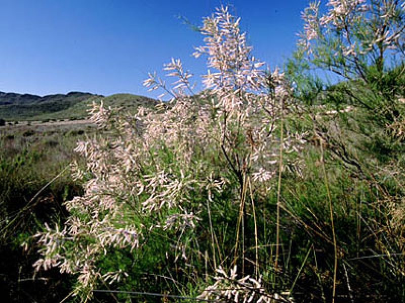
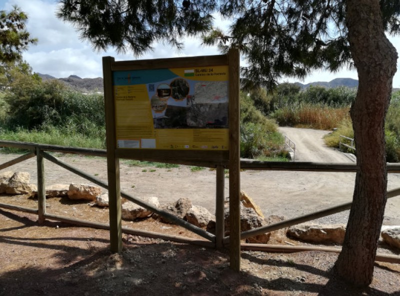
Caves with a story to tell and other sights which illustrate history and pre-history The Sierra de la Pedrera may reach no higher than 765 metres above sea level, but the area is covered in esparto glass and aromatic plants and is home to historic..
Read More
A mountain walk for all the family in the north Lorca countryside Zarzadilla de Totana is a village in the “Tierras Altas” area of the vast municipality of Lorca, on the high ground between Lorca to the south and Bullas, Caravaca de la Cruz and..
Read More
A testing 17-kilometre walk in the mountains and valleys of the north Lorca countryside Zarzadilla de Totana is a village in the “Tierras Altas” area of the vast municipality of Lorca, on the high ground between Lorca to the south and Bullas..
Read More
Spectacular scenery, prehistoric archaeology, the monastery of Santa Ana and thick pine woods in the mountains outside Jumilla The mountains of Sierra de Santa Ana are just 6 kilometres south of the town of Jumilla, and offer not only a stunning..
Read More
46 kilometres of the old drovers’ road run through the municipality of Jumilla The “Cañadas Reales” are the long-distance transhumance farming paths, or drovers’ roads which were traditionally used to drive livestock from one location..
Read More
The 14-kilometre Vía Verde welcomes walkers and cyclists between Mazarrón and La Pinilla When it was decided in the early 20th century that a railway should be built linking Mazarrón to the intended line between Cartagena and Totana the engineers..
Read More
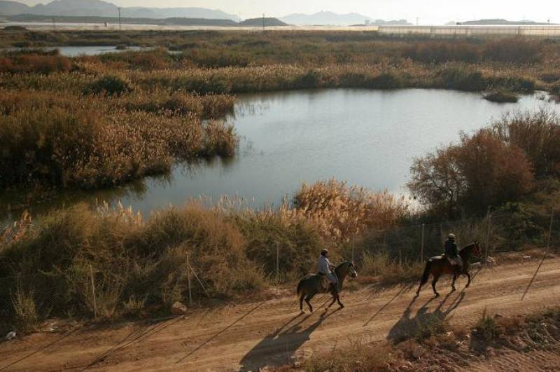
A protected nature reserve and Ramsar site between Mazarrón and Puerto de Mazarrón The landscape in and around Mazarrón is generally dry, but there is a pocket of 72 hectares of land near the coast between Puerto de Mazarrón and Bolnuevo which..
Read More
Magnificent views over the countryside in the north of the municipality of Lorca The Town Hall of Lorca has unveiled a new and spectacular fully signposted walking route in the north of the vast municipality (the second largest in Spain), leading..
Read More
A 7km walk along the Rambla del Cañar, Tallante-Isla Plana, PR-15 Level: Easy The rambla, a floodwater channel which is usually dry, runs from the coast at Isla Plana through inland to the village of Tallante, and the route is classified..
Read More
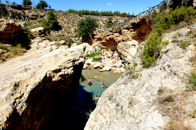
The Bullas waterfall and rock pools offer an inland bathing alternative in the north-west of the Murcia Region The Salto del Usero is one of the most widely enjoyed natural beauty spots in the Region of Murcia, and during the summer is used as an..
Read More
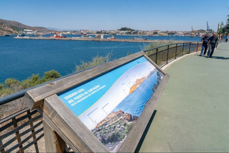
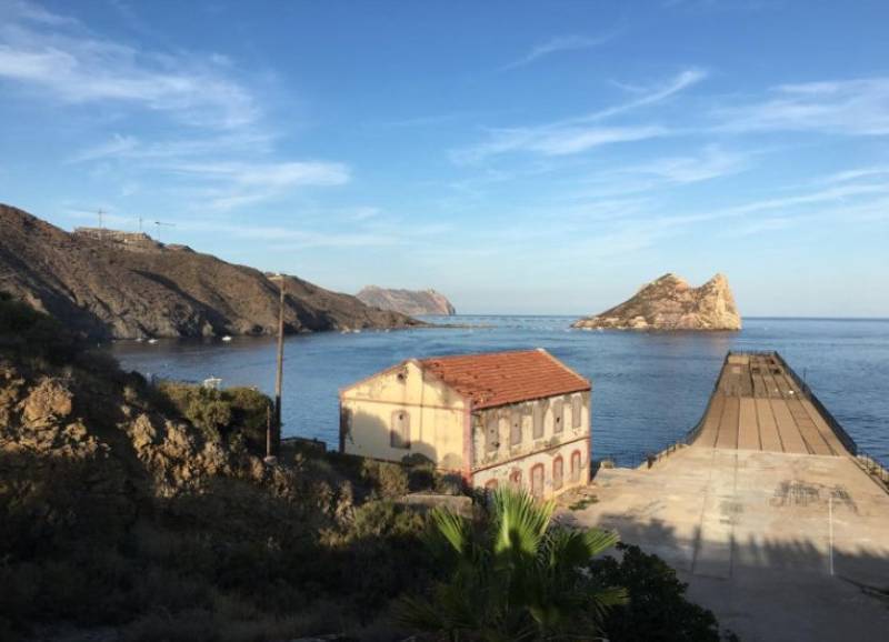
The “Sendero Azul”runs alongside the port and past the docks The Sendero Azul del Puerto de Cartagena is a gentle coastal walking route which runs from the Yacht club (next to the cruise ship port) on the main waterfront in the city down to..
Read More
A great area area for walking with several wild and picturesque beaches 1,882 hectares of land in Calblanque have been a protected nature reserve since 1987 in recognition of the fact that the area is one of the most typical of the coastline of..
Read More
A lush green environment on the banks of the upper reaches of the Segura in Calasparra and Moratalla Cañaverosa is the only one of the three nationally recognized nature reserves in the Region of Murcia to be located on land, with the other two both..
Read More
A lineal 3.3-kilometre walk in the mountains of Sierra Espuña This 3.35-kilometre lineal walk in the mountains of Sierra Espuña takes walkers along a route between two of the most popular places in the regional park, namely the Ricardo Codorn..
Read More
A 3.85-kilometre stretch of the GR-92 walk on the coastal plain of the eastern Cartagena coastline Sendero del Mirador de Punta Negra. Distance: 3.85km, lineal walk. This gentle walking route on an unspoilt stretch of the Cartagena coastline..
Read More
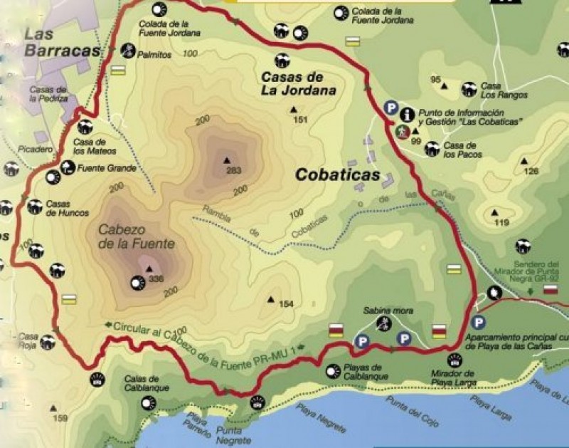
A 7.8-kilometre walk with spectacular views of the Mediterranean coastline in Calblanque Sendero Circular al Cabezo de la Fuente PR-1 This circular route around the 336-metre mountain of Cabezo de la Fuente in the regional park of Calblanque, on..
Read More
A short 2.2-kilometre route starting and finishing at the Sierra Espuña visitors centre in the regional park The Sendero Ricardo Codorníu (SL-MU 1), which is named after the man responsible for repopulating the forests of Sierra Espuña in the..
Read More
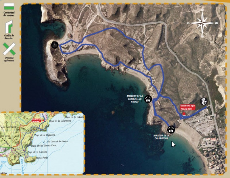
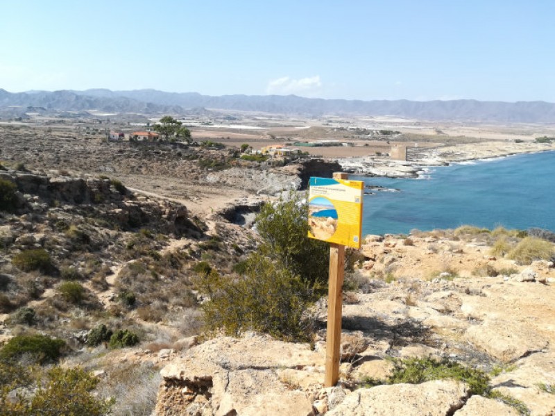
Four beaches and a fascinating array of flora and fauna on a short coastal walk in Águilas Details of the SL-MU 18 Cuatro Calas walk Start and finish: Playa de Calarreona Distance: 4 kilometres including detours, 2.8 km without detours..
Read More
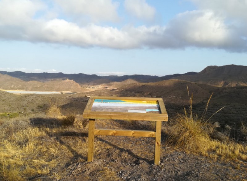
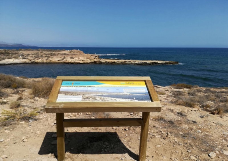
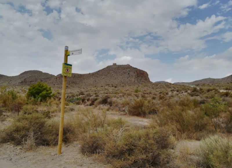
The PR-MU 104 route offers spectacular views from the lower slopes of Cabo Cope Cabo Cope is the imposing headland which juts out into the Mediterranean next to the village of Calabardina, in the municipality of Águilas, reaching a height of..
Read More
A 22-kilometre stretch of the route follows the Águilas coastline As well as being home to various recommended rural walking routes, the municipality of Águilas is also one of the many visited by the GR-92 route which runs along the whole of..
Read More
The PR-MU 112 walk is in the mountains which stand to the north of Águilas The route lies within an area which is included in the Natura 2000 network as a Site of Community Importance and is a ZEPA birdlife protection zone, due to the presence..
Read More
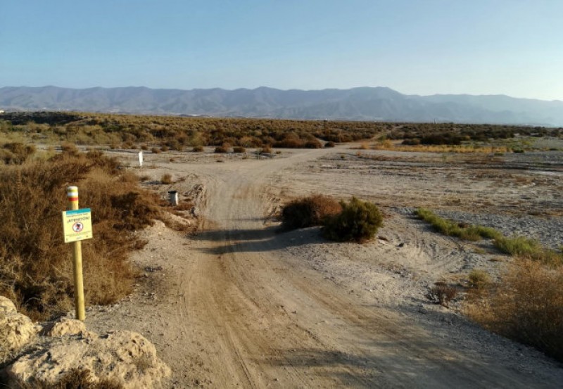
The SL-MU 23 walk includes wild beaches, a Roman jetty and a nuclear spring! The route lies entirely within the Regional Park of Cabo Cope y Puntas de Calnegre, and allows walkers to appreciate the natural and cultural heritage which make the..
Read More
The PR-MU 113 route is an 18-kilometre walk from the mountains behind Águilas to the town centre This route is named after the old water supply channel from Tébar to Águilas, a canal which was built on the orders of King Carlos III in the 18th..
Read More
The walk follows the route of the annual Romería del Rocío in Águilas This is a linear walk rather than a circular route, running from the Plaza de la Guardia Civil in the town of Águilas to the Molino del Saltaor beauty spot, and the route..
Read More
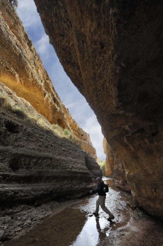
The Chícamo provides a geology lesson taking in the last ten million years! The River Chícamo in Abanilla is one of the best known beauty spots in the landscape of Murcia, and is of special interest not only to walkers but also to naturalists and..
Read More
A 2.6-kilometre walk in the picturesque foothills of Sierra Espuña This walk in the south-western foothills of Sierra Espuña follows an easy 2.6-kilometre route, starting at the Sanctuary of Santa Eulalia in the La Sierra district outside the town..
Read More
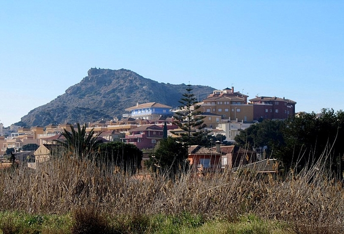
An interesting geological walk in El Carmolí with spectacular views over the Mar Menor The volcanic plug of El Carmolí, which rises to an altitude of 113 metres above sea level, is one of a series of 7-million-year-old andesite plugs which include..
Read More
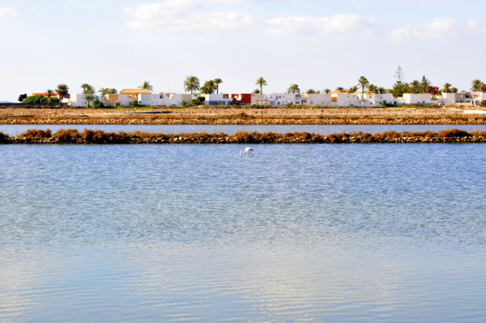
Saltflats and native plantlife alongside Stone Age remains between the Mar Menor and the Mediterranean At the southern end of the heavily built up area of La Manga del Mar Menor is a zone where there are practically no buildings at all, just a series..
Read More
The Chocolate de la Luz can once again be purchased from monks in the mountains outside Murcia Here's an enjoyable morning out which is suitable for those who enjoy a spot of sightseeing and a good view, as well as for those who enjoy a not too taxing..
Read More
The El Valle Visitor Centre Murcia The El Valle Visitor’s Centre is located in the heart of the regional park, the Parque Regional del Valle y Carrascoy, which runs alongside the capital city of Murcia, and is home to a number of monuments relating..
Read More
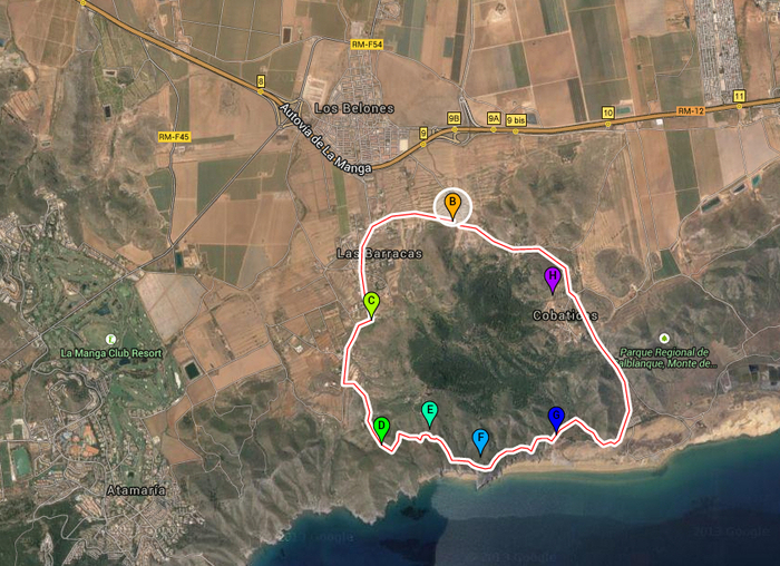
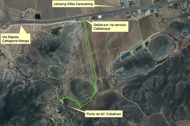
A circular geological route in the Cartagena countryside Sendero Circular Cabezo de la Fuente: Length: 8 km Difficulty: medium Start point: Las Cobaticas information centre The Calblanque regional park (Parque Regional de Calblanque..
Read More
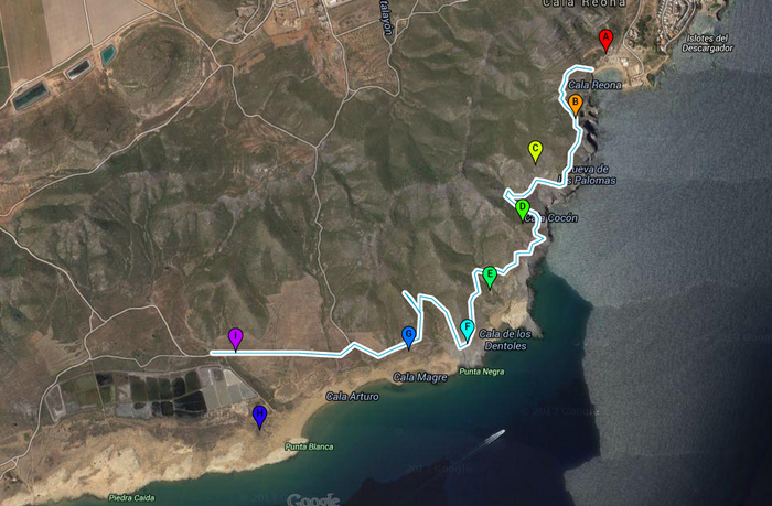
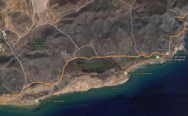
This pleasant walk in Calblanque is of great interest to geologists Distance: 4km, one way Start point: Cala Reona Difficulty level: medium This 4-kilometre route, which begins in Cala Reona and ends at the Salinas del Rasall in the regional..
Read More
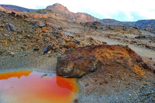
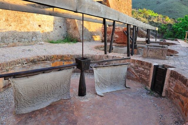
This foundation offer guided routes through the mining area of La Unión The Fundaciòn Sierra Minera is a non-profit organisation which works to preserve the heritage of the Sierra Minera, and also engages in a number of educational activities..
Read More
A seven-kilometre walk through the mountains and history of Portmán and La Unión The Carretera del 33 is a seven-kilometre walk through the mountains of the Sierra Minera between La Unión and the coastal town of Portmán, taking walkers on a journey..
Read More
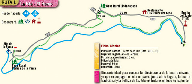
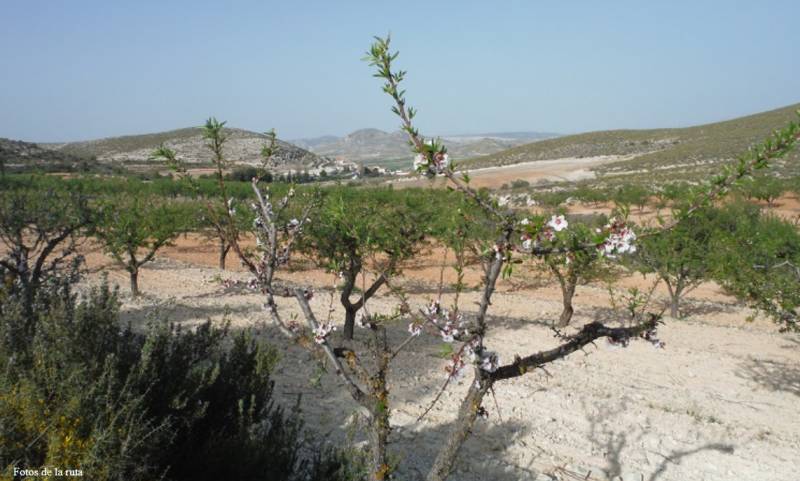
Route 1 La Isla– El Horno, from Cieza town This is a cycling and walking route through Cieza which is an ideal way to discover the beauty of the Ciezan countryside enjoy the fruit orchards and agricultural areas of the municipality, including..
Read More
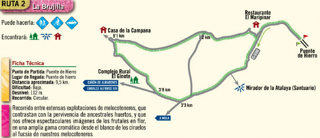
Route 2 La Brujilla This route could be cycled, walked or driven through the Cieza municipality. The route passes through the peach orchards and agricultural cultivated areas which make Cieza such an attractive location to visit, particularly..
Read More
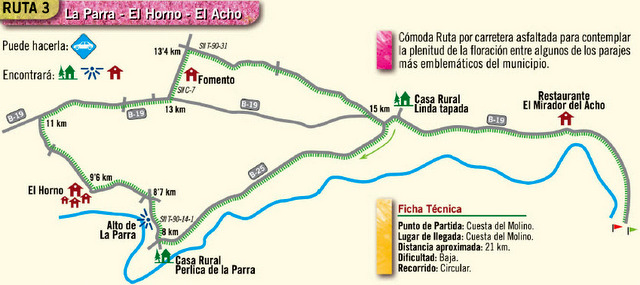
Route 3 La Parra –El Horno - El Acho This is a drivable tarmac route through Cieza and is designed for those who want to enjoy a drive through the peach orchards during La Floración, although can also be driven at any time of the year to..
Read More
Sendero PR-MU 11: Medina Siyâsa (Route PR-MU 11) See Wikilocks map: Click here The PR-MU 11, Medina Siyâsa, is an 8.5km long walking route in the municipality of Cieza, a signposted circular walk which runs alongside the Vega del Segura river..
Read More
Almadenes – Almorchón, 13.3 kilometres Click here for Wikilocs The PR-MU 25, Almadenes - Almorchón, is a medium length popular walking route in Cieza and is a well sign posted, circular route through one of the most characteristically Ciezan..
Read More
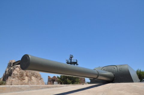
Early 20th century defence fortifications around the port of Cartagena Due to its sheltered natural harnour and the valuable mineral deposits nearby, Cartagena has always been an important port and strategical location and the doorway..
Read More