

- EDITIONS:
 Spanish News Today
 Alicante Today
 Andalucia Today
PROPERTY SEARCH

ARCHIVED - Latest on Gota Fría storm alert as Aemet postpone yellow alert until Tuesday
Murcia appears likely to be spared the worst of the second Gota Fría in six weeks
The unpredictable nature of the potentially destructive gota fría storms which sometimes arrive during the autumn in the Region of Murcia has been illustrated over the weekend by the difficulties faced by the State meteorological agency Aemet, as they attempt to forecast how the high altitude depression which is currently building along the eastern coast of Spain is likely to develop during the next couple of days.
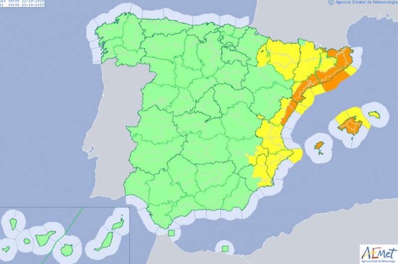
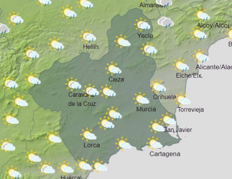
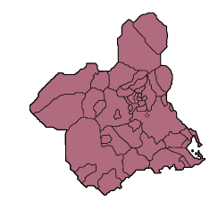
Initially a yellow alert for potential downpours had been issued for parts of the Region of Murcia for Monday 21st October, but this has now been withdrawn and the worst of the rain is now expected to occur during Tuesday morning. The latest yellow alert is restricted to northern and eastern areas of the Region, with Aemet warning of a 40 to 70 per cent chance of up to 20 millimetres of rain in any given hours between midnight and midday in the Altiplano (the large municipalities of Jumilla and Yecla in the north of Murcia, the Vega del Segura (including the city of Murcia) and the Campo de Cartagena and Mazarrón.
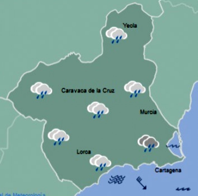
In addition, in central and south-eastern areas the accumulated rainfall during the first half of the day could reach up to 60 millimetres, according to Aemet: a very significant amount of water although far less than fell during the dramatic gota fría of mid-September, and it is to be hope that there will be no repeat of the disastrous flooding which caused such damage and disruption to homes, public property and the marine environment of the Mar Menor.
At the same time, the arrival of the rain also heralds a significant drop in temperatures, as was already the case during Sunday and on Monday morning in most parts of Murcia. Minimums on Monday are expected to fall to just 3 degrees in Yecla, 4 in Caravaca de la Cruz, 6 in Lorca, 9 in Murcia and 14 on the coast in Cartagena, while even the afternoon highs will drop to between 18 and 21, and on Tuesday for the first time in many months it is unlikely that the temperature will reach 20ºC anywhere in the Costa Cálida.
 In the meantime, the severest weather associated with this latest gota fría is expected to occur further north on the Mediterranean coast, in Catalunya and the north of the Comunidad Valenciana, where the amount of rain expected to fall by Aemet is up to 40 millimetres in an hour and 100 millimetres in any 12-hour period between midnight on Monday and the early hours of Wednesday.
Once again it is important to stress that the development of gota fría storms is notoriously hard to predict accurately, and although this information is the latest to have been issued by Aemet on Monday morning constant updates and alterations are to be expected: make sure to keep informed of the latest!
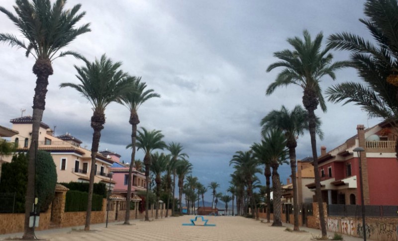
Image 2: menacing clouds ovber Los Alcázares on Monday morning (tourist office)
Join the Murcia Weather Watch group on Facebook to keep up to date with all the latest forecasts and weather related stories: https://www.facebook.com/groups/RegionOfMurciaWeatherWatch/.


Find more information by AREA, TOWN or URBANISATION .....
Cabo de Palos
Cartagena
El Carmoli
Islas Menores and Mar de Cristal
La Manga Club
La Manga del Mar Menor
La Puebla
La Torre Golf Resort
La Union
Los Alcazares
Los Belones
Los Nietos
Los Urrutias
Mar Menor Golf Resort
Pilar de la Horadada
Playa Honda / Playa Paraiso
Portman
Roldan and Lo Ferro
San Javier
San Pedro del Pinatar
Santa Rosalia Lake and Life resort
Terrazas de la Torre Golf Resort
Torre Pacheco
Aguilas
Aledo
Alhama de Murcia
Bolnuevo
Camposol
Condado de Alhama
Fuente Alamo
Hacienda del Alamo Golf Resort
Lorca
Mazarron
Puerto de Mazarron
Puerto Lumbreras
Sierra Espuna
Totana
Aledo
Alhama de Murcia
Bolnuevo
Camposol
Condado de Alhama
Fuente Alamo
Hacienda del Alamo Golf Resort
Lorca
Mazarron
Puerto de Mazarron
Puerto Lumbreras
Sierra Espuna
Totana
Abanilla
Abaran
Alcantarilla
Archena
Blanca
Corvera
El Valle Golf Resort
Hacienda Riquelme Golf Resort
Lorqui
Molina de Segura
Mosa Trajectum
Murcia City
Peraleja Golf Resort
Ricote
Sucina
Abaran
Alcantarilla
Archena
Blanca
Corvera
El Valle Golf Resort
Hacienda Riquelme Golf Resort
Lorqui
Molina de Segura
Mosa Trajectum
Murcia City
Peraleja Golf Resort
Ricote
Sucina
Urbanisations
CamposolCondado de Alhama
El Valle Golf Resort
Hacienda del Alamo Golf Resort
Hacienda Riquelme Golf Resort
Islas Menores and Mar de Cristal
La Manga Club
La Torre Golf Resort
Mar Menor Golf Resort
Mazarron Country Club
Mosa Trajectum
Peraleja Golf Resort
Santa Rosalia Lake and Life resort
Terrazas de la Torre Golf Resort
La Zenia
Lomas de Cabo Roig
Important Topics:
CAMPOSOL TODAY Whats OnCartagena SpainCoronavirusCorvera Airport MurciaMurcia Gota Fria 2019Murcia property news generic threadWeekly Bulletin
CAMPOSOL TODAY Whats OnCartagena SpainCoronavirusCorvera Airport MurciaMurcia Gota Fria 2019Murcia property news generic threadWeekly Bulletin