- Region
- Águilas
- Alhama de Murcia
- Jumilla
- Lorca
- Los Alcázares
- Mazarrón
- San Javier
-
ALL AREAS & TOWNS
- AREAS
- SOUTH WEST
- MAR MENOR
- MURCIA CITY & CENTRAL
- NORTH & NORTH WEST
- TOWNS
- Abanilla
- Abarán
- Aguilas
- Alamillo
- Alcantarilla
- Aledo
- Alhama de Murcia
- Archena
- Balsicas
- Blanca
- Bolnuevo
- Bullas
- Cañadas del Romero
- Cabo de Palos
- Calasparra
- Camping Bolnuevo
- Campo De Ricote
- Camposol
- Canada De La Lena
- Caravaca de la Cruz
- Cartagena
- Cehegin
- Ceuti
- Cieza
- Condado de Alhama
- Corvera
- Costa Cálida
- Cuevas De Almanzora
- Cuevas de Reyllo
- El Carmoli
- El Mojon
- El Molino (Puerto Lumbreras)
- El Pareton / Cantareros
- El Raso
- El Valle Golf Resort
- Fortuna
- Fuente Alamo
- Hacienda del Alamo Golf Resort
- Hacienda Riquelme Golf Resort
- Isla Plana
- Islas Menores & Mar de Cristal
- Jumilla
- La Azohia
- La Charca
- La Manga Club
- La Manga del Mar Menor
- La Pinilla
- La Puebla
- La Torre
- La Torre Golf Resort
- La Unión
- Las Palas
- Las Ramblas
- Las Ramblas Golf
- Las Torres de Cotillas
- Leiva
- Librilla
- Lo Pagan
- Lo Santiago
- Lorca
- Lorquí
- Los Alcázares
- Los Balcones
- Los Belones
- Los Canovas
- Los Nietos
- Los Perez (Tallante)
- Los Urrutias
- Los Ventorrillos
- Mar De Cristal
- Mar Menor
- Mar Menor Golf Resort
- Mazarrón
- Mazarrón Country Club
- Molina de Segura
- Moratalla
- Mula
- Murcia City
- Murcia Property
- Pareton
- Peraleja Golf Resort
- Perin
- Pilar de la Horadada
- Pinar de Campoverde
- Pinoso
- Playa Honda
- Playa Honda / Playa Paraíso
- Pliego
- Portmán
- Pozo Estrecho
- Puerto de Mazarrón
- Puerto Lumbreras
- Puntas De Calnegre
- Region of Murcia
- Ricote
- Roda Golf Resort
- Roldan
- Roldan and Lo Ferro
- San Javier
- San Pedro del Pinatar
- Santiago de la Ribera
- Sierra Espuña
- Sucina
- Tallante
- Terrazas de la Torre Golf Resort
- Torre Pacheco
- Totana
- What's On Weekly Bulletin
- Yecla


- EDITIONS:
 Spanish News Today
 Alicante Today
 Andalucia Today
article_detail
A history of Fuente Álamo
2,000 years of history in Fuente Álamo
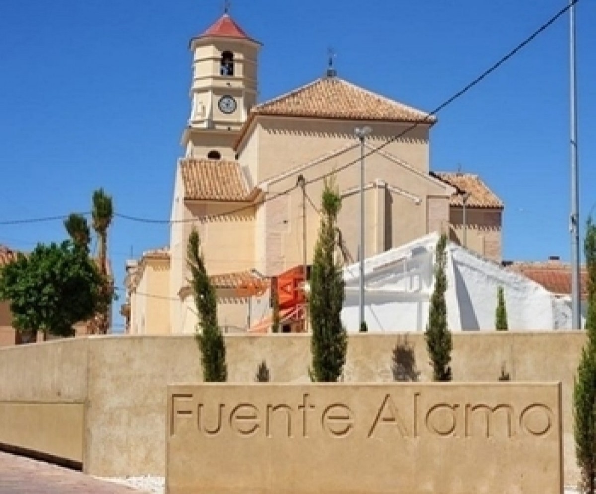
The municipality of Fuente Álamo, which borders on those of Cartagena and Murcia, is 35 kilometres from the capital of the Region of Murcia. It is located next to the Rambla of Fuente Álamo and surrounded by mountains in the Sierras of El Algarrobo, La Pinilla, Los Gómez, Los Victorias, Cabezos de Tallante and Carrascoy.
Its flat, rolling lands are fed by abundant water, and today the town is an important focal point of agricultural activity. It also boasts a high-tech industrial park and a prestigious golf complex within its boundaries, giving it a broad spread of activities, all of which contribute to stability and development as an expanding town.
Its proximity to the new Region of Murcia International Airport in Corvera is expected to further local employment prospects and contribute to the continuing development of the town in the future.
Pre-history to the Romans in Fuente Álamo
"Many years ago there was an old poplar tree, now long since gone, which drank from a nearby spring. In this place the roads from Murcia, Cartagena and Lorca came together, and the Sierras of Columbares, Almenara and Carrascoy crossed the landscape. The town which grew up at this place was known as Fuente Álamo."
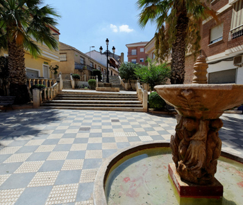 Fuente means "spring" or "source", and the abundance of water sources in this area together with fertile soil undoubtedly attracted prehistoric settlers to the area, although there is very little in the way of tangible evidence of their presence other than some paleolithic remains in the Sierra del Algarrobo.
The Sierra de Carrascoy holds sites dating from the Argaric period which encompassed 1800 BC to 525 BC, although nothing has been discovered dating from this stage of early human settlement in Fuente Álamo itself.
There is also evidence that there was some sort of activity during the Iberian period which followed that of the Argaric - from 525 BC until the 1st century AD, when the native populations became very much a part of the Romanised way of life which arrived in the region with the Roman armies who took Cartagena in 209 BC.
The proximity of the city of Qart Hadast, renamed Carthago Nova by the Roman invaders and now known to us as Cartagena, had a profound influence on the settlements which already existed throughout what is now the Region of Murcia, and the Romans took advantage of the former trade routes and natural resources available to them to exploit the natural wealth of the area to full advantage.
Roman settlements sprang up across the Region, and it is logical to assume there was some sort of Roman settlement at what is now the town of Fuente Álamo, given not only the natural spring, but also the strategic advantage of the location.
There were certainly settlements in La Pinilla and Las Palas, a section of road in La Pinilla showing the existence of a Roman road passing through the area, linking Carthago Nova and Cástulo (Cartagena and Jaén) via Lorca. It seems likely that the road passed through the modern localities of La Manchica, Las Palas, El Mingrano and La Pinilla.
The road might be the most important Roman relic in the municipality of Fuente Álamo, but it is by no means the only one. Coins, ceramics and other items have also been found, and they all serve to corroborate the human activity in the area of the time: there are also the remains of houses, burials, bronze statues, weapons, tools and pottery.
The Moors and the Middle Ages
Following the decline of the Roman empire in the 4th century, the area was occupied by the Visigoths until the 8th century before the Moors from North Africa became the dominant population until the 13th century. There is evidence of Moorish settlements, certainly at La Pinilla, and during this period small concentrations of population would have farmed the countryside on a very local level.
Although there is a complete lack of Moorish documentation mentioning Fuente Álamo, there are place names and the existence of landscape features which are typical of the Moors, such as settlements next to springs, surrounded by palm trees and prickly pears. There are also irrigation ditches and water wheels, which are typical of areas where the Moors practised agriculture.
It´s well worth looking at the water management systems displayed at the open-air water museum close to the rambla and Mercadona supermarket. this shows an aljibe (water cistern) and various water management systems commonly used by the Moorish settlers.
Later periods of armed conflict led to the gradual depopulation of the area, settlements grew and then shrank, and it was not until the 15th century that the population really started to stabilize and became consolidated.
There is documented evidence of a visit to the town made by the Concejo (chief administrator) of Murcia in 1463. At this time the authorities agreed to mark out the stones which were to divide the municipalities of Murcia, Cartagena and Lorca, and "La Fuente de Álamo" was the point at which the three were deemed to meet.
 This division of Fuente Álamo between three different administrations made life extremely hard for the peasants and farmers in the area. They were largely unprotected, they had to go to the cities in order to do anything, and they were overtaxed, overworked and insecure.
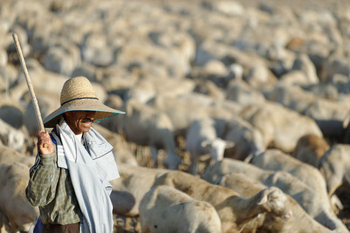
This situation was not rectified until the 18th century, when the municipality achieved independence. Although there were homes in the area during the Middle Ages, these were isolated dwellings in a largely unpopulated area, with a number of shepherds huts used by the transhumance farmers, ie the shepherds who covered vast distances with their flocks seeking pasture. These shepherds would bring their flocks through from the Sierra de Cazorla towards the more fertile zones of Campo Nubla and La Manchica, with stopping off points at water sources, such as Fuente Álamo.
In 1520, a group of farmers and livestock owners decided to build a more permanent settlement on an elevated piece of land between the Rambla de la Pozo, known today as the Rambla of El Fraile, and the Rambla of La Azohía.
Up to this point the threat of pirate attack from Africa had made life in this area very dangerous for residents, allied with the proximity to the borders with the Moorish Kingdom of Granada, so cross-border raids were a daily risk for the residents.
 However, by 1520 the Kingdom of Granada was in Christian hands and the numbers of coastal raids had diminished, watchtowers helping to minimise the risk of a surprise pirate attack. In order to repopulate the area, Lorca granted parcels of land to try and attract settlers, bringing people into the area from Librilla and Lorca. Many of the families whose descendants are still in the area today arrived at this point, bringing with them the names of Jiménez, Pagán, Ortega and Ponce de León.
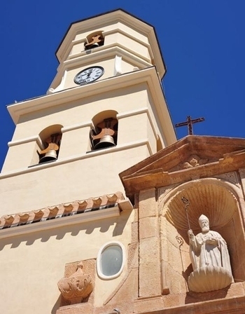
The growth in numbers and significance of the town is reflected in the emergence of the first church, which was known as the Iglesia de la Concepción.
A simple structure was erected by these first early settlers, who were believed to number around 25 in 1520, but it was superseded by the Iglesia de San Agustín in 1583. Also built in this era was the Casa Tercia, next to the church, whose purpose was to collect the tithes payable to the church. All the houses built belonged to the municipalities of Murcia, Cartagena and Lorca, who shared administrative and judicial control of the town, and each of the three named a deputy who was in charge of his share of jurisdictional responsibility.
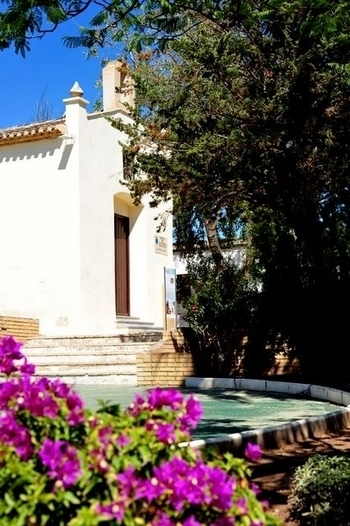
A few years later a second chapel was built just above the Fuente, the Ermita de San Roque.
By 1640, there were around 1000 people in the area.
The road to independence for Fuente Álamo
 The road to independence for Fuente Álamo was a long one.
The first steps could be said to have been taken in 1629, when a report by the Customs department makes mention of the barrel rights in the area, and notes the increased importance of the town. This importance is also reflected in the establishment of the Junta de Propios y del Pósito de Labradores, a kind of public granary cooperative set up to establish each inhabitants rights. This was in essence an unofficial Town Hall, and gradually became more and more established as a local administration centre. It also pushed forward the development of urban infrastructures in the town.
Eventually the inhabitants decided to push for the status of an independent "villa", cutting ties with Murcia, Cartagena and Lorca. A request was made to Felipe IV in 1634, asking for this status and for permission to set up their own Ayuntamiento or Town Hall: in return for their independence the residents of Fuente Álamo offered to pay 50 ducados, and the process was under way, but the status was not conceded until 66 years later.
During this period the area suffered occasional droughts and significant outbreaks of malaria and dysentery, and the insecurity of the inhabitants was further increased by the abundance of bandits and outlaws roaming the countryside. The authorities did nothing to quell the fears of the population in the face of these problems.
 In 1694 there was a public protest in the Plaza de Carlos II, which marked the beginning of a new segregationist movement. All the authorities and residents were present to witness the number of protesters and the reasons for their complaints. All argued that the status of "villa" was well deserved, and that it would be beneficial to the town and its inhabitants, and from that day on the hard work began to make sure that their claims were heard by the Crown.
The dream was finally made reality in 1700, when Carlos II acceded to the demand that his father had ignored and made Fuente Álamo a "villa". On 20th July 1700 the first town council was formed, presided over by Gregorio Reyllo.
But Murcia, Cartagena and Lorca were still fighting for the rights they had just lost, and two years later the next monarch, King Felipe V, acceded to the wishes of the three larger municipalities, returning their property to them (and, more importantly, the revenue and taxes the townspeople were paying).
The discontent of the residents of Fuente Álamo was so strong that it was necessary to send in armed forces to control and eventually put down their ensuing rebellion. The protests of the locals were hushed, but the discontent remained and the matter was shelved until a century later.
The "villa" of Fuente Álamo
The early years of the new municipality were hit by a number of setbacks, including frequent epidemics. The population fluctuated due to these outbreaks, which most likely originated in the stagnant water lying in the nearby ramblas. On top of this there were persistent periods of drought, which had a devastating effect on much of the local farming.
The broader picture in Spain in the 19th century also had an important effect on Fuente Álamo. During the War of Independence French troops passed through the area on their march to Cartagena, and the Ecclesiastical Confiscations of the Liberals were as harmful to Fuente Álamo as to many other places throughout the country.
The population fell and for a time the Casa Consistorial (Town Hall) was moved to the outlying area of Cuevas de Reylló, although it was moved back to the town only months later.
The livestock market (Mercado de Ganados y Productos del País)
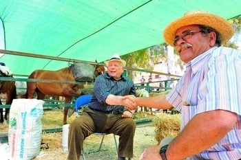 In the second half of the 19th century there was a modest resurgence in the economic fortunes of the town, which can be seen in its social development. Much of this was due to the establishment of the Mercado de Ganados y Productos del País, which grew in both regional and national prestige.
This is one of the most emblematic features of the history of Fuente Álamo, and much of the town's development revolves around the market. Livestock farming has always played an important part in the local economy thanks to the rich pasture land available in the Dehesa del Campo de Nubla, and in the 19th century transhumance gave way to more commercially minded concerns with permanent bases in the municipality.
The building which housed the Mercado de Ganados y Productos del País set the seal on this step forward for the town. Its construction, which began in 1839, brought both fame and money to the town, and traders brought their livestock here from all over the country. Fuente Álamo became one of the best known municipalities in Murcia, and at one point was supplying the meat markets of Barcelona and Valencia. Such was the level of activity around the market that the Town Hall frequently had to deal with complaints regarding the large numbers of livestock in the streets, which often made it difficult or impossible for locals to go about their daily business properly.
There were two annual livestock fairs, which put the town even more firmly on the map. The first was inaugurated in August 1870, and the second in July 1920.
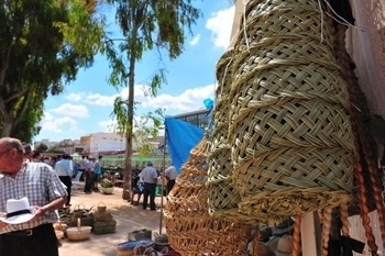
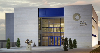
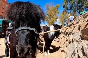 In the 1940s it became necessary to build more modern premises to house the market and it took up residence in a superbly appointed municipal building in 1955. Until the second half of the 20th century the presence of travelers and tradesmen from all over Spain brought a dynamism and lively atmosphere which made Fuente Álamo a uniquely attractive town in the Region. Numerous inns and bars catered for the visitors to the market at the weekend: the market was held on Saturdays, a tradition which is still maintained today, albeit without the livestock.
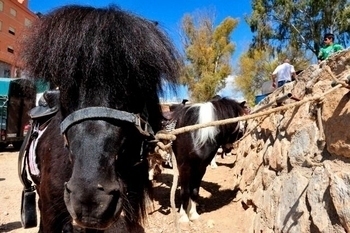
Nowadays, Fuente Álamo holds an annucal livestock market at which some small livestock, but mainly horses and donkeys are sold.
Livestock farming was seriously affected by the prolonged droughts of the late 20th century, and the importance of the market also decreased in the face of competition from new, more modern ways of conducting trade and commerce.
Modern Fuente Álamo
 The start of the 20th century was constantly marked by drought, unemployment and popular uprisings as industrialization gripped the country. The war years and the dictatorship shook the whole of Spain: The sculptures and artworks in the church were burnt or destroyed, as were many throughout the region, although the main structure of the church survived.
The Colegio José Antonio was occupied by the army and converted into a war hospital, and both the Casino Guerrero and the Iglesia de San Agustín were used as prisons. Fear and suffering were part of every household during the war years, as they were in so many other areas of the country.
One important incident from this time is the sinking of the Castillo de Olite at the entrance to the port of Cartagena in March 1939, following which those survivors who were not injured or wounded were held prisoner in Fuente Álamo until the war ended. In 1966 General Franco awarded the town the titles of Muy Noble and Muy Leal in recognition of what he called the "humanitarian work" of the townspeople, in reference to the prison housing the survivors of the Castillo de Olite. This event was the costliest sinking in Spanish coastal history in terms of lives lost, and the main street in the town was renamed Gran Vía de los Mártires del Castillo de Olite in remembrance of the victims.
Fuente Álamo today
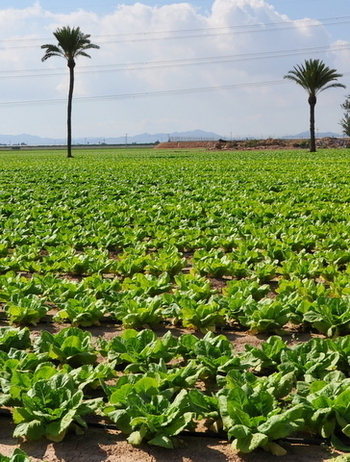
Fuente Álamo is blessed with good communication networks and infrastructures. The features which made it attractive in the past are still in existence today: the pleasant climate, the countryside, and the proximity to the biggest cities in the Region of Murcia as well as both the mountains and the coast. Agriculture and livestock are still among the main elements of the local economy.
 Some aspects have changed, inevitably, with the passage of time. Sheep have given way to pigs since the 1970s, and Fuente Álamo is now one of the most important pig-farming areas in the Region. Chicken farming has also grown considerably in the last few decades, as more modern methods of production have made the activity more economically viable.
Crop farming has also become more mechanized and modern, with systems in place to combat drought and make the products attractive to wider markets, and alongside this growth there has also been a large increase in the number of people employed in the transport sector.
Construction and service industries have also increased in importance, and the standard of living in the municipality has improved beyond all recognition.
The growth of industry has been slow, but there are now important metal companies, the ham warehouses of Balsapintada, and the food industry which underpins hopes for future growth. Other national and international companies have chosen to locate in the municipality in recent decades, the largest being the SABIC Petro-chemicals plant in La Aljorra and a factory making aircraft fuselages.
In the 1950s and 1960s Fuente Álamo was affected by the emigration which hit the whole Region, as workers left their homes to go to the north or abroad in search of opportunity, but today the municipality receives immigrants in search of employment. Immigrants have arrived mainly from Ecuador and Morocco (looking for employment in the agricultural industry) and the UK (looking for sunshine!). Fuente Álamo as a result, has one of the highest multicultural populations in the Region.
The construction of the Hacienda del Álamo golf resort has opened a new market for residential tourism and the construction of the technology park encouraged more enterprise industry to create employment. The construction of the new Region of Murcia International Airport at Corvera has also increased opportunities for Fuente Álamo in the future.
article_detail
Find more information by AREA, TOWN or URBANISATION .....
Cabo de Palos
Cartagena
El Carmoli
Islas Menores and Mar de Cristal
La Manga Club
La Manga del Mar Menor
La Puebla
La Torre Golf Resort
La Union
Los Alcazares
Los Belones
Los Nietos
Los Urrutias
Mar Menor Golf Resort
Pilar de la Horadada
Playa Honda / Playa Paraiso
Portman
Roldan and Lo Ferro
San Javier
San Pedro del Pinatar
Santa Rosalia Lake and Life resort
Terrazas de la Torre Golf Resort
Torre Pacheco
Aguilas
Aledo
Alhama de Murcia
Bolnuevo
Camposol
Condado de Alhama
Fuente Alamo
Hacienda del Alamo Golf Resort
Lorca
Mazarron
Puerto de Mazarron
Puerto Lumbreras
Sierra Espuna
Totana
Aledo
Alhama de Murcia
Bolnuevo
Camposol
Condado de Alhama
Fuente Alamo
Hacienda del Alamo Golf Resort
Lorca
Mazarron
Puerto de Mazarron
Puerto Lumbreras
Sierra Espuna
Totana
Abanilla
Abaran
Alcantarilla
Archena
Blanca
Corvera
El Valle Golf Resort
Hacienda Riquelme Golf Resort
Lorqui
Molina de Segura
Mosa Trajectum
Murcia City
Peraleja Golf Resort
Ricote
Sucina
Abaran
Alcantarilla
Archena
Blanca
Corvera
El Valle Golf Resort
Hacienda Riquelme Golf Resort
Lorqui
Molina de Segura
Mosa Trajectum
Murcia City
Peraleja Golf Resort
Ricote
Sucina
Urbanisations
CamposolCondado de Alhama
El Valle Golf Resort
Hacienda del Alamo Golf Resort
Hacienda Riquelme Golf Resort
Islas Menores and Mar de Cristal
La Manga Club
La Torre Golf Resort
Mar Menor Golf Resort
Mazarron Country Club
Mosa Trajectum
Peraleja Golf Resort
Santa Rosalia Lake and Life resort
Terrazas de la Torre Golf Resort
La Zenia
Lomas de Cabo Roig
Important Topics:
CAMPOSOL TODAY Whats OnCartagena SpainCoronavirusCorvera Airport MurciaMurcia Gota Fria 2019Murcia property news generic threadWeekly Bulletin
CAMPOSOL TODAY Whats OnCartagena SpainCoronavirusCorvera Airport MurciaMurcia Gota Fria 2019Murcia property news generic threadWeekly Bulletin
Contact Murcia Today: Editorial 966 260 896 /
Office 968 018 268

