- Region
- Águilas
- Alhama de Murcia
- Jumilla
- Lorca
- Los Alcázares
- Mazarrón
- San Javier
-
ALL AREAS & TOWNS
- AREAS
- SOUTH WEST
- MAR MENOR
- MURCIA CITY & CENTRAL
- NORTH & NORTH WEST
- TOWNS
- Abanilla
- Abarán
- Aguilas
- Alamillo
- Alcantarilla
- Aledo
- Alhama de Murcia
- Archena
- Balsicas
- Blanca
- Bolnuevo
- Bullas
- Cañadas del Romero
- Cabo de Palos
- Calasparra
- Camping Bolnuevo
- Campo De Ricote
- Camposol
- Canada De La Lena
- Caravaca de la Cruz
- Cartagena
- Cehegin
- Ceuti
- Cieza
- Condado de Alhama
- Corvera
- Costa Cálida
- Cuevas De Almanzora
- Cuevas de Reyllo
- El Carmoli
- El Mojon
- El Molino (Puerto Lumbreras)
- El Pareton / Cantareros
- El Raso
- El Valle Golf Resort
- Fortuna
- Fuente Alamo
- Hacienda del Alamo Golf Resort
- Hacienda Riquelme Golf Resort
- Isla Plana
- Islas Menores & Mar de Cristal
- Jumilla
- La Azohia
- La Charca
- La Manga Club
- La Manga del Mar Menor
- La Pinilla
- La Puebla
- La Torre
- La Torre Golf Resort
- La Unión
- Las Palas
- Las Ramblas
- Las Ramblas Golf
- Las Torres de Cotillas
- Leiva
- Librilla
- Lo Pagan
- Lo Santiago
- Lorca
- Lorquí
- Los Alcázares
- Los Balcones
- Los Belones
- Los Canovas
- Los Nietos
- Los Perez (Tallante)
- Los Urrutias
- Los Ventorrillos
- Mar De Cristal
- Mar Menor
- Mar Menor Golf Resort
- Mazarrón
- Mazarrón Country Club
- Molina de Segura
- Moratalla
- Mula
- Murcia City
- Murcia Property
- Pareton
- Peraleja Golf Resort
- Perin
- Pilar de la Horadada
- Pinar de Campoverde
- Pinoso
- Playa Honda
- Playa Honda / Playa Paraíso
- Pliego
- Portmán
- Pozo Estrecho
- Puerto de Mazarrón
- Puerto Lumbreras
- Puntas De Calnegre
- Region of Murcia
- Ricote
- Roda Golf Resort
- Roldan
- Roldan and Lo Ferro
- San Javier
- San Pedro del Pinatar
- Santiago de la Ribera
- Sierra Espuña
- Sucina
- Tallante
- Terrazas de la Torre Golf Resort
- Torre Pacheco
- Totana
- What's On Weekly Bulletin
- Yecla


- EDITIONS:
 Spanish News Today
 Alicante Today
 Andalucia Today
article_detail
History of Cehegin
Brief historical overview of Cehegin
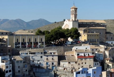 Throughout its history, Cehegín has been occupied by many varied cultures and inhabitants, different areas of the municipality assuming the prime ròle of importance during the various episodes of its history, as the populations adapted to the world in which they lived. War, pestilence, human development, diplomacy, technology, religion, all have played their part in shaping the municipality which exists today and broadly speaking, four different areas of Cehegín represent four different eras of occupation:
Prehistory (4000-600BC)
Shelter and safety made the steep slopes of the Peña Rubia, Sierra de la Puerta, Virgen de la Peña,( Copper Age) and Morra de la Cerámica ( bronze age) of prime importance.
Iberian, Roman and Visigoth (600BC to 711AD)
- Valle del Paraíso and Begastri, water, farming and strategic location made the Cerro de Roenas the focal point of population.
Islamic occupation (711AD to 1243)
- Alquipir, and Puntarrón, Begastri was abandoned the Moorish invaders sought height and strategic safety away from the old settlement.
Mediaeval, Modern and contemporary (1243-current date)
- The current location of Cehegín town.
Prehistoric Cehegín.
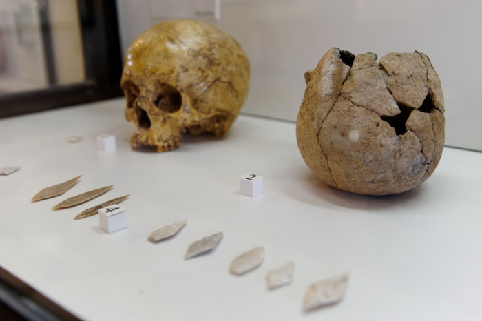 Cehegín had three natural features which attracted prehistoric settlers: water and natural springs, shelter in the form of natural caves formed in the rocky heights of the Sierra de la Puerta and Peña Rubia and abundant food supplies and natural resources in the forests and plains surrounding these mountainous zones.
There are a series of natural caves and shelters in both the Peña Rubia and Sierra de la Puerta, which present definitive evidence of Neolithic occupation, then subsequnt habitation throughout prehistory, right up to the arrival of the Romans.
The Peña Rubia is a large mass of limestone which lies to the south-east of Cehegín, and on its steepest eastern slope are a number of shelters, three of which contain arte rupestre, or prehistoric rock art: the Cueva de las Conchas, The Cueva del Humo and the Cueva de las Palomas. The art in these caves was discovered between 1976 and 1983, and is of particular interest as the works were not situated on rockfaces, as is typical of levantine art around 4000 years ago, but inside the caves.
Different cultures and eras are represented in the caves, starting in the Late Neolithic Era. These cave paintings were declared a world heritage site by UNESCO in 1998, once the claims of a local man that he himself had created the artworks were disproven by the scientific community.
Flints, stone tools, ceramics and bone tools found at these sites can all be seen in the Municipal Archaeological Museum in Cehegín.
Cehegín Copper Age, Bronze Age, Iron Age.
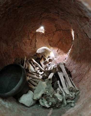
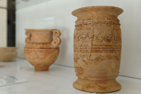 From the Copper Age onwards, the municipality of Cehegín was also home to later cultures who settled in this fertile territory. On Peña Rubia itself there are group burial sites belonging to the Copper Age,(3000BC) and Argaric settlements have been found dating from the end of the Bronze Age in the Sierra de la Puerta and Cabezo del Trigo, dating between the period of 1800 and 1300BC.
Metallurgy continued to develop and by around 700 BC as the iron Age began, traces of a native population collectively known as the Iberians emerged.
Several Iberian settlements are believed to have existed around Cehegín, but the most important developed on an area known today as the Cabezo de Roenas, an elevated hill on the banks of the River Quípar which later became the town of Begastri.
It is difficult to know exactly how extensive this first settlement, built by these settlers, the Iberians, actually was, as the Roman town which was built over the top of the first Iberian settlement buried the remains of the first town, re-cycling the foundations of the dwellings for further construction. Unlike other important Iberian sites within the region which were abandoned ( The El Cigarralejo in Mula and the Coimbra del Barranco Ancho in Jumilla) this settlement was occupied for hundreds of years after the disappearance of the Iberians.
The Iberians were an essentially agricultural population, although traded with the Phoenicians and Greeks who worked along the Mediterranean coastline, exchanging ceramics, metalwork, hides, luxury goods and even esparto grass. The Iberians also contributed important military warriors to the armies of Greece and Rome during the armed conflicts of the Punic wars, which preceded the Roman invasion of Cartagena in 209BC.
Click Iberians in Begastri for more details about this era of Begastri history.
The Romans in Begastri.
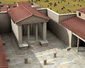 In 209BC the Romans invaded Cartagena and a steady process of Romanization enveloped what is now the Region of Murcia. Agricultural villas were built with the mission of producing food to feed the City of Carthago Nova ( now Cartagena) and the slaves working in the mineral mines in the Sierra Minera ( up to 30,000 at one point) and to produce goods which could be exported, such as olive oil, concentrated fish sauces and wheat.
The Romans brought with them more efficient farming techniques and new processes, new construction techniques and a sophistication hitherto unseen in the Iberian peninsula, the local Iberians slowly embracing their ways and customs. During the era of Roman occupation, Begastri became an important settlement, believed to have contained substantial public buildings and a population of 13,000 people, the equivalent of the modern day population of Cehegín, and other roman farming villas were built in different locations within what is now the modern day municipality of Cehegín.
Click for full information, Begastri under the Romans.
The Visigoths and Byzantines in Begastri.
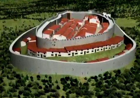 By the end of the 3rd Century AD, the engorged Roman Empire was struggling to control its vast territories, and was divided into two following nearly a century of succession instability. Barbaric Germanic tribes started to spread across Europe, the Goths, once allies of the Romans creating a vast territory which swallowed up Spain, and sacked Rome, Hispania, a Visigoth Kingdom. Fearful of the invading barbarians, the population of Begastri dismantled the imposing public buildings, using the stone to build 5 metre thick defensive walls, and filling the space created with dwellings.
In 425, Cartagena was overrun by the Vandals and the Alani and the Visigoths occupied Begastri until the Byzantines( half of the former Roman Empire,) claimed Cartagena as part of their efforts to regain the lost lands of the Roman Empire and Begastri reverted to Byzantine control for a period of around 50 years.( In 560AD).
A second defensive wall was constructed to protect the town, which lay on the border between Visigoth and Byzantine lands, but the Byzantines were defeated and pushed out of Spain, and Cartagena, which had been the capital of Byzantine territories, razed to the ground. Begastri reverted to the Visigoths, and became an Episcopal seat, and a Visigoth town of substance.
Documents still remain from this period and the names of some of the Bishops who attended the councils of Toledo are known, such as Vitalis and Acrusminus.
The last Bishop of Begastri recorded to have attended the council of Toledo was in 688, and there is no further documented evidence related to the town until 713AD when the pact of Tudmir was signed.
Click for more information about the Visigoths in Begastri
The Conquest of the Moors
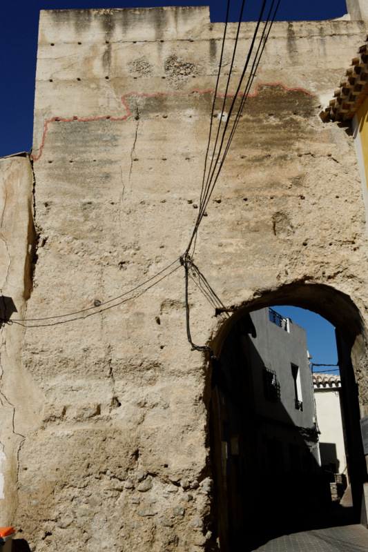 In 711 a fatal miscalculation by a Visigoth nobleman fighting for the Visigoth Kingship brought the Moors across the seas from Morocco, and the Visigoths were crushed as the overwhelming forces of the Moors swept across Spain. Begastri was part of the Kingdom of Aurariola (Orihuela), ruled by Duke Teodomiro, and by 713AD the Governor realised resistance was futile and sought damage limitation by signing a peace treaty with Abd Al-Aziz, the chief of the Moorish army in the Eastern coastal region.
The Pact of Tudmir established that the Moorish invaders would respect the traditions and possessions of the Visigoths in the kingdom of Murcia in return for obedience, the payment of taxes and the handing over of seven cities, one of which was Begastri.
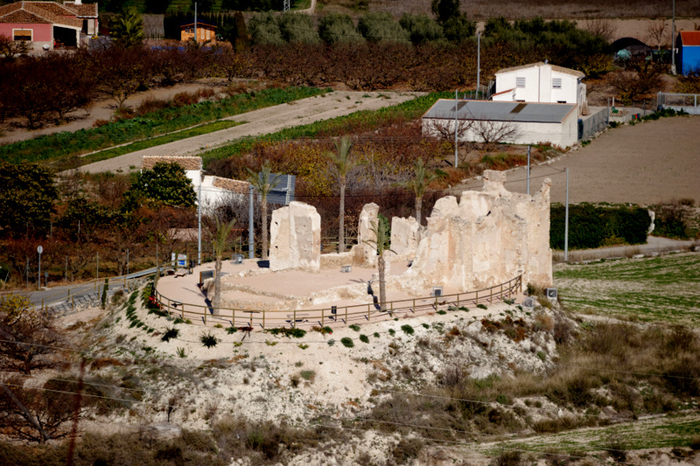
When the Moors arrived in Begastri, they decided to settle just outside the old city, rather than inhabit the former settlement of Begastri. The tribe concerned, the Zenehegis, chose to establish themselves on the Puntarrón hill, from where they could look out over the valley of the Argos river and the white city of Begastri, and this new settlement later grew into the town of Cehegín, a hìsn, or military fortification at its centre. Supporting this was the fortification of Alquipir, a minor Husun, a fortification which watched over communication routes and gave farmers living 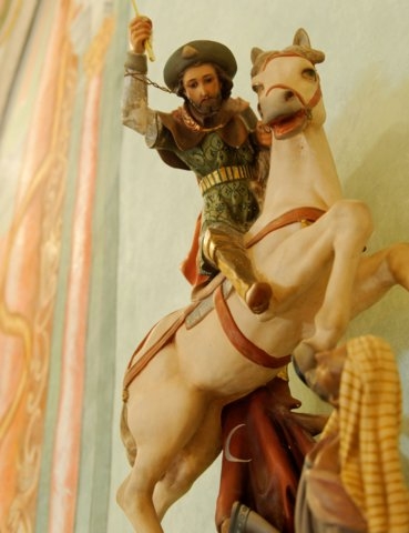 outside of the urban nucleus shelter in times of danger.
Although the Iberian Christians who wanted to remain in Begastri did so, little by little the inhabitants gravitated towards the new emplacement, and this process was accelerated by the events of 789, when the terms of the Pact of Tudmir were broken. There were still people living in the rubble of the ruined city during the 9th and 10th centuries, the ruins would also have been used by those farming the lands at the foot of the cerro, and there appears to have been habitation of some sort until the 13th century when the Christian Reconquist swept down into the area.
The Reconquista by Castile, and the new Cehegín
During the 12th and 13th centuries, the powerful Kingdoms of northern Spain, Castile and Aragón, fought to regain lands occupied by the Moorish invaders, and by the 13th century, the advance of the Christians towards the south of the peninsula gained unstoppable momentum, with the Kingdom of Murcia surrendering to the Crown of Castile in the Treaty of Alcaraz in 1243. Murcia was now a protectorate of Castile, and although the treaty established terms to respect the rights of the local moorish population, Castile set about a programme of repopulating the area with Christin settlers.
 The first Christians to come back to Cehegín were those who settled in the district now known as Canara, which was placed under the control of Pedro Meléndez Fan. However, the terms of the Treaty of Alcaraz were frequently broken, and the failure by Alfonso X to respect the culture and rights of the Moors led to the Moorish uprising of 1264. The rebellion was quashed two years later, when Alfonso requested military aid from his Father in law, Jaime of Aragón, who brought crushing military power to subdue the rebellions.
The military assistance rendered was repaid by granting the lands of Cehegín, Bullas and Caravaca to the powerful military Order of the Knights Templars.
The Knights Tempars in Cehegín
The rule of the Templars was repressive, though, and the Moors gradually left Cehegín. The failure of attempts by Christian authorities to repopulate the area, left the town deserted by the beginning of the 14th century, and it was subsumed into the neighbouring town of Caravaca de la Cruz.
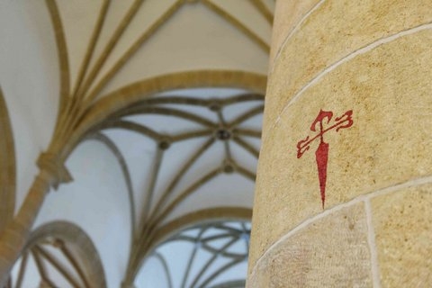
In 1312, the power of the Templars had grown too great and the order was broken up, the towns of Caravaca, Bullas and Cehegín placed in the hands of the Military Order of Santiago by Alfonso XI in 1344. At the same time he also separated Cehegín from Caravaca administratively. In reality, however, the Order of Santiago had been in charge in Cehegín since 1335, when they had bought the district of Canara from its owner, Hurtado Ruiz de Gamarra.
In the second half of the 14th century a few people began to inhabit the town again, with new construction erecting churches and more substantial residential dwellings in the centre, although plague and disease were ever present during Mediaeval Spain.
The old city of Begastri became known as the Cabezo de las Ruinas, the ruins plundered for the cut stone used by the Romans in construction work for the growing town of Cehegín.
The Boom after the Reconquista
 The proximity to the frontier with the Nazarí kingdom of Granada continued to be a handicap to Murcia’s development until Granada was taken by the Crown of Castile in 1492 and the Moorish population was expelled.
Once the danger of cross border raids had diminished, the town underwent a period of spectacular growth, and the population rose from just under 3,000 at the end of the 15th century to over 5,000 in the 16th.
This increase in population coincided with advances in crop farming techniques and the expansion of livestock farming. However, humans will be humans, and no sooner had the threat of the moorish incursions diminished than a dispute began with the residents of Caravaca de la Cruz, and those living in Canara sought the protection of Cehegín against the threat posed by the livestock farmers of Caravaca.
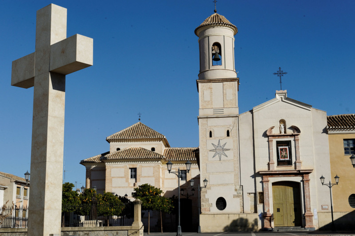
Now that the Moors were gone, the population spread outside the city walls, and the city grew and became more monumental in appearance. Various impressive buildings were erected, most of them religious, including the churches of La Soledad, La Concepción, La Magdalena and the church of Santo Cristo in the 16th century, and the Franciscan Convento de San Esteban in the 17th.
In most of Spain the 17th century was a time of crisis, but Cehegín got off relatively lightly. Despite the shortages brought about by wars, epidemics and the plague, the number of people living in the city continued to rise, halted only by the separation from Bullas, which achieved its independence in 1689.
After the War of Succession between 1701 and 1713, the rest of the century was a time of economic and social recovery. The population grew again after the loss of Bullas, and reached as many as 7,000, due to the continuing advances in farming techniques and the availability of previously barren land. Cereal crops were grown alongside grapes, which became more and more important to Cehegín as the century wore on, while the trades guilds ran the local cottage industries and crafts.
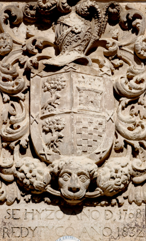
The city’s architectural heritage was also enriched by new buildings, most of them with civic functions. These include the Palacio de Ahumada, the Hospital de la Real Piedad, the Ayuntamiento and the Palacio de los Fajardo.
One of the most important events in the town took place on 25th July 1725, when the figure of the patron saint, the Virgen de las Maravillas, was unveiled. The statue was commissioned by the Franciscans, and shows the Virgin Mary with the baby Jesus in her arms. It was crafted in Naples by Nicolás Fumo.
Progress in the 19th Century
 The early years of the 19th century were dominated by the War of Independence (also known as the Peninsular War), during which Cehegín was ransacked by Napoleon’s troops as they fled from Andalucía. After the war ended, though, the city became relatively prosperous: in 1847 it was finally freed from the shackles of government by the Order of Santiago, as ecclesiastical properties were freed from encumbrance, and the state took over after five centuries of religious administration.
Hemp and esparto grass became important products in the area, and industry grew up alongside the plantations related to the production of ropes and footwear. In the last three decades of the century iron ore mines were opened, and the town’s communications were improved thanks to the bridges over the Quipar and Argos rivers. At the end of the century electric lighting made its first appearance in Cehegín.
The 20th Century
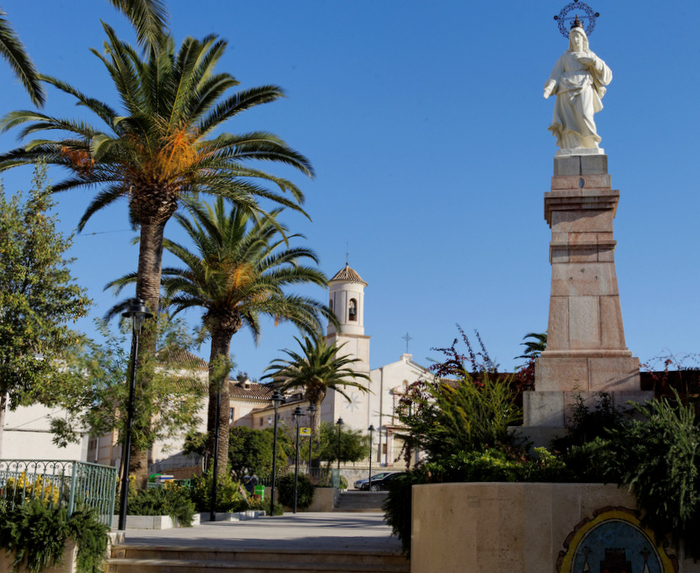 At the start of the 20th century Cehegín was the Region’s leading iron ore producer, ahead of more traditional areas like Cartagena, but the worldwide economic crisis in 1929 put paid to that, as the main export market was in Germany, which suddenly found itself in the depths of economic depression.
At the same time, the esparto grass and hemp industries collapsed, and Cehegín was left practically without industry.
During the years of dictatorship, the population dropped from 17,000 to 12,000, working men seeking employment in other agricultural areas, including France.
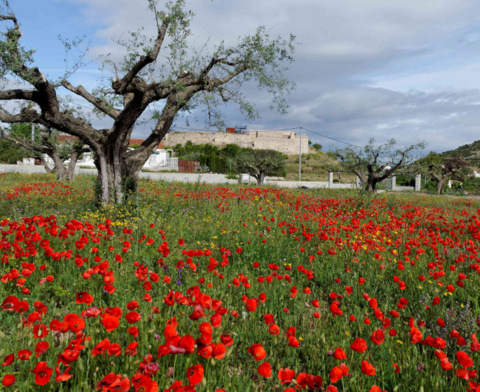 However, a programme to revive the area included the creation of industries based on soft fruit growing and canning, as the area is particularly suitable for soft fruit crops, and an industry quarrying marble has also become important to the local economy. Tourism is also on the rise, especially since the old centre of Cehegín was recognized as a Historic Monument by the National Ministry of Culture in 1982.
The castle was lost in 1957, but the opening of the motorway between Murcia and Caravaca has made the town far more accessible to visitors, who help to make it a bustling and thriving community, with a population of around 16,000.
More information about Cehegín
Cehegín lies within the North West area of Murcia. For more daily news, whats on or local information relating to the whole area, select North West from the toolbar beneath the header of every page, or select North west from the map box at the bottom of every page. For more specific information about Cehegín, select the town name Cehegín from the map box at the bottom of every page.
article_detail
Find more information by AREA, TOWN or URBANISATION .....
Cabo de Palos
Cartagena
El Carmoli
Islas Menores and Mar de Cristal
La Manga Club
La Manga del Mar Menor
La Puebla
La Torre Golf Resort
La Union
Los Alcazares
Los Belones
Los Nietos
Los Urrutias
Mar Menor Golf Resort
Pilar de la Horadada
Playa Honda / Playa Paraiso
Portman
Roldan and Lo Ferro
San Javier
San Pedro del Pinatar
Santa Rosalia Lake and Life resort
Terrazas de la Torre Golf Resort
Torre Pacheco
Aguilas
Aledo
Alhama de Murcia
Bolnuevo
Camposol
Condado de Alhama
Fuente Alamo
Hacienda del Alamo Golf Resort
Lorca
Mazarron
Puerto de Mazarron
Puerto Lumbreras
Sierra Espuna
Totana
Aledo
Alhama de Murcia
Bolnuevo
Camposol
Condado de Alhama
Fuente Alamo
Hacienda del Alamo Golf Resort
Lorca
Mazarron
Puerto de Mazarron
Puerto Lumbreras
Sierra Espuna
Totana
Abanilla
Abaran
Alcantarilla
Archena
Blanca
Corvera
El Valle Golf Resort
Hacienda Riquelme Golf Resort
Lorqui
Molina de Segura
Mosa Trajectum
Murcia City
Peraleja Golf Resort
Ricote
Sucina
Abaran
Alcantarilla
Archena
Blanca
Corvera
El Valle Golf Resort
Hacienda Riquelme Golf Resort
Lorqui
Molina de Segura
Mosa Trajectum
Murcia City
Peraleja Golf Resort
Ricote
Sucina
Urbanisations
CamposolCondado de Alhama
El Valle Golf Resort
Hacienda del Alamo Golf Resort
Hacienda Riquelme Golf Resort
Islas Menores and Mar de Cristal
La Manga Club
La Torre Golf Resort
Mar Menor Golf Resort
Mazarron Country Club
Mosa Trajectum
Peraleja Golf Resort
Santa Rosalia Lake and Life resort
Terrazas de la Torre Golf Resort
La Zenia
Lomas de Cabo Roig
Important Topics:
CAMPOSOL TODAY Whats OnCartagena SpainCoronavirusCorvera Airport MurciaMurcia Gota Fria 2019Murcia property news generic threadWeekly Bulletin
CAMPOSOL TODAY Whats OnCartagena SpainCoronavirusCorvera Airport MurciaMurcia Gota Fria 2019Murcia property news generic threadWeekly Bulletin
Contact Murcia Today: Editorial 966 260 896 /
Office 968 018 268

