- Region
- Águilas
- Alhama de Murcia
- Jumilla
- Lorca
- Los Alcázares
- Mazarrón
- San Javier
-
ALL AREAS & TOWNS
- AREAS
- SOUTH WEST
- MAR MENOR
- MURCIA CITY & CENTRAL
- NORTH & NORTH WEST
- TOWNS
- Abanilla
- Abarán
- Aguilas
- Alamillo
- Alcantarilla
- Aledo
- Alhama de Murcia
- Archena
- Balsicas
- Blanca
- Bolnuevo
- Bullas
- Cañadas del Romero
- Cabo de Palos
- Calasparra
- Camping Bolnuevo
- Campo De Ricote
- Camposol
- Canada De La Lena
- Caravaca de la Cruz
- Cartagena
- Cehegin
- Ceuti
- Cieza
- Condado de Alhama
- Corvera
- Costa Cálida
- Cuevas De Almanzora
- Cuevas de Reyllo
- El Carmoli
- El Mojon
- El Molino (Puerto Lumbreras)
- El Pareton / Cantareros
- El Raso
- El Valle Golf Resort
- Fortuna
- Fuente Alamo
- Hacienda del Alamo Golf Resort
- Hacienda Riquelme Golf Resort
- Isla Plana
- Islas Menores & Mar de Cristal
- Jumilla
- La Azohia
- La Charca
- La Manga Club
- La Manga del Mar Menor
- La Pinilla
- La Puebla
- La Torre
- La Torre Golf Resort
- La Unión
- Las Palas
- Las Ramblas
- Las Ramblas Golf
- Las Torres de Cotillas
- Leiva
- Librilla
- Lo Pagan
- Lo Santiago
- Lorca
- Lorquí
- Los Alcázares
- Los Balcones
- Los Belones
- Los Canovas
- Los Nietos
- Los Perez (Tallante)
- Los Urrutias
- Los Ventorrillos
- Mar De Cristal
- Mar Menor
- Mar Menor Golf Resort
- Mazarrón
- Mazarrón Country Club
- Molina de Segura
- Moratalla
- Mula
- Murcia City
- Murcia Property
- Pareton
- Peraleja Golf Resort
- Perin
- Pilar de la Horadada
- Pinar de Campoverde
- Pinoso
- Playa Honda
- Playa Honda / Playa Paraíso
- Pliego
- Portmán
- Pozo Estrecho
- Puerto de Mazarrón
- Puerto Lumbreras
- Puntas De Calnegre
- Region of Murcia
- Ricote
- Roda Golf Resort
- Roldan
- Roldan and Lo Ferro
- San Javier
- San Pedro del Pinatar
- Santiago de la Ribera
- Sierra Espuña
- Sucina
- Tallante
- Terrazas de la Torre Golf Resort
- Torre Pacheco
- Totana
- What's On Weekly Bulletin
- Yecla


- EDITIONS:
 Spanish News Today
 Alicante Today
 Andalucia Today
article_detail
History of Los Belones
A brief history of Los Belones, and the Rincón de San Ginés
 Los Belones forms part of the administrative area of Rincón de San Ginés, an easterly corner of the modern Cartagena municipality, the history of the area closely linked to the various stages in the history of Cartagena City itself.( Click History of Cartagena)
There are many locations to visit in Cartagena City relating to the history of the area and finds from the different periods of history can be found in the municipal archaeological museum in Cartagena.( Click Archaeological Museum, Cartagena)
Prehistory in Los Belones
Archaeological findings have proved that there were human settlements in Rincón de San Ginés dating from the late Paleolithic, although not specifically in Los Belones, the early inhabitants preferring the fringe of the 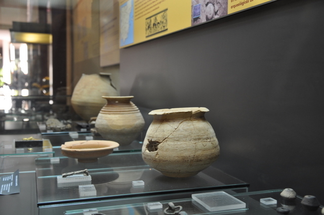 Campo de Cartagena and Mar Menor to give a choice of both marine and land hunting. Evidence of settlement has been found in the Los Mejillones cave near to los Belones and the Los Dentoles cave in Calblanque, where fragments of bone and antler harpoons were used over 12,000 years ago.
Larger settlements sprang up in the Neolithic ( or new stone age a period in Spain from roughly 7000 BC to 1700BC) , the inhabitants producing ceramics, using stone axes and wearing polished stone necklaces. Items from this period have been found in the Los Pájaros cave near to Cabo de Palos.
The site of Las Amoladeras was a seasonally used Chalcolithic ( copper age- the later phase of the Neolithic which began around 3500 BC in Europe and continued to 1700BC) settlement in what is now Cabo de Palos dating back to 2850 BC, where the inhabitants enjoyed the plentiful supply of fish and seafood from the Mediterranean. It is also close to the salt flats of Cabo de Palos which at that time supplied fresh water, making it an ideal place to hunt mammals and water birds.
The settlement was built on a platform of fossilized dunes near the sea, and the lack of foundations and fortifications indicate the seasonality of its use over a long period of time. It appears that the settlement existed for two reasons: firstly to exploit the natural resources provided by the sea, and secondly the plentiful opportunities for hunting. The small mills found here show that part of the food requirement was met by cereal production somewhere near the settlement.
Iberian Remains in Los Nietos
As technology developed, man’s ability to make tools and smelt metals enabled him to create more permanent settlements and farm rather than rely on subsistence hunting methods.
In this area of the Iberian peninsula (Spain) the main culture which developed and occupied this area was the Argaric culture (2200 to 1500BC) of which there are significant remains further inland. The Argarics generally chose higher, strategically advantageous sites, near to fresh water and preferred higher ground, so the flat lands of the Mar Menor were not their natural choice.
 For this reason there is little evidence of the Argaric culture having been present in El Rincón de San Ginés, as is the case in the rest of the municipality of Cartagena: the only remains which could point to it having reached the area date from around 2000 BC and are located in Cala del Pino, in La Manga.
As the Argarics disappeared as a definable culture, their place was taken by the Iberians, a collection of indigenous tribes who exploited the agricultural resources available to them and began to trade with the cultures plying the Mediterranean basin, traders ranging from modern day Libya as far as Cornwall in the UK in their search for trade goods and raw materials. The Iberian peninsula was rich in ores, grain and esparto grass, and gradually as the influences of outside cultures brought new crops such as olives, and technology, including the potter’s wheel, a healthy trading culture grew up.
In Los Nietos there is a site which has made it possible to study what was most probably an Iberian town and burial site which was occupied from the end of the 5th century BC to the second century BC when the Roman invasion changed the face of Spain.
This area is known as La Loma del Escorial, and was an important Iberian settlement occupying around one and a half hectares. It probably sprang up as a consequence of the valuable lead and silver deposits in the nearby Sierra Minera of La Unión and Cartagena, which would have been the economic driving force behind the town, and its proximity to the sea ensured its prosperity.
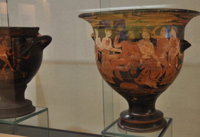
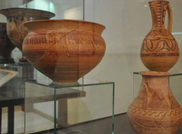
The settlement was enclosed within protective walls and is believed to have also had two towers either side of a main entrance. The burial site shows evidence of typical cremation funeral rites and the deeply hierarchical social structure of this indigenous society, within which individuals enjoyed differing degrees of power and wealth. Most of the grave goods found in this site show that the population was relatively low in this hierarchy and as such was not wealthy, most of the grave goods being of fairly poor quality, although there were some exceptional pieces of trade ceramics found in some of the wealthier burials which have pride of place in the archaeological museum in Cartagena.
The zenith of this settlement in Los Nietos occurred in the first half of the 4th century BC, when these Greek Attica bowls decorated with red figures were made( shown in the first photograph). After this period the settlement declined, and eventually disappeared in the early second century BC following the Roman invasion.
The Barca family founds Qart Hadast and rules the coast
The competition to dominate Mediterranean trade routes lead to a series of wars between the emerging 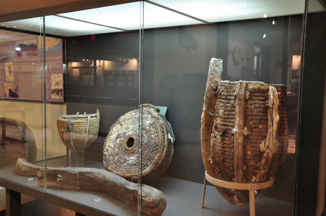 Roman nation and the Carthaginians, who were based in Carthage on the African coast. The Carthaginians had in their turn sprung from the Phoenicians, a culture driven out of their Libyan homeland who traded throughout the Mediterranean, leaving behind remains in several Murcian locations ( Mazarrón 2 sunken boats, La Manga del Mar Menor 1 sunken vessel, Águilas evidence of smelting).
The Carthaginians were gradually driven South by the Romans and after the first Punic wars settled in Cartagena, staging a “peaceful take-over” of the Iberian settlement in the location of modern Cartagena as the result of a treaty by which both sides decided to respect the natural boundary of the River Ebro. As of the 4th century BC the Carthaginians, led by the Barca dynasty which included Hasdrubal and Hannibal, held sway over the whole of the south-east of the Iberian Peninsula.
The Carthaginians introduced new techniques in cultivating the land in the area, and new industries were created using the esparto grass which abounds naturally in this part of Spain.
The Romans in Rincón de San Ginés
However, the Carthaginians broke the treaty established with the Romans by crossing the Ebro and attacking Sagunto, following which Hannibal set off to attack Rome directly from Cartagena on his famous journey 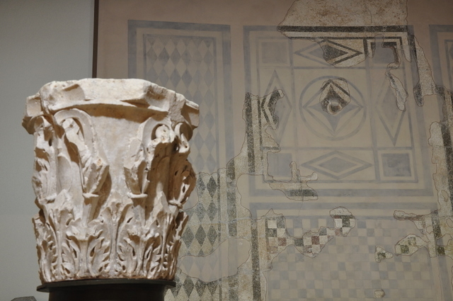 across the Alps, and never returned, the Romans taking the opportunity presented by his absence to take this area back and effectively wipe out the Carthaginians.
When the Romans conquered Carthago Nova in the 3rd century BC they set about exploiting the natural resources of the area, re-opening the mines in the Sierra Minera, establishing salt flats to create natural salt along the edges of the Mar Menor and building agricultural villae along the coast. Amongst the remains found in this corner are those of a fish-salting factory, discovered between the towns of Los Nietos and Playa Honda, used to make fish sauces such as garum, and salt fish, shipped across the Roman Empire. In Cala Reona the remains of a shipwreck from the 5th or 6th century have been found, the boat carrying a cargo of salted fish in amphorae. Many Roman wrecks along this coastline have yielded a wealth of archaeological material, giving researchers a clear picture of the scale of activity in the Cartagena shipping port.
The Romans derived a lot of wealth from the mines around Cathago Nova (now Cartagena), under both the Republic and the Empire, and at times as many as 35,000 slaves were working in them in order to extend further the economic dominance of Rome throughout the Mediterranean in the 2nd century BC.
One of the settlements which sprang up at this time as a result of mining activity was El Castillet, which lies at the eastern end of the Sierra Minera. Here archaeologists have unearthed a residential building with various annexes, and it is believed that it was used as a distribution point for mining products and a supply station for the neighbouring communities which were devoted to mining and agriculture.
By the 5th century Rome was dividing, its power crumbling and its territories under attack from waves of Vandals, Goths and Visigoths. Although these subsequent invasions left their mark on Cartagena city, there is no evidence relating to this occupation in Rincón de San Ginés.
Each October Cartagena celebrates its Romans and Carthaginians fiestas in honour of this colourful period of its history.
The Moors in Los Belones
By the beginning of the 8th century weak Visigoth rule and a power struggle for the throne opened up the peninsula to the Moors from Africa, and in 711 much of modern day Spain fell under their control.
 The Moors were undoubtedly present around the Mar Menor for the next 500 years, and left little in the way of physical remains although this was one of the areas chosen by the Emirs for their leisure palaces, known as “Al-Kasars” (hence the name of the town of Los Alcázares). The Arabs, Syrians and Berbers left behind them the “encañizada” fishing technique which is still used in this area, consisting of the construction of an elaborate trap using reeds and stakes in the saltwater inlets which bring water from the Mediterranean to the Mar Menor. This technique was used to capture the mullet and gilthead bream which lay their eggs here, being lured into a labyrinth of cages from which they were harvested in hand-held nets.
The economy under the Moors was based on agriculture and trade, and the mines in Rincón de San Ginés were largely ignored. It may be that the most accessible seams had been over-exploited by the Romans centuries beforehand. The presence of the Moors in the area is celebrated in colourful style in Los Alcázares straight after Easter every year in the Berber fiestas.
The Christian Conquest in Los Belones
By the early 13th century, the Christian forces of Castile y León and Aragón were gaining ground in the South of Spain and in 1243 Murcia become the property of Prince Alfonso of Castile ( later to become Alfonso X of  Castile) via a peaceful surrender, although the Mudejar uprising 20 years later in 1266 had a greater impact on the region when many of those who had supported the uprising were evicted. Following this the Christian settlers who replaced them started to move away from the Moorish settlements and build new settlements of their own, many in the locations of the modern-day towns.
In the wake of the Reconquista, the Kingdom of Murcia was subjugated to Castile, and in this period the first known documentary reference to Rincón de San Ginés is found in the “Libro de Montería” (hunting book) of King Alfonso X “El Sabio”, where the area of Cabo de Palos and possibly the Isla del Ciervo are mentioned as excellent winter hunting grounds. In 1283 the King “donated” the lagoon of Cabo de Palos to Murcia in order to supply the city’s residents with seafood, and at the same time he divided La Manga into two parts, awarding the north to Murcia and the south to Cartagena. This division still remains, although nowadays the northern end belongs to the municipality of San Javier.
Berber pirate raids, Mar Menor coastline
The monastery of San Ginés de la Jara also dates back to this time, acting as a refuge for the locals when the Berber pirate raids reached the area. These incursions began when Moors expelled from the area fought back to try and regain something from the lands and livestock they had lost and became increasingly common in the 15th and 16th centuries, after the Reconquist was completed in 1492 and the Moors evicted from Spain completely following the fall of the last stronghold in Spain, in Granada. The increased problem of pirate raids led to the construction of a network of defensive watchtowers along the coast, some of which still stand today. It is known that three were built in La Manga and one in Cabo de Palos on the site where today the lighthouse stands, but unfortunately none of these has survived the centuries. Further along the coast in both directions these watchtowers still survive in Mazarrón and Pilar de la Horadada, and on into both Andalucía and Valencia.
The threat from the Berber raids discouraged settlers so for a long time the area was practically empty of human habitation and the Council of Cartagena rented the land out to the few who were willing to farm it. It 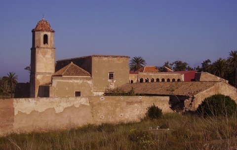 was also used in winter as grazing land for the flocks kept for transhumance farming, but the fear of these North African looters even prevented fishing in the area for centuries. Financial rewards were offered by the Council to encourage repopulation, and they also actively helped to rescue any hostages taken by the pirates, but takers were few and the area remained largely depopulated until the threat of piracy diminished in the 18th century.
Modern history of the Mar Menor and Los Belones
By the 18th century the construction of the Military Arsenal in Cartagena had contributed to an increase in demand for fresh produce to not only supply the construction force but also the personnel stationed there, stimulating an increase in the farming population of the area.
Rincón de San Ginés started to grow.
In 1726 the islands in the Mar Menor were taken over by the navy for the use of Prince Felipe, the son of Felipe V, so that he could enjoy the hunting there. It was also decreed that the islands should pass into the custody of the Navy’s General Intendant in Cartagena, but eventually they were administered directly by the Ministry of the Fleet.
A census in 1758 noted the existence of 76 farm labourers and seven mills in San Ginés, and in the neighbourhood registry of 1761 it is recorded that in the Convent of San Francisco in the area of San Ginés de la Xara there were 18 priests, 8 novices, 18 lay brothers and 6 servants. By 1771 there was a population of 1,020, and in the 1787 Floridablanca census the number had dropped slightly to 963.
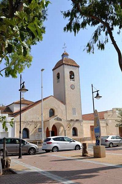
The nineteenth century began with Rincón de San Ginés finally being awarded the status of “Diputación” of Cartagena, including the important population centres of Cabo de Palos, Los Belones and La Manga. The 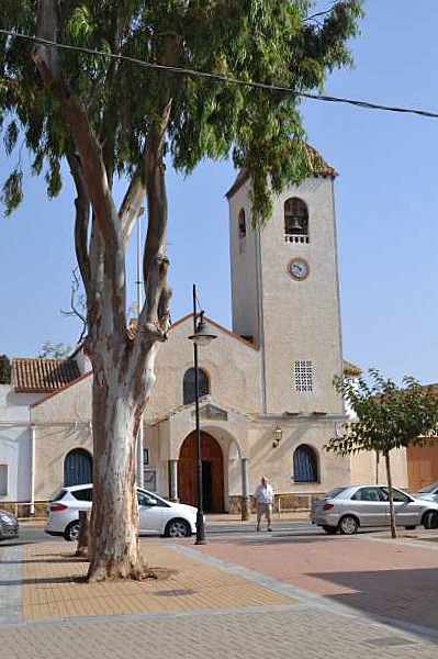 members of the Belón family who presumably gave its name to the town of Los Belones donated land for the construction of a church dedicated to San Isidro Labrador, and in 1893 this became the parish church.
During the century the ecclesiastical confiscations of Mendizábal and Madoz ( church property was seized and sold off, the money passing to the crown) ensured that the unfarmed land in La Manga was sold off in small parts so that it could be used, and at the same time the industrial strength of Cartagena grew as the mines in the Sierra Minera were reopened. People flocked to Cartagena and La Unión in the mining boom, and new outlying settlements such as those at the crossroads in Atamaría, Los Nietos and El Llano came into existence.
The lighthouses at Cabo de Palos and Portmán were built as part of a general national plan passed in 1847, and the lamp at Cabo de Palos was first lit on 1st February 1865. The town at this time was a fishing village and salt exporter, and the name was officially changed from La Barra to Caserío de Cabo de Palos in 1900.
By this point the fishing brotherhood of Cabo de Palos had been created, receiving permission to sell fish in the port due its distance from Cartagena. Purchasers came to Cabo de Palos from as far away as Valencia to buy here.
The 20th century in La Manga and Los Belones
In the early years of the twentieth century the fishing in La Manga was plentiful: there were various wooden jetties along the shore where the fishing boats moored, and “caldero” became a staple dish for those living here.
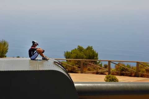 At this time the Defence Plan for the Cartagena naval base was devised, and as part of this 44 element structure, anti-aircraft guns were installed both on Cabo Negrete and on the Monte de las Cenizas, with another coastal battery being installed just east of the Portmán lighthouse. These 3 gun batteries can still be visited today and are impressive reminders of the strategic military importance of Catrtagena.
The “Negrete” battery was situated at an altitude of 283 metres above sea level, giving commanding views over the Mediterranean. Its 105mm Vickers guns were put in place between 1930 and 1932 and became fully operative the following year.
The Cenizas battery is at 305 metres above sea level, and the British-made 381mm cannons were primed in 1934, while the La Chapa battery in Portmán is lower down at 48m above sea level, and was armed with 152.4mm guns.
Civil War was a turbulent time for Cartagena, loyal to the Republican cause, and an important shipping port for the Republican Navy, a fact which lead to repeated and intense bombing raids, the most noteworthy of which occurred on the 25th November, 1936, during which the Condor legion carried out an intensive raid on the city between 5.30pm and 9pm, a raid which became known as the “Bombardeo de las Cuatro Horas” or the four hour bombing. The best place to find out more about this is at the Civil War Air Raid Museum in Cartagena.
Following the war, a period of rebuilding took place within the City, but on the Mar Menor fringe the most important change occurred when the Maestre family bought first the northern end and then the southern end 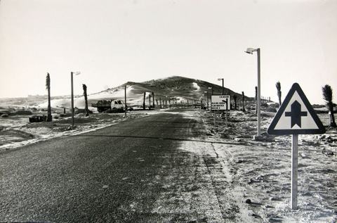 of the La Manga isthmus, and presented an urbanization plan which received government support. This southern end now belongs to Rincón de San Ginés, and the urbanization plan marked the most important turning point in the area’s history, converting a barren, sandy spit into a 20km expanse of urban holiday development.
The holiday homes here were initially a luxury reserved for the privileged few, but it soon became the Region of Murcia’s premier beach holiday destination, both for Spaniards and in the international market.
Construction spilled over from La Manga and the inland shore of the Mar Menor at Playa Honda became a popular destination, visitor numbers increased in Islas Menores and in 1964 the first high-rise apartment block was built on La Manga itself. By the end of the 1960s the strip had become an important tourist resort in its own right, and in 1973 work began on the construction of the Puerto Tomás Maestre, which eventually provided 1,500 mooring berths.
All of this development brought about huge changes in the lifestyle of those living in the area, with the population gradually moving towards the coast. Holiday homes sprang up in Cala Flores, Playa Paraíso, Playa Honda, Islas Menores and La Manga del Mar Menor, and eventually La Manga Club was founded.
In the 1970s La Manga was still privately owned, and for this reason the Town Halls were under no obligation to supply basis utilities. The owners themselves paid a special rate for street-lighting, beach cleaning and rubbish collection, but nowadays the local councils have taken on full responsibility for these basic services.
While tourism was growing, the mining industry was declining, and as a result of the crisis in this sector in the 1960s and 70s many workers were forced to leave the area to find jobs elsewhere. Others, though, found 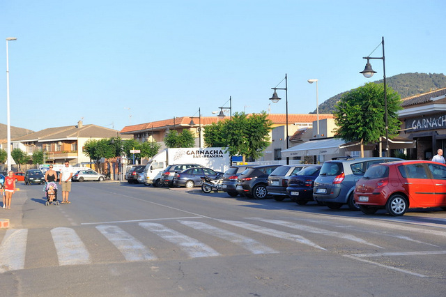 alternative employment in the emerging tourism sector, and many locals from Los Belones were employed in preparing the land for construction at La Manga Club. Construction on the resort finally began in 1975: at the time it was the largest tourist complex in the Region of Murcia, and in the 21st century it remains the most prestigious, the flagship of international tourism in the Region.
Nowadays the economy of Los Belones is based primarily on tourism and, to a lesser degree, on industry and agriculture. Irrigated crops are now preferred to arid farming, and among the fruit and vegetables grown here the most important are peppers, broccoli, melons and lemons. Cotton and almonds are also grown, and sheep and chicken farms are dotted around the area.
Tourism, and the service sector, however, remain the most visible form of business activity and the area boasts a multinational population, with a good mixture of permanent residents and holiday home owners
article_detail
Find more information by AREA, TOWN or URBANISATION .....
Cabo de Palos
Cartagena
El Carmoli
Islas Menores and Mar de Cristal
La Manga Club
La Manga del Mar Menor
La Puebla
La Torre Golf Resort
La Union
Los Alcazares
Los Belones
Los Nietos
Los Urrutias
Mar Menor Golf Resort
Pilar de la Horadada
Playa Honda / Playa Paraiso
Portman
Roldan and Lo Ferro
San Javier
San Pedro del Pinatar
Santa Rosalia Lake and Life resort
Terrazas de la Torre Golf Resort
Torre Pacheco
Aguilas
Aledo
Alhama de Murcia
Bolnuevo
Camposol
Condado de Alhama
Fuente Alamo
Hacienda del Alamo Golf Resort
Lorca
Mazarron
Puerto de Mazarron
Puerto Lumbreras
Sierra Espuna
Totana
Aledo
Alhama de Murcia
Bolnuevo
Camposol
Condado de Alhama
Fuente Alamo
Hacienda del Alamo Golf Resort
Lorca
Mazarron
Puerto de Mazarron
Puerto Lumbreras
Sierra Espuna
Totana
Abanilla
Abaran
Alcantarilla
Archena
Blanca
Corvera
El Valle Golf Resort
Hacienda Riquelme Golf Resort
Lorqui
Molina de Segura
Mosa Trajectum
Murcia City
Peraleja Golf Resort
Ricote
Sucina
Abaran
Alcantarilla
Archena
Blanca
Corvera
El Valle Golf Resort
Hacienda Riquelme Golf Resort
Lorqui
Molina de Segura
Mosa Trajectum
Murcia City
Peraleja Golf Resort
Ricote
Sucina
Urbanisations
CamposolCondado de Alhama
El Valle Golf Resort
Hacienda del Alamo Golf Resort
Hacienda Riquelme Golf Resort
Islas Menores and Mar de Cristal
La Manga Club
La Torre Golf Resort
Mar Menor Golf Resort
Mazarron Country Club
Mosa Trajectum
Peraleja Golf Resort
Santa Rosalia Lake and Life resort
Terrazas de la Torre Golf Resort
La Zenia
Lomas de Cabo Roig
Important Topics:
CAMPOSOL TODAY Whats OnCartagena SpainCoronavirusCorvera Airport MurciaMurcia Gota Fria 2019Murcia property news generic threadWeekly Bulletin
CAMPOSOL TODAY Whats OnCartagena SpainCoronavirusCorvera Airport MurciaMurcia Gota Fria 2019Murcia property news generic threadWeekly Bulletin
Contact Murcia Today: Editorial 966 260 896 /
Office 968 018 268

