- Region
- Águilas
- Alhama de Murcia
- Jumilla
- Lorca
- Los Alcázares
- Mazarrón
- San Javier
-
ALL AREAS & TOWNS
- AREAS
- SOUTH WEST
- MAR MENOR
- MURCIA CITY & CENTRAL
- NORTH & NORTH WEST
- TOWNS
- Abanilla
- Abarán
- Aguilas
- Alamillo
- Alcantarilla
- Aledo
- Alhama de Murcia
- Archena
- Balsicas
- Blanca
- Bolnuevo
- Bullas
- Cañadas del Romero
- Cabo de Palos
- Calasparra
- Camping Bolnuevo
- Campo De Ricote
- Camposol
- Canada De La Lena
- Caravaca de la Cruz
- Cartagena
- Cehegin
- Ceuti
- Cieza
- Condado de Alhama
- Corvera
- Costa Cálida
- Cuevas De Almanzora
- Cuevas de Reyllo
- El Carmoli
- El Mojon
- El Molino (Puerto Lumbreras)
- El Pareton / Cantareros
- El Raso
- El Valle Golf Resort
- Fortuna
- Fuente Alamo
- Hacienda del Alamo Golf Resort
- Hacienda Riquelme Golf Resort
- Isla Plana
- Islas Menores & Mar de Cristal
- Jumilla
- La Azohia
- La Charca
- La Manga Club
- La Manga del Mar Menor
- La Pinilla
- La Puebla
- La Torre
- La Torre Golf Resort
- La Unión
- Las Palas
- Las Ramblas
- Las Ramblas Golf
- Las Torres de Cotillas
- Leiva
- Librilla
- Lo Pagan
- Lo Santiago
- Lorca
- Lorquí
- Los Alcázares
- Los Balcones
- Los Belones
- Los Canovas
- Los Nietos
- Los Perez (Tallante)
- Los Urrutias
- Los Ventorrillos
- Mar De Cristal
- Mar Menor
- Mar Menor Golf Resort
- Mazarrón
- Mazarrón Country Club
- Molina de Segura
- Moratalla
- Mula
- Murcia City
- Murcia Property
- Pareton
- Peraleja Golf Resort
- Perin
- Pilar de la Horadada
- Pinar de Campoverde
- Pinoso
- Playa Honda
- Playa Honda / Playa Paraíso
- Pliego
- Portmán
- Pozo Estrecho
- Puerto de Mazarrón
- Puerto Lumbreras
- Puntas De Calnegre
- Region of Murcia
- Ricote
- Roda Golf Resort
- Roldan
- Roldan and Lo Ferro
- San Javier
- San Pedro del Pinatar
- Santiago de la Ribera
- Sierra Espuña
- Sucina
- Tallante
- Terrazas de la Torre Golf Resort
- Torre Pacheco
- Totana
- What's On Weekly Bulletin
- Yecla


- EDITIONS:
 Spanish News Today
 Alicante Today
 Andalucia Today
History of San Miguel de Salinas
The modern tourism boom and arrival of irrigated water have changed the landscape of this municipality
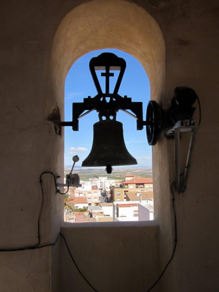 Although it seems that the first buildings in the town as we know it today were not built until 1599, there is evidence that the area now occupied by San Miguel de Salinas was home to human occupants long before.
The archaeological remains at Las Zahurdas, just to the south-east of the town, show that there was a Moorish settlement here: the word “zahurda” is apparently derived from the Arabic word for pigsty. The Moors occupied this area of southern Spain from 711 until the Christian Reconquist regained the territories on behalf of the Christian Kingdom of Castilla y León in 1243. Areas where there was a natural supply of water for crop irrigation were logical places in which to farm, and this was close enough to the major settlement of Orihuela  for protection and to be controlled.
However, fragments of Carthaginian pottery and ceramics have been found at the same site, and the availability of drinking water in Las Zahurdas makes it probable that there was some kind of human habitation here over two thousand years ago. The Carthaginians were active in this area of the Iberian Peninsula when they effectively “moved in” with the local Iberian tribes following the first Punic wars in which they were driven down along the Spanish coast by the Romans, signing the Ebro treaty in 226BC, which should have guaranteed them safety from the Romans on the other side of the River Ebro. However, General Hannibal, from the nearby city of Qart Hadast, modern day Cartagena, rashly attacked and sacked Roman Sagunto sparking off the second Punic wars which culminated in the Roman invasion of this whole area, and the departure of Hannibal with his army and elephants off across Europe, to cross the Alps and try to attack Rome directly, ultimately a mission which resulted in complete failure, his own death and permitted the Romans to  dominate southern Spain for the next 600 years.
A more complete history can be found in the dedicated Pilar de la Horadada section, explaining how the major Roman trade and communications route, the Via Augusta ran along this coastline, linked in to many smaller settlements and agricultural farms such as that which probably existed in this same location. Evidence of the Roman presence has been found in San Miguel de Salinas in the shape of several Roman coins.
Following the fall of the Roman Empire, the Visigoths invaded, bringing their own version of Christianity to what is now Spain, and again, there was a powerful Visigoth overlord based in Orihuela, so it is possible that habitation continued in this area throughout this period. ( see History of Orihuela for a full account of this neighbouring municipality)
In 711 the Moors took southern Spain and ocupied the area until 1243 when the Reconquist swept down, forcing the Moors back into their last remaining kingdom of Granada until 1492 when the Reconquist was finally completed and Spain became a fully Catholic country, with Castilla y León and Aragón united.
Historians mention an old convent dedicated to the order of San Agustín around the year 800, and there was 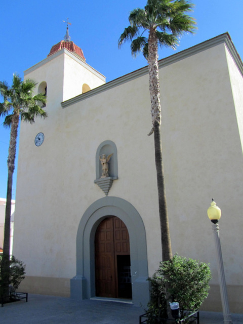 later evidence of a mediaeval monastery devoted to San Ginés, although this was ransacked in 1407. It seems certain that there was also a township of sorts, with the remains discovered showing a burial ground near what is now the town centre.
At the very end of the sixteenth century some of the owners of local agricultural land began to congregate around what has now become the modern town. The first small church, dedicated to San Ginés, was a rudimentary affair built not long afterwards, but was soon in such poor condition that it was demolished in 1689 to make way for a more permanent structure. This was completed in 1719 and awarded the status of parish church four years later, due to the difficulty for locals in making the trip to Orihuela to attend Mass.
At this time San Miguel was included in the municipality of Orihuela, as were many other areas such as Torrevieja, and the first attempt to segregate from the larger municipality was curtailed after just two years in 1815. A second segregation in 1820 seemed to be prospering after the boundaries were established in 1822 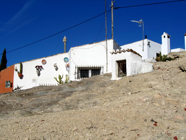 (including a stretch of coastline) , but one year later the return of absolutist monarch Fernando VII to Spain meant that the old order was once again restored.
At this point there were approximately 2,000 inhabitants in the area included within the tentatively drawn-up boundaries of San Miguel, and over 1,600 in the town itself, but these figures were to decline over the next century or so. In 1829 San Miguel was one of the many towns in the Vega Baja area which were devastated by the Torrevieja earthquake, with few buildings left standing apart from the church. It took many years for the town to be reconstructed, and this process was possible only as a result of the support given by Félix Herrero Valverde, the Bishop of Orihuela at the time.
Thus it was not until 1836 that independence was finally granted, although disputes with the neighbouring areas of Orihuela, Almoradí and Torrevieja regarding the exact boundaries would continue for some time afterwards. In fact, the current municipal boundaries were not established until 1955!
In 1848 the politician and geographer Pascual Madoz Ibáñez, writing in his “Diccionario geográfico-estadístico-histórico de España” described San Miguel de Salinas as consisting of 22 huts made from reed 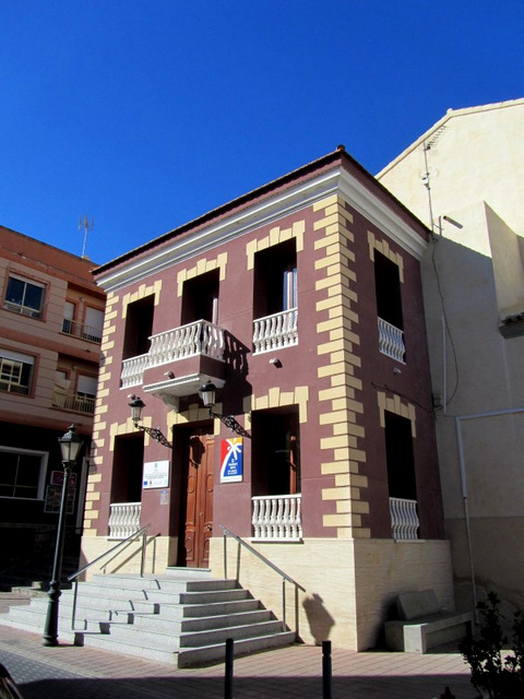 and wood, 77 caves in the hillside, eight streets and two squares, a Town Hall and two schools ( some of these cave houses will have been in the area where there are currently a number of cave houses still in existence). The total population at the time was reported as just 994, and this illustrates the extent to which San Miguel had been destroyed by the earthquake nineteen years previously. There is also mention of four mills, one of which is almost certainly the semi-ruined structure next to the cave dwellings in the Barrio Primero de Mayo.
The Town Hall to which Madoz refers, situated at the back of the church, had been completed in 1840, and also contained the local jail. It continued in use as the seat of local government until 1988, and is now home to the Tourist Office.
In the early twentieth century the population gradually rose again, reaching 1,621 in 1930, but this trend was reversed during the Civil War and the ensuing dictatorship. During the war the Republicans set fire to the church, all the statues were destroyed and the priest was murdered.
Only when the “trasvase” ( the canals network which brought running water down to dry southern Spain from the wetter northern areas) was inaugurated in the late 1970s did some semblance of prosperity return to the area, enabling new crops such as citric fruit to be planted for the first time, and in the 1980s the number of inhabitants finally rose above 2,000 again for the first time in almost 150 years.
The real growth in San Miguel, though, has come not from agriculture, although crops still occupy a large part 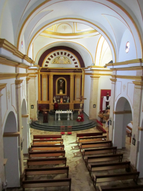 of the municipality, but from residential tourism in the last ten years. Since 2000 the number of people living here has almost quadrupled to over 7,000, with thousands of northern Europeans taking up residence and boosting the local Padrón. According to 2012 census figures 38.5% of the residents were British, narrowly outnumbering the Spaniards, and another 16% were from other EU countries. The same census also shows that the largest age group in the local population is those aged between 65 and 70.
Many of these residential tourists live in the area bordering on Orihuela Costa, but while they live in what is almost exclusively an enclave for foreigners they still enjoy the “real” Spanish lifestyle of the town of San Miguel itself.
In economic terms, the effects of this influx of new residents, most of them with disposable income, have revolutionized the town. In 1986 the annual Town Hall budget was 37,000 euros, but by 2004 and 2005 this had swollen to over nine million euros. Since then it has dropped back to 4.9 million in 2014, but on the back of the coastal boom of the first years of this millennium San Miguel is now, in relative terms, a thriving community after for many years being an economically restricted municipality.
Cartagena
El Carmoli
Islas Menores and Mar de Cristal
La Manga Club
La Manga del Mar Menor
La Puebla
La Torre Golf Resort
La Union
Los Alcazares
Los Belones
Los Nietos
Los Urrutias
Mar Menor Golf Resort
Pilar de la Horadada
Playa Honda / Playa Paraiso
Portman
Roldan and Lo Ferro
San Javier
San Pedro del Pinatar
Santa Rosalia Lake and Life resort
Terrazas de la Torre Golf Resort
Torre Pacheco
Aledo
Alhama de Murcia
Bolnuevo
Camposol
Condado de Alhama
Fuente Alamo
Hacienda del Alamo Golf Resort
Lorca
Mazarron
Puerto de Mazarron
Puerto Lumbreras
Sierra Espuna
Totana
Abaran
Alcantarilla
Archena
Blanca
Corvera
El Valle Golf Resort
Hacienda Riquelme Golf Resort
Lorqui
Molina de Segura
Mosa Trajectum
Murcia City
Peraleja Golf Resort
Ricote
Sucina
Condado de Alhama
El Valle Golf Resort
Hacienda del Alamo Golf Resort
Hacienda Riquelme Golf Resort
Islas Menores and Mar de Cristal
La Manga Club
La Torre Golf Resort
Mar Menor Golf Resort
Mazarron Country Club
Mosa Trajectum
Peraleja Golf Resort
Santa Rosalia Lake and Life resort
Terrazas de la Torre Golf Resort
La Zenia
Lomas de Cabo Roig
CAMPOSOL TODAY Whats OnCartagena SpainCoronavirusCorvera Airport MurciaMurcia Gota Fria 2019Murcia property news generic threadWeekly Bulletin


