- Region
- Águilas
- Alhama de Murcia
- Jumilla
- Lorca
- Los Alcázares
- Mazarrón
- San Javier
-
ALL AREAS & TOWNS
- AREAS
- SOUTH WEST
- MAR MENOR
- MURCIA CITY & CENTRAL
- NORTH & NORTH WEST
- TOWNS
- Abanilla
- Abarán
- Aguilas
- Alamillo
- Alcantarilla
- Aledo
- Alhama de Murcia
- Archena
- Balsicas
- Blanca
- Bolnuevo
- Bullas
- Cañadas del Romero
- Cabo de Palos
- Calasparra
- Camping Bolnuevo
- Campo De Ricote
- Camposol
- Canada De La Lena
- Caravaca de la Cruz
- Cartagena
- Cehegin
- Ceuti
- Cieza
- Condado de Alhama
- Corvera
- Costa Cálida
- Cuevas De Almanzora
- Cuevas de Reyllo
- El Carmoli
- El Mojon
- El Molino (Puerto Lumbreras)
- El Pareton / Cantareros
- El Raso
- El Valle Golf Resort
- Fortuna
- Fuente Alamo
- Hacienda del Alamo Golf Resort
- Hacienda Riquelme Golf Resort
- Isla Plana
- Islas Menores & Mar de Cristal
- Jumilla
- La Azohia
- La Charca
- La Manga Club
- La Manga del Mar Menor
- La Pinilla
- La Puebla
- La Torre
- La Torre Golf Resort
- La Unión
- Las Palas
- Las Ramblas
- Las Ramblas Golf
- Las Torres de Cotillas
- Leiva
- Librilla
- Lo Pagan
- Lo Santiago
- Lorca
- Lorquí
- Los Alcázares
- Los Balcones
- Los Belones
- Los Canovas
- Los Nietos
- Los Perez (Tallante)
- Los Urrutias
- Los Ventorrillos
- Mar De Cristal
- Mar Menor
- Mar Menor Golf Resort
- Mazarrón
- Mazarrón Country Club
- Molina de Segura
- Moratalla
- Mula
- Murcia City
- Murcia Property
- Pareton
- Peraleja Golf Resort
- Perin
- Pilar de la Horadada
- Pinar de Campoverde
- Pinoso
- Playa Honda
- Playa Honda / Playa Paraíso
- Pliego
- Portmán
- Pozo Estrecho
- Puerto de Mazarrón
- Puerto Lumbreras
- Puntas De Calnegre
- Region of Murcia
- Ricote
- Roda Golf Resort
- Roldan
- Roldan and Lo Ferro
- San Javier
- San Pedro del Pinatar
- Santiago de la Ribera
- Sierra Espuña
- Sucina
- Tallante
- Terrazas de la Torre Golf Resort
- Torre Pacheco
- Totana
- What's On Weekly Bulletin
- Yecla


- EDITIONS:
 Spanish News Today
 Alicante Today
 Andalucia Today
Introduction to La Manga del Mar Menor
La Manga del Mar Menor, one of the most iconic beach resorts of Spain
La Manga del Mar Menor is one of the most important summer holiday destinations in the Region of Murcia, and is the name given both to the sandy spit of land which almost completely encloses the saltwater lagoon of the Mar Menor, separating it from the Mediterranean, and to the urban development which has completely changed the face of tourism in Murcia since the 1960s.
La Manga del Mar Menor is 21 kilometres long but never more than a kilometre wide, indeed at some points it narrows so much that developments cannot be built on either side of the road.
There are thousands of privately owned apartments along La Manga del Mar Menor, as well as a myriad of hotels and other accommodation options.
Addresses generally include an indication of roughly where the property lies, km 0 being Cabo de Palos at the southern end of La Manga and the numbers increasing northwards. So if a property is advertised as lying at km 18, then it is 18 kilometres along La Manga del Mar Menor from the southern end.
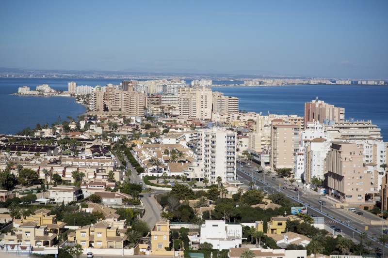
Although locals are often offended by the term, holiday makers tend to refer to La Manga del Menor as “The Strip”, so it’s common to hear a location being "at km 12 of the strip”.
This, of course, can affect the rental value or price of accommodation, as the further away from Cabo de Palos, the longer the drive to explore outside of the immediate area. Although regular bus services run the entire length of La Manga during peak months, and many holidaymakers are happy to stay on the beaches in their immediate surroundings, those who like to explore and visit other areas may prefer accommodation nearer km 0.
Administration of La Manga del Mar Menor is divided between the municipalities of Cartagena and San Javier; the southern half within the municipality of Cartagena and the north in San Javier. The bulk of San Javier municipality lies on the opposite side of the Mar Menor, so although San Javier can be reached by road in around 40 minutes out of season it's often quicker to take the ferry.
History and geography
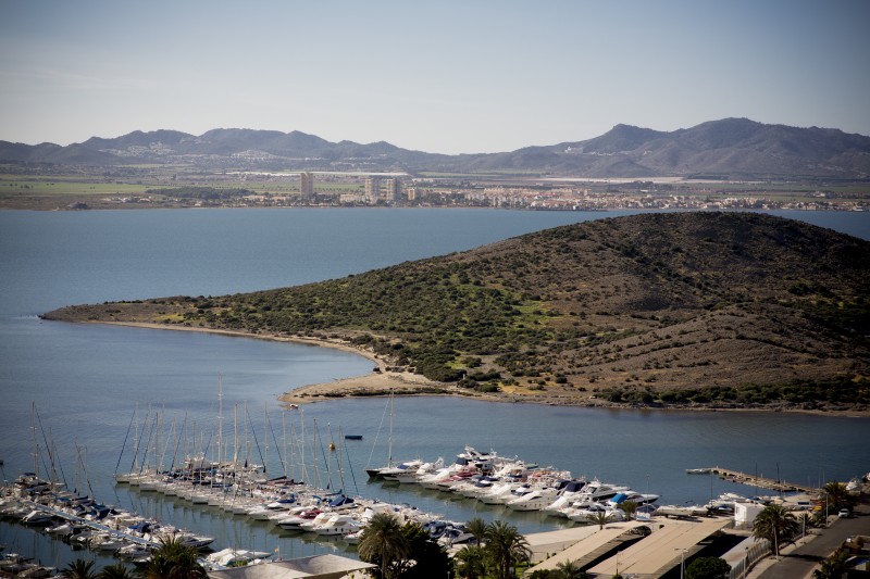
It seems incredible now, but until approximately 70 years ago La Manga del Mar Menor was of interest almost exclusively to geographers, who knew it as the spit of land which protrudes from the headland of Cabo de Palos and encloses the Mar Menor, the saltwater lagoon which, with an area of around 160 square kilometres, is the largest inland area of salt water in Europe.
Even in 1939, at the end of the Spanish Civil War, there was barely any evidence of human activity on La Manga, apart from a couple of windmills and the archaeological remains, both on land and offshore, which provide evidence that humans have lived in the area for thousands of years.
The origins of La Manga date from between 65 million and 1.7 million years ago, when the Baetic mountains were being formed and the area which is now the Mar Menor was an open bay on the Mediterranean coast. As a result of the folding and rising of the land over a period of around 10 million years, the basin of the bay was filled with a large quantity of sediment from the Campo de Cartagena and the rivers which ran through it.
At the same time, a series of volcanic eruptions under the sea bed gave rise to the islands close to La Manga, the land mass of Calnegre and other small promontories, and these areas of higher ground caused the marine currents from the north to run into Cabo de Palos and deposit a spit of sand which gradually grew.
By about 2,000 years ago the Mar Menor was similar to nowadays: a closed lagoon, linked to the Mediterranean by “golas” (small channels).
Prehistoric evidence is scarce, although there are traces of Theropitecus Oswaldis, an early pre hominid in the Cueva Victoria in El Beal, dating from 2.5 million years ago, and later the Neanderthals are known to have inhabited the Cabezo Gordo in Torre Pacheco.
Moving on to the millennium before the birth of Christ, one of the most important archaeological finds is that of the Bajo de la Campana Phoenician shipwreck, which dates from around 600 BC and provides evidence that Phoenician ships moored at El Estacio, the main entry point into the Mar Menor. San Pedro del Pinatar was an important trading port at this point in time, and both Greeks and Phoenicians took advantage of the shelter offered by the sandy spit as they forged inland trading routes from the coast.
Archaeologists have also discovered a Roman wreck on top of the Phoenician vessel at Bajo de la Campana, and it is known that the Romans took advantage of the salinity of the Mar Menor to develop an important food-salting industry in the area. They also developed salted industrial production, shipping garum, a pungent fish sauce, across the Roman Empire, as well as exporting vast quantities of silver, lead and other minerals extracted from their vast mines in the Sierra Minera.
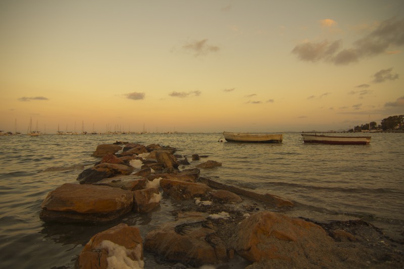
The Moors took control of the Murcia area in 713AD, contributing to the development of La Manga and the area of the Mar Menor by the introduction of fishing devices known as “encañizadas”. These were placed in the natural channels between the Mar Menor and the Mediterranean, to trap fish in a labyrinth of cages from which they were unable to escape, and some can still be seen today.
In the 16th century the coastline of the Mar Menor and the rest of Murcia became unsafe due to the frequent Berber pirate raids launched from the north of Africa. The persistence of these attacks led Carlos I and his son Felipe II to order the construction of watchtowers along the shoreline, and one of these was erected in La Manga during the first half of the 16th century. The Torre de San Miguel, was a circular construction with its own rainwater deposit, and was situated in El Estacio.
When the pirate raids ceased in the 18th century the forests and bushes were cleared to provide firewood, adding to the deforestation effect of the prevailing winds.
In the 1850s La Manga del Mar Menor passed into private ownership, and the new owners were the predecessors of the speculators who later developed the area and promoted the first buildings on the spit. But they soon sold the land on, mostly to the Maestre family, and by the 1950s the northern end of La Manga was entirely owned by Tomás Maestre Zapata.
But it was not until 1956 that Tomás Maestre Aznar persuaded his uncle to sell him his rights in the north of La Manga in order to work on a project of his own in the area, although first he also needed land in the southern half. This he achieved, and in 1961 the first development project began, with the support of Manuel Fraga, the Minister for Tourism under General Franco. He it was who, having seen the beaches of La Manga, gave central government support to the promotion of La Manga as a centre for tourism, and these plans were approved between 1966 and 1968.
From this point on the landscape of La Manga del Mar Menor began to take on the appearance it has now, with numerous developments right next to the beach, as well as bungalows, shopping centres, restaurants and towers such as the "Torre Júpiter" and the "Torre Varadero".
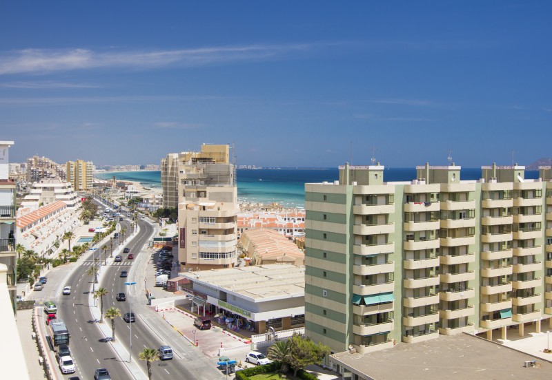
By the start of the 1970s the status of La Manga as a consolidated tourist destination was undisputed, and it became internationally famous, appearing in holiday brochures all over Europe. During the decade the sporting port, the Puerto Deportivo Tomás Maestre was built, but later construction became a lot more haphazard, and concentrated, changing the face of what had been just a barren spit of sandy land only a few years before.
At the same time, La Manga Club, which is not on the narrow spit itself but near the village of Los Belones, close to Cabo de Palos, made sure that the name of La Manga was known internationally, and at the end of the twentieth century the number of foreign residents living on the “strip” rose and the year-round population increased as a consequence. By 2013 the population was reported to be just over 17,000.
La Manga in the 21st century
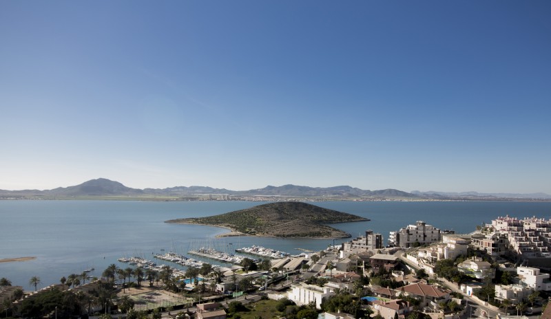
La Manga today is without any doubt one of the most cosmopolitan places in the Region of Murcia and the Costa Cálida. The permanent population is sufficient to support a variety of businesses and there are both primary and secondary schools, and despite the administrative ambiguity caused by it falling into the territories governed by two Town Halls (San Javier and Cartagena) it is a town in its own right, albeit an unusual one.
The main north-south road which runs the length of La Manga, the Gran Vía, is an essential part of life here, and is the spine which joins all of the community together.
It’s difficult to become lost on La Manga del Mar Menor, as the narrow width of the land means that all roads lead back to the Gran Vía and it is difficult to find a property which is more than just a few metres from the Gran Vía.
The geography of the spit is such that inevitably the southern end, which starts at Km0 by Cabo de Palos, receives more visitors and was the first part to be developed, simply because it’s the first area where visitors arrive from the mainland. The first developments here included the Torre Varadero and the Torre Zeus, which are still the two tallest buildings in the municipality of Cartagena, and shopping centres and a plethora and bars and restaurants arrived with the first summer visitors. These are still in evidence and are replicated in varying styles all along the spit, although with less intensity at the far northern end in the municipality of San Javier, where the land peters out opposite the regional park of the wetlands, dunes and salt flats of San Pedro del Pinatar.
Beaches
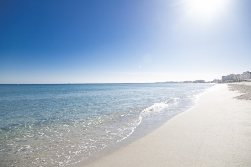
The resort attracts a large number of visitors every summer, and without a doubt the beaches and the water sports on offer in the Mar Menor and the Mediterranean, with a range of sea conditions, are the main attractions.
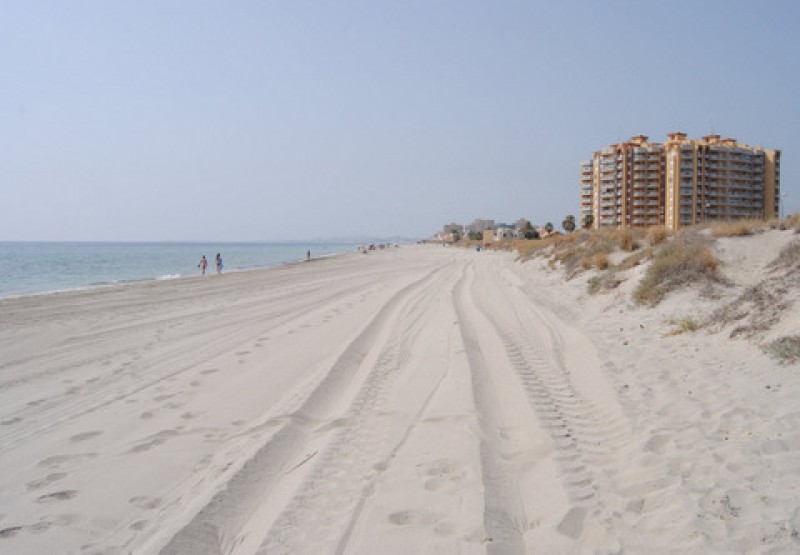
Beaches on the Mar Menor are calm, flat, with gently sloping shorelines and in many cases, it is possible to wade out a considerable distance from the beach and still be only waist high in the water, a factor which ensures that the water on the fringes of the Mar Menor is warmer. By mid-August the water is markedly warm on the shallow fringes and the waters are not tidal, so there are no waves. This creates safe bathing conditions.
On the other hand, those who prefer the vast, open beaches which run along the Mediterranean coastline of La Manga can simply cross the road and enjoy the rolling waves of the Mediterranean and a totally different set of beach conditions.
Although the urban density of La Manga del Mar Menor is high, the beaches themselves are very often virtually empty (other than in some points of concentration) as there is simply such a vast area of sand.
During the peak months there are lifeguards and medical personnel at many beaches and a full range of services, including sunbed and sunshade hire, sporting equipment hire, footwashes and walkways are offered. These vary from beach to beach.
Click here to see full information about the beaches of the municipality of San Javier.
Watersports
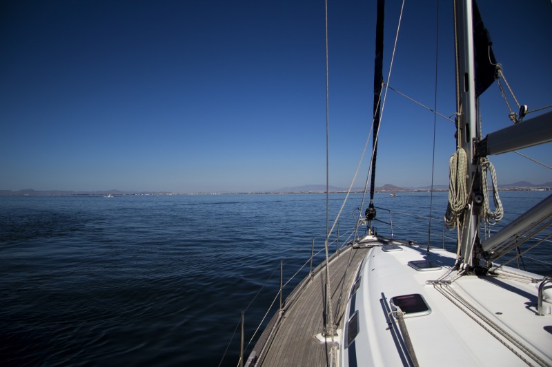
The combination of shallow water, gently sloping beaches and no waves, currents or tides makes the Mar Menor one of the safest places to learn watersports in Europe, and as a result, it is hugely popular with beginners in the arts of dinghy sailing, windsurfing, kitesurfing, stand-up paddle and kayaking. The fact that a thermal wind blows in during the afternoons only increases the attractions of the area as this creates perfect conditions for afternoon intermediate sailors.
As a result of this, there are many schools offering tuition in these areas and ample suppliers of equipment.
The Mediterranean coastline offers many interesting opportunities for divers and sailors, so there are three marinas in the Mar Menor providing mooring for over 2,000 boats and an ample offering of those supplying marine services.
In addition, the attractive conditions and ample accommodation options make the San Javier municipality an enjoyable place in which to practice various beach sports and other sports, such as running, and as a result the municipality hosts a vast number of sporting events throughout the year.
Travelling to and from La Manga del Mar Menor
By road, La Manga del Mar Menor is usually reached on the RM-12 motorway from Cartagena and Murcia (joining the AP-7 outside Cartagena. Approximate driving times from Kilometre 0 are 20 minutes to Cartagena, 35 minutes to Murcia-Corvera airport, 40 minutes to Murcia and 1 hour 10 minutes to Alicante-Elche airport.
The ferry from Puerto Tomás Maestre provides a relaxing and quick alternative for travel between La Manga and the towns of Santiago de la Ribera (in San Javier) and San Pedro del Pinatar on the inland shore of the Mar Menor.
There are frequent bus services to and from Cartagena, with special summer services laid on for those spending the day (or night) in La Manga.
Other services
La Manga del Mar Menor has a year-round permanent population, so is well equipped with schools, libraries, police, medical and municipal services. (Click to see useful numbers in the San Javier municipality).
Visitors will find plenty of shops, commercial centres and places in which to eat, and there is no shortage of entertainment during the busy summer season, with businesses offering a full range of services and leisure facilities.
San Javier is home to a major Jazz Festival during the summer as well as a festival of theatre and dance and there are many activities on offer throughout the year. See the What’s On section for a list of forthcoming events and activities.
Click for more information about La Manga del Mar Menor.
Click for more information about the municipality of San Javier.
More local information, news and events in La Manga del Mar Menor:
Cartagena
El Carmoli
Islas Menores and Mar de Cristal
La Manga Club
La Manga del Mar Menor
La Puebla
La Torre Golf Resort
La Union
Los Alcazares
Los Belones
Los Nietos
Los Urrutias
Mar Menor Golf Resort
Pilar de la Horadada
Playa Honda / Playa Paraiso
Portman
Roldan and Lo Ferro
San Javier
San Pedro del Pinatar
Santa Rosalia Lake and Life resort
Terrazas de la Torre Golf Resort
Torre Pacheco
Aledo
Alhama de Murcia
Bolnuevo
Camposol
Condado de Alhama
Fuente Alamo
Hacienda del Alamo Golf Resort
Lorca
Mazarron
Puerto de Mazarron
Puerto Lumbreras
Sierra Espuna
Totana
Abaran
Alcantarilla
Archena
Blanca
Corvera
El Valle Golf Resort
Hacienda Riquelme Golf Resort
Lorqui
Molina de Segura
Mosa Trajectum
Murcia City
Peraleja Golf Resort
Ricote
Sucina
Condado de Alhama
El Valle Golf Resort
Hacienda del Alamo Golf Resort
Hacienda Riquelme Golf Resort
Islas Menores and Mar de Cristal
La Manga Club
La Torre Golf Resort
Mar Menor Golf Resort
Mazarron Country Club
Mosa Trajectum
Peraleja Golf Resort
Santa Rosalia Lake and Life resort
Terrazas de la Torre Golf Resort
La Zenia
Lomas de Cabo Roig
CAMPOSOL TODAY Whats OnCartagena SpainCoronavirusCorvera Airport MurciaMurcia Gota Fria 2019Murcia property news generic threadWeekly Bulletin

