Lorca beaches: Playa or Cala de Calnegre
A Blue Flag beach on the unspoilt Mediterranean coastline of Lorca
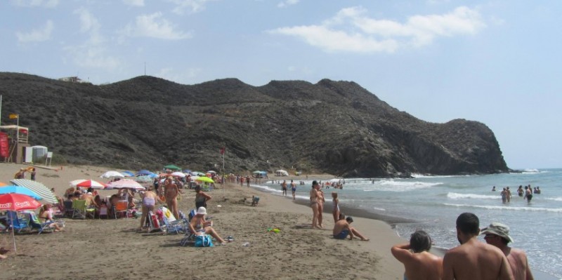
Playa de Calnegre is one of three coves which are reachable by car via a mountain track close to the long beach of Puntas de Calnegre on the coastline of the municipality of Lorca, and is the most popular among bathers and other beachgoers.

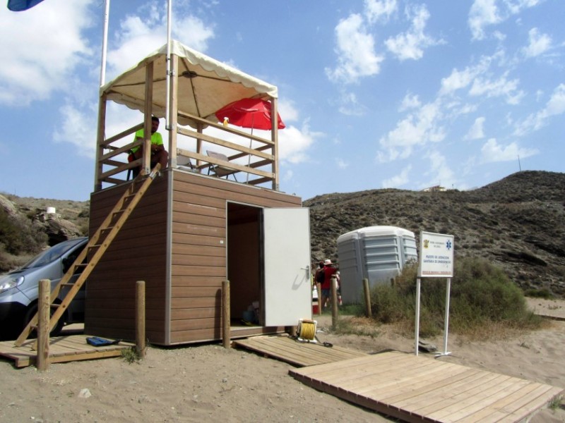
This may be due to its being the first of the three along this track, or to the bathing conditions, or maybe to the higher level of services than at the other two covers: there is a permanent beach restaurant here, a lifeguard service is operational in summer, and the range of facilities is such that the Playa de Calnegre was the recipient of the first Blue Flag for quality beaches ever awarded to the municipality of Lorca in 2017 (a status which has been maintained since).
The facilities, apart from the improved access, the lifeguards and the restaurant, include chemical toilets, foot showers, rubbish bins, beach cleaning and a range of information panels concerning the protected flora and fauna of the area, which include loggerhead sea turtles and various plant species.
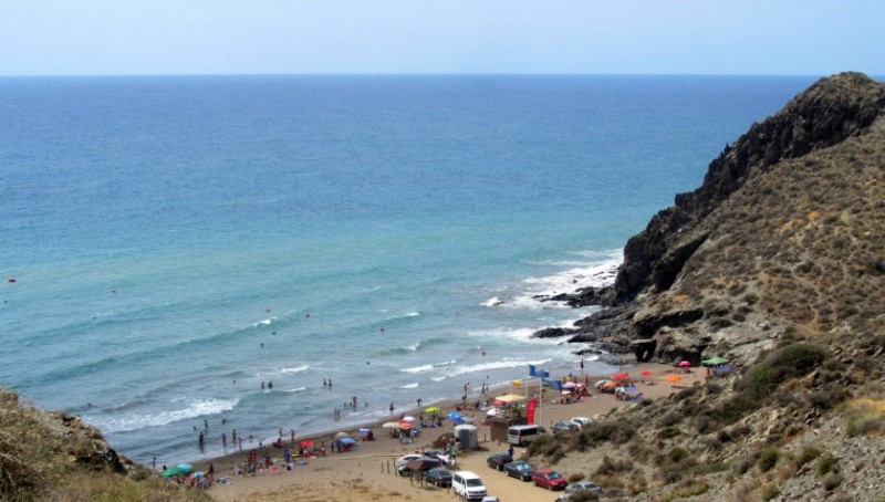
The official description of the Playa de Calnegre is that it measures 190 metres in length and 38 metres in breadth and boasts a surface of fine golden sand, but this scarcely does justice to its picturesque location. On either side are steep rocky cliffs and headlines, and it is no wonder that it is popular with those looking to spend a whole day on the shore of the Mediterranean: there are plenty of opportunities to clamber up the rocks (always being careful not to tread on the protected vegetation) as well as relaxing on the sand, although some of the paths up the mountainside are decidedly steep!

In short, it is very unusual in the Costa Cálida to find such a well-appointed beach in such a rural location, and the combination is a very attractive one indeed: a visit is thoroughly recommended.
How to reach Playa de Calnegre
The track which leads to the beach of Calnegre is accessed from the RM-D-21 road which loops south from the RM-332 between Mazarrón and Águilas, and which end of the loop drivers take use will depend on where they are approaching from.
Those coming from Águilas are advised to take the AP-7 motorway heading towards Cartagena and exit at kilometre 857, from where it is relatively simple to follow the signs to Puntas de Calnegre. Anyone with time on their hands and a strong desire to avoid motorway toll charges will prefer the RM-332, although this will take considerably longer: again, Puntas de Calnegre is signposted shortly before reaching Ramonete.

The track to the beach of Calnegre (as well as the Cala del Baño de las Mujeres and the Cala de Sical) leaves the RM-D21 on the right around half a kilometre before reaching Puntas de Calnegre, and although it is unsurfaced and steep in parts it is well maintained. Normal cars will have no problem, passing space for two vehicles is available, and the only problem is that the amount of dust raised will mean washing your car once your visit is over!
Anyone heading to this beach from Mazarrón, on the other hand, is likely to prefer taking the RM-D21 at the other end, and approaching Puntas de Calnegre via Cañada de Gallego. This takes drivers on a trip through the tomato-growing greenhouse fields of the Mazarrón countryside before hitting the coast in time to follow the beach of Parazuelos and enter the village from the north.
In this case the track to the Playa de Calnegre is half a kilometre past Puntas de Calnegre, rather than before reaching the village.
In all there is space for around 100 cars in the area at the back of the beach and along the track leading down to it.
For more local information visit the home page of Lorca Today.
