San Javier beaches: Playa El Pescador

An attractive stretch of sand on the Mar Menor in Santiago de la Ribera
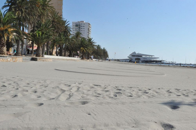
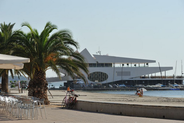
Playa El Pescador is one of the urban beaches in Santiago de la Ribera, on the Mar Menor coastline in the municipality of San Javier, and lies between the Playa de Colón and Playa Barnuevo.
It's an attractive urban beach, 280 metres long with an average width of 20 metres, and the sand is fine, soft and groomed. There is lower occupancy than at some of the others in this long run of beaches, mainly due to the restricted traffic flow on the seafront and the lower density of holiday apartments in this area of residential dwellings.
Facilities
This beach has a good range of core services and during the peak summer months offers drinking water, disabled parking spaces, a cordoned-off bathing area, toilets, toilets adapted for disabled users, beach bar, sporting equipment and courts, bike racks, picnic facilities, a shaded promenade, children's play areas, footwashes, bins, ramps, and wooden walkways down onto the sand. The beach is also used for regattas, tournaments, beach volleyball and beach football.

Shade
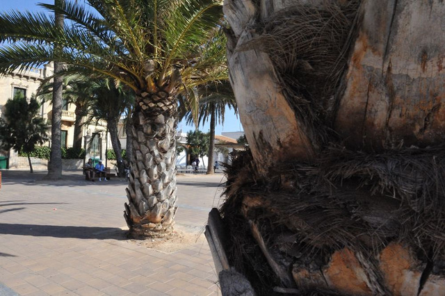
Behind the beach is the Paseo Marítimo, which runs right the way along the seafront offering areas of shade and seating.
Bars and Restaurants
There are plenty of shops, bars and restaurants all within easy walking distance, as Playa de Barnueno is very close to the main bar and restaurant zone of Santiago de la Ribera. The area is popular all year round among both locals and visitors.
No smoking!
In the summer of 2019 this beach was nominated by the Town Hall of San Javier as a "no smoking" beach. No official ban is in place, but bathers and other beachgoers are urged to refrain from lighting up on the sand, not only for the sake of their own health but also in order to prevent discarded butts from remaining on the beach and then contributing to marine pollution when they are washed into the sea.
Of the nine beaches involved in this scheme on the Costa Cálida three are in the municipality of San Javier, the others being those of El Castillico in Santiago de la Ribera and Playa Mistral in La Manga del Mar Menor.
Parking
There is very little parking as this area is a pedestrianised zone in summer and most of the available parking is in the streets behind the front line of residential buildings. If driving to the beach, it may be necessary to park a few streets back during the summer.
There is a bus-stop nearby, which offers connections to Murcia, Alicante and Cartagena. Full details of bus services can be obtained from the tourist information office.

Beaches in Santiago de la Ribera
San Javier has two distinct sections of beaches, one being in Santiago de la Ribera, close to the main centre of San Javier town, all of which are Mar Menor beaches, and the other on the opposite side of the Mar Menor on the spit of land called La Manga de Mar Menor (or "the strip", as it is often referred to by holidaymakers), where there are both Mar Menor and Mediterranean beaches.
Mar Menor beaches are enclosed within the protective circle of Europe's largest saltwater lagoon, which is fed by the Mediterranean. The Mar Menor is totally unique, its geographical peculiarities creating some of the best conditions in Spain for those learning watersports, particularly windsurfing and sailing.
Murcia is the warmest mainland region in Spain, and has an average temperature of 18 degrees, which makes it perfect for year-round watersports activity, and bathers can enjoy the waters of the Mar Menor for most of the year. The water is not tidal and has only very insiginficant currents and waves, so it's perfect for family bathing or watersport beginners.
It has shallow fringes which slope gently, and is only 7 metres deep in the centre, so the water temperature is warmer than that of the Mediterranean, particularly around the edges where it is possible to wade out 50 metres from the shore and still only be waist deep.
The Mar Menor beaches are all around the lagoon, which covers a surface area of nearly 170 square kilometres, with 70 kilometres of internal coastline, separated from the Mediterranean by the 22 kilometres of La Manga. Channels known as "golas" cut across La Manga, enabling water to flow bewteen the two seas as well as making it possible for boats to sail between the two.
It is important when choosing a beach to understand that the Mar Menor beaches offer shallow and calm bathing conditions, whereas the Mediterranean beaches are wider, longer, windier, and are susceptible to wave conditions and currents.
The beaches of Santiago de la Ribera, working from south to north, are the following:
Playa de la Hita: a natural beach with no facilities next to the environmentally protected area of Islas del Mar Menor and the Camping Mar Menor park.
 Playa de Barnuevo
Playa del Pescador: 280 metres long, with fine soft sand.
 Playa de Colón: a glorious kilometre-long beach, 30 metres wide, with fine sand, an important locations for watersports enthusiasts with a windsurfing and sailing school.
 Playa El Castillico: 450 metres long, with an average width of 40 metres, very popular in summer.
Playa del Atalayón (sailing moorings only, no beach).
Safety precautions for bathers
This is a Mar Menor beach and it is advisable to observe the following safety precautions when bathing:
- most of the Mar Menor beaches have very gently sloping shelves, meaning that bathers can walk a considerable distance from the shore and still only be waist high in the water. These shore fringes are also very warm, heating up more than the deeper waters, or the Mediterranean coastline, particularly during the hot summer months.
- many beaches are also protected by netting to exclude jellyfish. This creates safe bathing areas for families but also leads to a situation which can be life threatening, as the safety of the beaches results in many elderly bathers bathing alone. This in itself is not life threatening, but every year there are unnecessary deaths when bathers suffer a heart attack, stroke, faint or have a dizzy spell of some sort whilst bathing alone, slipping into the water without anybody else being aware that this has happened.
The transition from hot beach to cold water can shock the body, causing dizziness or fainting, so it is advisable to splash the body with water to cool down before wading out into the Mar Menor or Mediterranean.
Even though there are lifeguards at many Mar Menor beaches, accidents happen and every year there are unnecessary fatalities, the simple rule being if you have a medical condition, are taking medication, or are of advanced age, don´t bathe alone no matter how shallow and calm the water is.
And for all ages, a red flag means do not bathe, particularly on the Mediterranean beaches.
Click to see an overview of the beaches in San Javier, or to go to the home page of San Javier Today for more local news, events and other information.
Santiago de la Ribera beaches, Playa El Pescador
San Javier has 2 totally distinct sections of beaches, one part being in Santiago de la Ribera, close to the main centre of San Javier town, all of which are Mar Menor beaches, and the other across the opposite side of the Mar Menor on the La Manga strip, at La Manga, which are a mixture of Mar Menor and Mediterranean beaches.
Mar Menor beaches are enclosed within the protective circle of what is, essentially, Europe's largest saltwater lake, although it's often difficult to think of this as a lake as it is fed by the Mediterranean, and is on the Mediterranean coastline.
The Mar Menor is totally unique, its geographical peculiarities creating some of the best conditions in Spain for those learning watersports, particularly windsurfing and sailing.

Murcia is the warmest mainland region in Spain, and has an average temperature of 18 degrees, which makes it perfect for year-round watersports activity and bathers can enjoy the waters of the Mar Menor for most of the year. The water in the Mar Menor is not tidal and has no currents or waves, so is perfect for family bathing or watersport beginners.
It has shallow fringes, which slope gently, and is only 7 metres deep in the centre, so the water temperature is warmer than that of the Mediterranean, particularly around the edges where it is possible to wade out 50 metres from the shore and still only be waist deep.
All of the beaches listed as Mar Menor beaches are inside the circle of the Mar Menor, which covers a surface area of nearly 170 square kilometres, with 70 kilometres of internal coastline, separated from the Mediterranean by a 22km long strip of land (the La Manga Strip as it's often referred to by foreign visitors, or La Manga del Mar Menor), which is connected to the Mediterranean via a canal channel, so sailing boats can sail between the Mar Menor and Mediterranean and the water retain its salinity.
The internal area of the Mar Menor is divided between several municipalities, or local councils. The La Manga strip is divided into two sections for administrative purposes, although there is no geographical difference, the far end belonging to San Javier and the lower section linking to Cabo de Palos belongs to Cartagena. Cartagena continues around the Cabo de Palos section and the bottom section of the Mar Menor. The next municipality along is Los Alcázares, then San Javier which has Santiago de la Ribera as its seaside urban area, and finally San Pedro del Pinatar, which also includes the marshy salinas at the top end of the Mar Menor, which disintegrate into a series of marshy quasi-islands linking to the top part of the La Manga Strip.

The Santiago de la Ribera beaches(Mar Menor beaches):
Playa de Barnuevo.
Playa de El Pescador
Playa de Colón
Playa del Atalayon ( sailing moorings only, no beach)
Playa El Castillico
Playa El Pescador
The second in the main urban beach run in Santiago de la Ribera is Playa El Pescador, which adjoins the Playa de Colón and Playa Barnuevo..
This is an attractive urban beach, and is 280 metres long, with an average width of 20 metres, the sand fine, soft and groomed.
This is a lower occupancy beach than some of the others in this long run of beaches, mainly due to the restricted traffic flow behind this beach, and the lower density of holiday apartments in this area of residential dwelling.
Facilities:
This beach has a good range of core services and during the peak summer months offers drinking water, disabled parking spaces, cordoned bathing area, toilets, toilets adapted for disabled users, beach bar, sporting equipment, playing fields, parking racks for bicycles, picnic facilities, a shaded paseo Marítimo, children's play areas, footwashers, bins, ramps, and wooden walkways down onto the sand. This beach is also used for regattas, tournaments, beach volleyball and beach football.

Shade.
Behind the beach is the Paseo Marítimo which runs right the way along the seafront offering areas of shade and seating.
Bars and Restaurants,
There are plenty of shops, bars and restaurants all within easy walking distance, as this beach is very close to the main bar and restaurant zone of Santiago de la Ribera. Behind this beach are all year round bars on the paseo, a popular place for locals and visitors alike.
Parking.
There is very little parking, as this area is a pedestrianised zone in summer and most of the available parking is in the streets behind the front row houses. If driving to the beach, it may be necessary to park a few streets back during peak summer season. The urban bus service runs along behind this beach.
Full details of bus services can be obtained from the tourist information office.
Click for introduction to the San Javier beaches
Click for more information about the San Javier municipality


 Welcome To
 San JavierLa Manga del Mar MenorSantiago de la RiberaRoda


 Welcome To
 San JavierLa Manga del Mar MenorSantiago de la RiberaRoda


 Welcome To
 San JavierLa Manga del Mar MenorSantiago de la RiberaRoda


 Welcome To
 San JavierLa Manga del Mar MenorSantiago de la RiberaRoda


