- Region
- Águilas
- Alhama de Murcia
- Jumilla
- Lorca
- Los Alcázares
- Mazarrón
- San Javier
-
ALL AREAS & TOWNS
- AREAS
- SOUTH WEST
- MAR MENOR
- MURCIA CITY & CENTRAL
- NORTH & NORTH WEST
- TOWNS
- Abanilla
- Abarán
- Aguilas
- Alamillo
- Alcantarilla
- Aledo
- Alhama de Murcia
- Archena
- Balsicas
- Blanca
- Bolnuevo
- Bullas
- Cañadas del Romero
- Cabo de Palos
- Calasparra
- Camping Bolnuevo
- Campo De Ricote
- Camposol
- Canada De La Lena
- Caravaca de la Cruz
- Cartagena
- Cehegin
- Ceuti
- Cieza
- Condado de Alhama
- Corvera
- Costa Cálida
- Cuevas De Almanzora
- Cuevas de Reyllo
- El Carmoli
- El Mojon
- El Molino (Puerto Lumbreras)
- El Pareton / Cantareros
- El Raso
- El Valle Golf Resort
- Fortuna
- Fuente Alamo
- Hacienda del Alamo Golf Resort
- Hacienda Riquelme Golf Resort
- Isla Plana
- Islas Menores & Mar de Cristal
- Jumilla
- La Azohia
- La Charca
- La Manga Club
- La Manga del Mar Menor
- La Pinilla
- La Puebla
- La Torre
- La Torre Golf Resort
- La Unión
- Las Palas
- Las Ramblas
- Las Ramblas Golf
- Las Torres de Cotillas
- Leiva
- Librilla
- Lo Pagan
- Lo Santiago
- Lorca
- Lorquí
- Los Alcázares
- Los Balcones
- Los Belones
- Los Canovas
- Los Nietos
- Los Perez (Tallante)
- Los Urrutias
- Los Ventorrillos
- Mar De Cristal
- Mar Menor
- Mar Menor Golf Resort
- Mazarrón
- Mazarrón Country Club
- Molina de Segura
- Moratalla
- Mula
- Murcia City
- Murcia Property
- Pareton
- Peraleja Golf Resort
- Perin
- Pilar de la Horadada
- Pinar de Campoverde
- Pinoso
- Playa Honda
- Playa Honda / Playa Paraíso
- Pliego
- Portmán
- Pozo Estrecho
- Puerto de Mazarrón
- Puerto Lumbreras
- Puntas De Calnegre
- Region of Murcia
- Ricote
- Roda Golf Resort
- Roldan
- Roldan and Lo Ferro
- San Javier
- San Pedro del Pinatar
- Santiago de la Ribera
- Sierra Espuña
- Sucina
- Tallante
- Terrazas de la Torre Golf Resort
- Torre Pacheco
- Totana
- What's On Weekly Bulletin
- Yecla


- EDITIONS:
 Spanish News Today
 Alicante Today
 Andalucia Today
The River Segura in Archena
The Segura still helps to tell the history of Archena
Water has played a determining role in the history of many municipalities of the Region of Murcia, but in few can it have been so important as in Archena, where not only is agriculture dependent on the water from the River Segura but the prosperity of the town is inextricably linked to the thermal spa waters which were used as long as 2,000 years ago by the Romans.(See History of Archena)
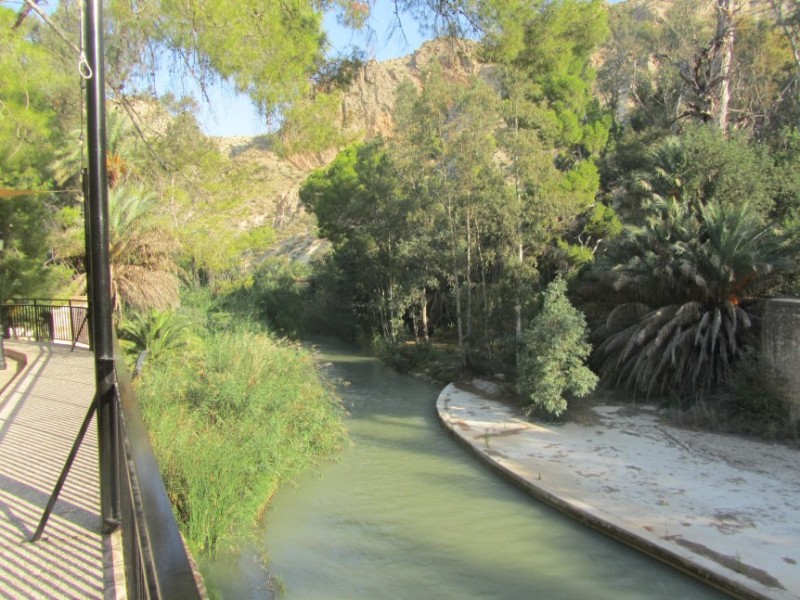
The spa waters are now at the centre of the biggest spa resort in Murcia and one of the most complete in the whole of Spain, the Balneario de Archena, while the role of the Segura is a rather less high-profile one. However, the fact that the location of the spa is one of the most pleasant sports in the Region is due to it standing on the green and leafy banks of the river, and the walking and cycling route which runs through Archena following the river upstream from Murcia to the Ricote valley is one of the most popular among visitors to the Costa Cálida.
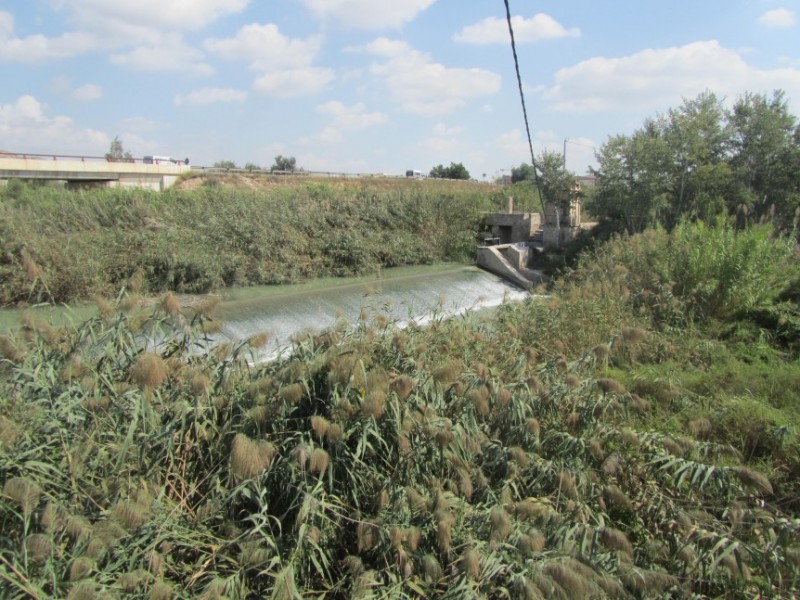
These days the flow of the Segura in Archena is regulated further upstream at the weir of Ojós, where the valley narrows prior to the river running through Ulea and Villanueva. It is only as the water passes Archena that the valley widens out as it heads downstream towards Lorquí, Ceutí, Alguazas, Las Torres de Cotillas, Molina de Segura and the city of Murcia, where the “Vega Alta” plain ends and the “Vega Media” begins.
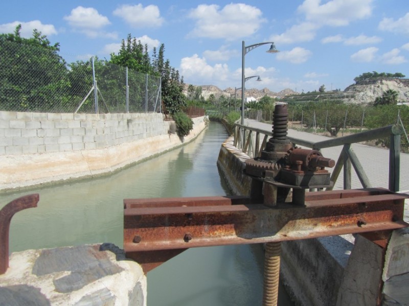
The water and the fertile plain of the Segura were doubtless of crucial importance to settlers in the area of Archena in prehistoric times, and for the Romans the existence of the thermal baths and the river helped to ensure that the town was included on the road network they constructed. But the river was not fully exploited to enable agriculture to develop fully until the arrival of the Moors in southern Spain in the 8th century AD, and it was they who created most of the “aceguias” (irrigation ditches) and other infrastructures which still distribute water to the agricultural land which lies mainly to the south of the town.
A short walk in the flat countryside to the south of Archena still transports visitors to an age when farming was carried out on privately owned smallholdings, and water supplies reached the land by means of a series of sluice gates which each farmer was allowed to open only at specific times and on specific days!
After the Moors were ousted from Murcia in the 13th century the population of Archena (and the rest of Murcia) fell, and many of these infrastructures were neglected, but the water of the river was still put to good use as those who remained made their living from the production of esparto grass and linen. Both products were cleaned in the river as it passes through the town, leading to protests from those who lived downstream and had to drink the “dirty” water created: water pollution in the Segura was an issue even in the Middle Ages in Archena!
(The esparto grass traditions in Archena are now almost entirely consigned to the past, although there is a small and quirky museum in the town which is well worth a visit!)
An important infrastructure was added in the 15th century between Archena and Ulea, namely the “Acueducto de la Rambla”, and the next significant development was in 1628 when the course of the main acequia was altered. The work consisted of the construction of a tunnel under the mountain to reduce the amount of water lost, and was a major feat of civil engineering at the time!
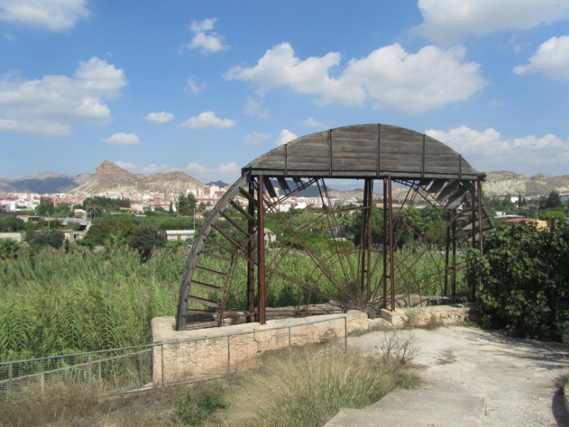
By this time the population of the agricultural land were using water wheels to extract domestic supplies, although those which can still be seen today date from rather later.
Throughout its history, then, Archena has depended on the River Segura, and those exploring the town and the surrounding countryside these days can still see plenty of evidence of this close relationship, even just on the picturesque stretch on the eastern side of the town and next to the Balneario, close to the museum and the tourist office: a highly recommended stroll!
But it should not be forgotten that the river has not always been a tranquil support for the development of Archena: for one thing flooding is always a risk - there is evidence that the first Roman baths were buried under an avalanche of mud in the 1st century AD - while in more modern times the Segura has acted as a natural barrier to communications routes linking Archena with the rest of Murcia.
For many years a small boat ferried passengers across the Segura very close to the spot where the main bridge now stands, but this method of transport was not operative in times of heavy rainfall, effectively isolating the town and preventing the transport of fresh agricultural produce.
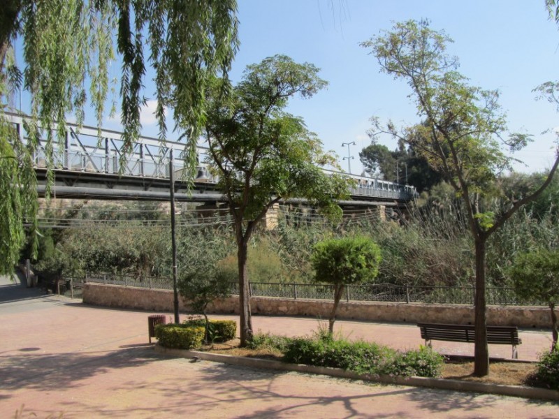
A reliable wooden bridge was not built until 1865 (work was delayed by an unspecified “catastrophe” mentioned in the municipal archives in 1863), and then the iron bridge which still stands today was started in 1833 but not completed until after the Spanish Civil War, in 1942. Plans have now been approved for a second bridge to be built alongside it in order to improve road traffic into and out of the town.
Click here for further information about the Archena municipality
Cartagena
El Carmoli
Islas Menores and Mar de Cristal
La Manga Club
La Manga del Mar Menor
La Puebla
La Torre Golf Resort
La Union
Los Alcazares
Los Belones
Los Nietos
Los Urrutias
Mar Menor Golf Resort
Pilar de la Horadada
Playa Honda / Playa Paraiso
Portman
Roldan and Lo Ferro
San Javier
San Pedro del Pinatar
Santa Rosalia Lake and Life resort
Terrazas de la Torre Golf Resort
Torre Pacheco
Aledo
Alhama de Murcia
Bolnuevo
Camposol
Condado de Alhama
Fuente Alamo
Hacienda del Alamo Golf Resort
Lorca
Mazarron
Puerto de Mazarron
Puerto Lumbreras
Sierra Espuna
Totana
Abaran
Alcantarilla
Archena
Blanca
Corvera
El Valle Golf Resort
Hacienda Riquelme Golf Resort
Lorqui
Molina de Segura
Mosa Trajectum
Murcia City
Peraleja Golf Resort
Ricote
Sucina
Condado de Alhama
El Valle Golf Resort
Hacienda del Alamo Golf Resort
Hacienda Riquelme Golf Resort
Islas Menores and Mar de Cristal
La Manga Club
La Torre Golf Resort
Mar Menor Golf Resort
Mazarron Country Club
Mosa Trajectum
Peraleja Golf Resort
Santa Rosalia Lake and Life resort
Terrazas de la Torre Golf Resort
La Zenia
Lomas de Cabo Roig
CAMPOSOL TODAY Whats OnCartagena SpainCoronavirusCorvera Airport MurciaMurcia Gota Fria 2019Murcia property news generic threadWeekly Bulletin


