


- EDITIONS:
 Spanish News Today
 Alicante Today
 Andalucia Today

PROPERTY SEARCH

ARCHIVED - AEMET confirms Gota Fría is expected to arrive on Monday evening
Rain is expected to be heaviest on Tuesday and may persist until Wednesday
Click here to read more about this topic; What is a Gota Fría or DANA
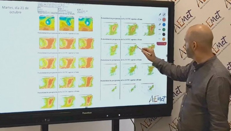
AEMET, the Spanish state meteorological agency, has confirmed that a second episode of Gota Fría is heading towards the Murcia Region and is expected to arrive on Monday evening.
Storms of this nature are generally preceded by wind and a yellow alert level has been issued for the coastal areas of the Campo de Cartagena and Mazarrón between 4am in the morning and 10am in the morning of Sunday.
Winds of up to 50 or 60 k/h, or gale force 7 are expected to precede the storm along this stretch of coast.
During Sunday the weather is expected to be cloudy with the probability of some storms and light rain across the region.
On Monday the region is expected to receive some generalised rain during the day and the DANA, or Gota Fría, is likely to arrive on Monday evening, although as is normal in these situations, AEMET is reluctant to specify in great detail where the rains are most likely to be heaviest and has yet to issue specific alerts, but has issued a bulletin advising that a DANA is heading towards the Mediterranean coast.
This is not specifically directed at the Murcia Region, indeed, the worst of the rain is expected to assail the northernmost points of the Comunidad Valenciana, the Valencia Region, specifically the province of Valencia, the Region of Cataluña and the Balearic Islands. Possible rainfalls of up to 200mm are predicted for Cataluña.
In the Murcia Region the rain is expected to be particularly heavy on Tuesday, the Altiplano, which covers Yecla and Jumilla, part of the Vega del Segura which runs along the Ricote Valley and down towards the capital city and the Campo de Cartagena, the area surrounding the Mar Menor, expected to receive the heaviest downpours, although it must be stressed that Aemet expects the rainfall to be considerably less than in the episode of Gota Fría which assailed the region during the period of 12th and 13th September.(Click here for an overview of what happened in September)
Although little detail has been provided of the anticipated volume of rain, Aemet has said that the rains will be “persistent and abundant” on Tuesday and may still be in evidence on Wednesday, although the storm will move away along the coast towards Cataluña on Wednesday.
A yellow alert for rains of up to 20mm in an hour has been issued for Monday evening in the coastal areas of the Alicante province. At the moment no specific warnings have been issued for Murcia on Monday.
Warnings are always issued to the general public to avoid unnecessary journeys once the rain starts, so use the remaining hours before the rains are scheduled to arrive to check household drains, water run-offs and ensure no vehicles are parked either in the ramblas or in the path of known water run-offs.
Unfortunately these Gota Fría downpours can be very localised and it is notoriously difficult for forecasters to accurately pinpoint where the rainfall will be heaviest; as a consequence some areas will experience flooding, and 2 kilometres away the locals will sit there complaining that they were panicked unnecessarily and didn´t see a drop of rain!
If you are holidaying in the area, heed the advice to remain inside once the rain starts as every year the emergency services are called to rescue motorists from vehicles stranded in flooded underpasses, from rural roads where the ditches have disappeared beneath a sheet of water and a motorist has been unable to see where the road stopped and the ditch began, or a vehicle has attempted to cross a running rambla and been swept down to the sea by the force of the water.
As ever it must be repeated that the behaviour of these weather phenomena is notoriously hard to predict accurately, and the best advice is to keep abreast of the latest forecasts on Monday as the storm approaches in case the situation changes.
Join the Murcia Weather Watch group on Facebook to keep up to date with all the latest forecasts and weather related stories and to post your own photos of anything that happens where you live: https://www.facebook.com/groups/RegionOfMurciaWeatherWatch/.
Follow Murcia Today on Facebook to keep up to date with all the latest news, events and information in the Region of Murcia and the rest of Spain: https://www.facebook.com/MurciaToday/


Find more information by AREA, TOWN or URBANISATION .....
Cabo de Palos
Cartagena
El Carmoli
Islas Menores and Mar de Cristal
La Manga Club
La Manga del Mar Menor
La Puebla
La Torre Golf Resort
La Union
Los Alcazares
Los Belones
Los Nietos
Los Urrutias
Mar Menor Golf Resort
Pilar de la Horadada
Playa Honda / Playa Paraiso
Portman
Roldan and Lo Ferro
San Javier
San Pedro del Pinatar
Santa Rosalia Lake and Life resort
Terrazas de la Torre Golf Resort
Torre Pacheco
Aguilas
Aledo
Alhama de Murcia
Bolnuevo
Camposol
Condado de Alhama
Fuente Alamo
Hacienda del Alamo Golf Resort
Lorca
Mazarron
Puerto de Mazarron
Puerto Lumbreras
Sierra Espuna
Totana
Aledo
Alhama de Murcia
Bolnuevo
Camposol
Condado de Alhama
Fuente Alamo
Hacienda del Alamo Golf Resort
Lorca
Mazarron
Puerto de Mazarron
Puerto Lumbreras
Sierra Espuna
Totana
Abanilla
Abaran
Alcantarilla
Archena
Blanca
Corvera
El Valle Golf Resort
Hacienda Riquelme Golf Resort
Lorqui
Molina de Segura
Mosa Trajectum
Murcia City
Peraleja Golf Resort
Ricote
Sucina
Abaran
Alcantarilla
Archena
Blanca
Corvera
El Valle Golf Resort
Hacienda Riquelme Golf Resort
Lorqui
Molina de Segura
Mosa Trajectum
Murcia City
Peraleja Golf Resort
Ricote
Sucina
Urbanisations
CamposolCondado de Alhama
El Valle Golf Resort
Hacienda del Alamo Golf Resort
Hacienda Riquelme Golf Resort
Islas Menores and Mar de Cristal
La Manga Club
La Torre Golf Resort
Mar Menor Golf Resort
Mazarron Country Club
Mosa Trajectum
Peraleja Golf Resort
Santa Rosalia Lake and Life resort
Terrazas de la Torre Golf Resort
La Zenia
Lomas de Cabo Roig
Important Topics:
CAMPOSOL TODAY Whats OnCartagena SpainCoronavirusCorvera Airport MurciaMurcia Gota Fria 2019Murcia property news generic threadWeekly Bulletin
CAMPOSOL TODAY Whats OnCartagena SpainCoronavirusCorvera Airport MurciaMurcia Gota Fria 2019Murcia property news generic threadWeekly Bulletin