- Region
- Águilas
- Alhama de Murcia
- Jumilla
- Lorca
- Los Alcázares
- Mazarrón
- San Javier
-
ALL AREAS & TOWNS
- AREAS
- SOUTH WEST
- MAR MENOR
- MURCIA CITY & CENTRAL
- NORTH & NORTH WEST
- TOWNS
- Abanilla
- Abarán
- Aguilas
- Alamillo
- Alcantarilla
- Aledo
- Alhama de Murcia
- Archena
- Balsicas
- Blanca
- Bolnuevo
- Bullas
- Cañadas del Romero
- Cabo de Palos
- Calasparra
- Camping Bolnuevo
- Campo De Ricote
- Camposol
- Canada De La Lena
- Caravaca de la Cruz
- Cartagena
- Cehegin
- Ceuti
- Cieza
- Condado de Alhama
- Corvera
- Costa Cálida
- Cuevas De Almanzora
- Cuevas de Reyllo
- El Carmoli
- El Mojon
- El Molino (Puerto Lumbreras)
- El Pareton / Cantareros
- El Raso
- El Valle Golf Resort
- Fortuna
- Fuente Alamo
- Hacienda del Alamo Golf Resort
- Hacienda Riquelme Golf Resort
- Isla Plana
- Islas Menores & Mar de Cristal
- Jumilla
- La Azohia
- La Charca
- La Manga Club
- La Manga del Mar Menor
- La Pinilla
- La Puebla
- La Torre
- La Torre Golf Resort
- La Unión
- Las Palas
- Las Ramblas
- Las Ramblas Golf
- Las Torres de Cotillas
- Leiva
- Librilla
- Lo Pagan
- Lo Santiago
- Lorca
- Lorquí
- Los Alcázares
- Los Balcones
- Los Belones
- Los Canovas
- Los Nietos
- Los Perez (Tallante)
- Los Urrutias
- Los Ventorrillos
- Mar De Cristal
- Mar Menor
- Mar Menor Golf Resort
- Mazarrón
- Mazarrón Country Club
- Molina de Segura
- Moratalla
- Mula
- Murcia City
- Murcia Property
- Pareton
- Peraleja Golf Resort
- Perin
- Pilar de la Horadada
- Pinar de Campoverde
- Pinoso
- Playa Honda
- Playa Honda / Playa Paraíso
- Pliego
- Portmán
- Pozo Estrecho
- Puerto de Mazarrón
- Puerto Lumbreras
- Puntas De Calnegre
- Region of Murcia
- Ricote
- Roda Golf Resort
- Roldan
- Roldan and Lo Ferro
- San Javier
- San Pedro del Pinatar
- Santiago de la Ribera
- Sierra Espuña
- Sucina
- Tallante
- Terrazas de la Torre Golf Resort
- Torre Pacheco
- Totana
- What's On Weekly Bulletin
- Yecla


- EDITIONS:
 Spanish News Today
 Alicante Today
 Andalucia Today
Outlying districts of Fuente Álamo: La Pinilla
La Pinilla is in the south-west of the municipality of Fuente Álamo de Murcia
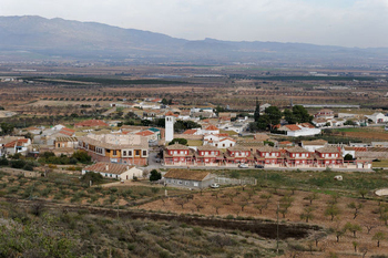
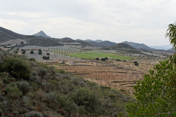 La Pinilla is a small rural district located in the south-west of the municipality of Fuente Álamo, and is one of the villages which grew up along the route of the old "Camino Real" transhumance farming trail between Cartagena and Lorca.
The village was always a farming community and most of the local economy today is based on agriculture, pig and chicken rearing concerns standing alongside non-irrigated crops such as olives and almonds. Other members of the local community work outside the village, there being very few alternative career paths.
The tale of La Pinilla begins 12 million years ago - various fossils have been found in the area - and there is also some evidence to suggest that there were Roman and Moorish settlements nearby, such as the old Barrio del Fortín. The population suddenly grew in the middle of the twentieth century, when a new area of cooperative housing was built, but a later period of emigration and the re-invention of crop farming in the surrounding area have made La Pinilla the residential agricultural village it is today.
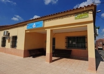 Click for map, La Pinilla, Fuente Álamo, Murcia.
A brief history of La Pinilla
Fossil remains
Many fossils have been found in parts of the area surrounding La Pinilla, such as the Finca de Los Montesinos, El Majar de Gracia and Las Cuestas.
12 million years ago, this area was underwater, and the various strata in which the fossils have been found correspond to coastal, shallow water. The presence of various types of coral indicates that the water here was very warm at the time.
There is an area near the former railway (see below) which is particularly rich in fossils, particularly (for enthuisiasts) Ostrea crassissima, Cardium edulus, Strombus Almería and Comus mercatí.
The Romans in La Pinilla
 The Romans conquered Cartagena (Carthago Nova) in 209 BC, and not only built infrastructure throughout the region but also set up trade routes to move the raw materials and natural resources of Spain throughout their vast Empire.
Some of the existing trade routes used by the indigenous population and their trading partners were brought under the control of the Empire, and the road linking Carthago Nova, Eliocroca (Lorca) and Cástulo (Jaén) passed directly through La Pinilla. As the centuries passed, the road became the Camino Real between Cartagena and Lorca.
There are Roman remains from the 3rd century BC scattered in various places along it including a Roman tombstone found near Pantaleo, now on display at the Archaeological Museum in Cartagena.
The Moors in La Pinilla
 After the 4th century and the departure of the Romans, Cartagena was subjected to a number of invasions, the most permanent being that of the Visigoths. But by the early 8th century Moorish invaders from Africa were sweeping across southern Spain and in 713 the pact of Tudmir was signed, which allowed Moorish settlers to take up farming in peace, in co-operation with a negotiated Visigoth Governor for the area.
The Moors became the dominant population by the 9th century and it is thought that the name of La Pinilla comes from the Arabic "Ben-iella", meaning "daughter of the pact". There is no documentation related to the village from the period when it was under Moorish rule, and evidence of human activity in this time is limited to a few remains in El Fortín and Cueva Jara.
Most probably the Moors would have chosen to live close to sources of water and would have built wells, ponds and irrigation ditches. Caves like Cueva Lara were dug out and turned into little oases in the enormous dry plains.
Christian La Pinilla
This area again changed hands in 1243 when it was the subject of another pact, which gave control to the Christian Castilian forces of Prince Alfonso, who later became Alfonso X "El Sabio" (The Wise). There is little information about the area at that time, although it did suffer depopulation following an uprising of the Moors in 1266. Many of them were expelled from the area.
It is known that in the 16th century the village belonged to the township of Lorca, and was part of the area which began to be repopulated in the Campo de Cartagena. Encouragement was given to those repopulating and revitalizing the countryside in Lorca, Librilla and other neighbouring municipalities, and it is believed that the growth of the village began in the area of El Fortín, where the first church was built. The first documented reference to the church dates from 1748 in the will of one of the inhabitants of the village.
The "villa", as it then was, probably passed into the hands of a rich landowner from Lorca at around this time, and after 1820, when the municipal boundaries of Fuente Álamo were defined, La Pinilla had to wait 26 years before being able to free itself from Lorca and form part of Fuente Álamo. This was a period of bitter arguments with the Town Hall in Mazarrón over the ownership of the Fuente de La Pinilla and the Cabezo de la Calera.
In the early part of the 20th century, a time of hunger, pestilence and crop failure brought misery to the residents, but as the century progressed there was a period of relative prosperity.
 In the 1920s, under the dictatorship of Primo de Rivera, a new program to build more infrastructures was begun, and this plan included the construction of a railway line from Cartagena to Totana. The railway promised to end the isolation of La Pinilla and stimulate further growth, but these hopes were dashed when General Berenguer came to power in 1928 and work on the line was halted. Part of the proposed route of the line is still used as a greenway but otherwise no vestige of the railway remains.
Public schools were built in the village in 1935, one for girls and another for boys, funded by the Town Hall of Fuente Álamo, but the outbreak of the Civil War in 1936 brought to La Pinilla the same conflicts as in all other areas of Spain, pitting neighbours and even brothers against each other.
Cartagena is close by and it was not unknown for villages nowhere near the city to be hit by stray bombs during the fierce bombardments which took place during the war. Fearful that pilots on unsuccessful bombing raids might release their bombs over the area on their way back from missions, it became commonplace for locals to seek shelter in the caves each night until the raids were over.
After the war ended in 1939 there began a hard post-war period for the residents of La Pinilla, the economic hardships of the period being exacerbated by the residual bitterness felt by supporters of both sides in the struggle.
 Some left the town to escape these residual quarrels, some to fight on elsewhere in different causes (such as Miguel Marín, who joined the French resistance) and others simply to start life anew in fresh fields. For those who remained in the village these were two decades of drought, disease, fear, misery and, above all, hunger, and they became a hardy population of farmers, agricultural workers and shopkeepers.
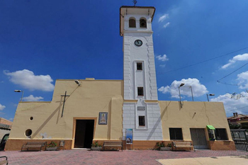
La Pinilla was hooked up to the national grid in 1942, when it became the first village in the area to receive electricity. Despite this, though, the village remained a very traditional community, with religious affairs very much at the centre of everything that went on, and nothing really changed until the arrival in 1953 of a new priest, Antonio Gómez Ruiz. In the eight years he spent here he introduced a series of forward-thinking changes, including the construction of the church tower in 1957, making it the highest building in the area.
 The cemetery was made presentable, trees were planted, a kindergarten was set up, a group of 32 new houses was built and running water was brought to the village (previously it had been necessary to bring drinking water from the other side of the cemetery, more than a kilometre away). Sr Gómez even oversaw the organization of communal trips to the seaside in Isla Plana, where the children escaped from the hardship of their daily existence for a few days every year.
In July 1960 the first telephone in the village was installed in the house of Antonio Madrid, although it was later moved to the bar belonging to Joaquín Barcelona, and in 1968 work was completed on the updating of the area's sewage system.
Today part of the land around the village is still used for dry crops, and some of the inhabitants are employed in local pig and chicken farms. The proximity of Mazarrón, with its growing services sector, and Fuente Álamo with industrial activity, offer better work prospects for the younger population, and the village is now mostly residential.
The church of Nuestra Señora de Montserrat
 Click here for details.
Fiestas in La Pinilla
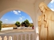
The local fiestas are held at the start of September in honour of the Virgen de la Luz, the patron saint of the village since the middle of the 19th century, when for reasons unknown she substituted the Virgen de Montserrat.
Social Centre
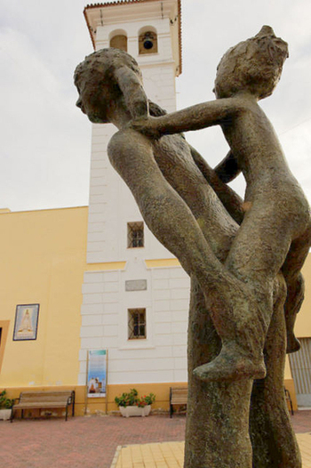
 In the area of La Pinilla known as Las Casas Nuevas is the Plaza de las Eras, where most of the public buildings are grouped together. These include the social centre, and it is in this square that the locals celebrate the events of the village fiestas.
The centre includes a computer room with free internet access, where various courses and workshops are held throughout the year. All cultural events are based around the social centre, and the fiestas are coordinated and organized from here.
Sports facilities are located next to the local primary school, with courts and pitches for football, volleyball and handball. The health centre and a childrens play area are also close by.
Property in La Pinilla
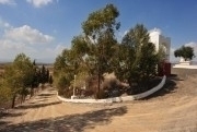
In the first years of the 21st century La Pinilla became popular with British expats, partly due to the presence of an estate agency in the area. They were attracted by the country properties, many of them reformed, and the area is an easily manageable drive from the coast and the beaches of Mazarrón. On the other hand, it is still quintessentially Spanish, despite the large expat population of nearby Mazarrón.
Infrastructure connections are good: Corvera airport is around 30 minutes away by car and it is very close to the AP-7 motorway. Hypermarket shopping is available in Cartagena (30 minutes) and there are numerous supermarkets in Fuente Álamo and Mazarrón.
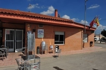
La Pinilla has a bar/restaurant and a local surgery.
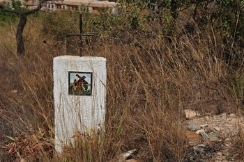
El Calvario and the Vía Crucis of La Pinilla
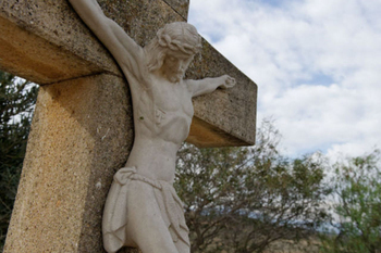 This is a charming Vía Crucis and walk which is little known outside the immediate village community. Click here for details.

Cartagena
El Carmoli
Islas Menores and Mar de Cristal
La Manga Club
La Manga del Mar Menor
La Puebla
La Torre Golf Resort
La Union
Los Alcazares
Los Belones
Los Nietos
Los Urrutias
Mar Menor Golf Resort
Pilar de la Horadada
Playa Honda / Playa Paraiso
Portman
Roldan and Lo Ferro
San Javier
San Pedro del Pinatar
Santa Rosalia Lake and Life resort
Terrazas de la Torre Golf Resort
Torre Pacheco
Aledo
Alhama de Murcia
Bolnuevo
Camposol
Condado de Alhama
Fuente Alamo
Hacienda del Alamo Golf Resort
Lorca
Mazarron
Puerto de Mazarron
Puerto Lumbreras
Sierra Espuna
Totana
Abaran
Alcantarilla
Archena
Blanca
Corvera
El Valle Golf Resort
Hacienda Riquelme Golf Resort
Lorqui
Molina de Segura
Mosa Trajectum
Murcia City
Peraleja Golf Resort
Ricote
Sucina
Condado de Alhama
El Valle Golf Resort
Hacienda del Alamo Golf Resort
Hacienda Riquelme Golf Resort
Islas Menores and Mar de Cristal
La Manga Club
La Torre Golf Resort
Mar Menor Golf Resort
Mazarron Country Club
Mosa Trajectum
Peraleja Golf Resort
Santa Rosalia Lake and Life resort
Terrazas de la Torre Golf Resort
La Zenia
Lomas de Cabo Roig
CAMPOSOL TODAY Whats OnCartagena SpainCoronavirusCorvera Airport MurciaMurcia Gota Fria 2019Murcia property news generic threadWeekly Bulletin
