- Region
- Águilas
- Alhama de Murcia
- Jumilla
- Lorca
- Los Alcázares
- Mazarrón
- San Javier
-
ALL AREAS & TOWNS
- AREAS
- SOUTH WEST
- MAR MENOR
- MURCIA CITY & CENTRAL
- NORTH & NORTH WEST
- TOWNS
- Abanilla
- Abarán
- Aguilas
- Alamillo
- Alcantarilla
- Aledo
- Alhama de Murcia
- Archena
- Balsicas
- Blanca
- Bolnuevo
- Bullas
- Cañadas del Romero
- Cabo de Palos
- Calasparra
- Camping Bolnuevo
- Campo De Ricote
- Camposol
- Canada De La Lena
- Caravaca de la Cruz
- Cartagena
- Cehegin
- Ceuti
- Cieza
- Condado de Alhama
- Corvera
- Costa Cálida
- Cuevas De Almanzora
- Cuevas de Reyllo
- El Carmoli
- El Mojon
- El Molino (Puerto Lumbreras)
- El Pareton / Cantareros
- El Raso
- El Valle Golf Resort
- Fortuna
- Fuente Alamo
- Hacienda del Alamo Golf Resort
- Hacienda Riquelme Golf Resort
- Isla Plana
- Islas Menores & Mar de Cristal
- Jumilla
- La Azohia
- La Charca
- La Manga Club
- La Manga del Mar Menor
- La Pinilla
- La Puebla
- La Torre
- La Torre Golf Resort
- La Unión
- Las Palas
- Las Ramblas
- Las Ramblas Golf
- Las Torres de Cotillas
- Leiva
- Librilla
- Lo Pagan
- Lo Santiago
- Lorca
- Lorquí
- Los Alcázares
- Los Balcones
- Los Belones
- Los Canovas
- Los Nietos
- Los Perez (Tallante)
- Los Urrutias
- Los Ventorrillos
- Mar De Cristal
- Mar Menor
- Mar Menor Golf Resort
- Mazarrón
- Mazarrón Country Club
- Molina de Segura
- Moratalla
- Mula
- Murcia City
- Murcia Property
- Pareton
- Peraleja Golf Resort
- Perin
- Pilar de la Horadada
- Pinar de Campoverde
- Pinoso
- Playa Honda
- Playa Honda / Playa Paraíso
- Pliego
- Portmán
- Pozo Estrecho
- Puerto de Mazarrón
- Puerto Lumbreras
- Puntas De Calnegre
- Region of Murcia
- Ricote
- Roda Golf Resort
- Roldan
- Roldan and Lo Ferro
- San Javier
- San Pedro del Pinatar
- Santiago de la Ribera
- Sierra Espuña
- Sucina
- Tallante
- Terrazas de la Torre Golf Resort
- Torre Pacheco
- Totana
- What's On Weekly Bulletin
- Yecla


- EDITIONS:
 Spanish News Today
 Alicante Today
 Andalucia Today
article_detail
History of Cieza
7,000 years of agriculture in this fertile valley
The municipality of Cieza has a long and interesting history, its benign climate, geographical location, fertile 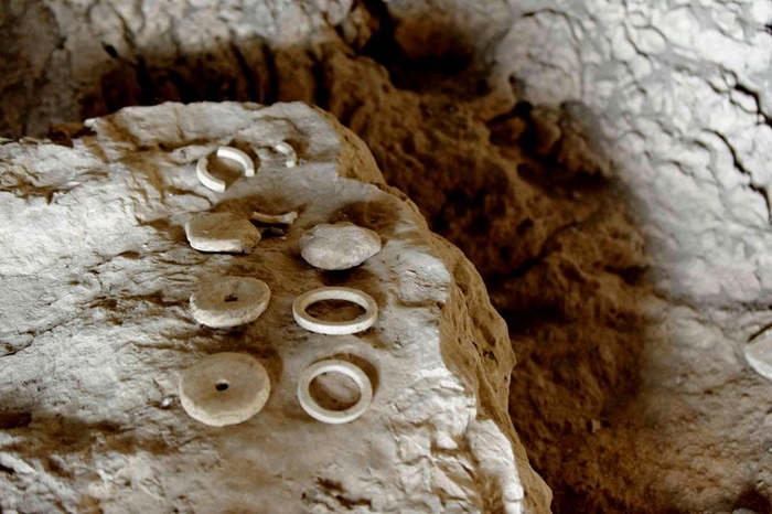 plains, porous rock which created numerous caves to offer natural shelter and abundant water supplies, attracting the attention of settlers from the earliest prehistory. The area has enjoyed almost unbroken occupation for thousands of years and contains archaeological sites with a rich heritage, offering several interesting locations for modern-day visitors.
Prehistory: The Paleolithic Era
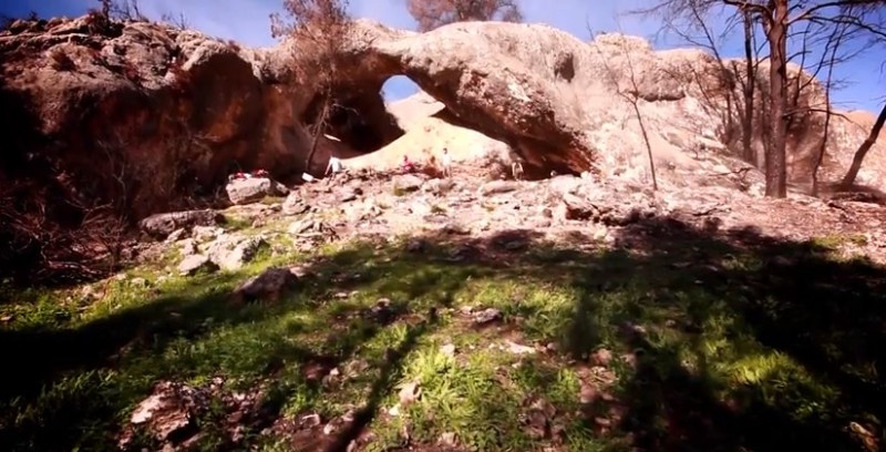
The earliest evidence of human occupation of the area of Cieza can be seen in the cave paintings of the Cueva de la Serreta, or Cima de la Serreta, on the left bank of the Almadenes canyon which lies on the boundary with Calasparra.
The natural porous nature of the limestone rocks from which the gorge is formed, has led to the formation of many natural caves and holes in the rocks around the area, creating a natural and attractive means of shelter 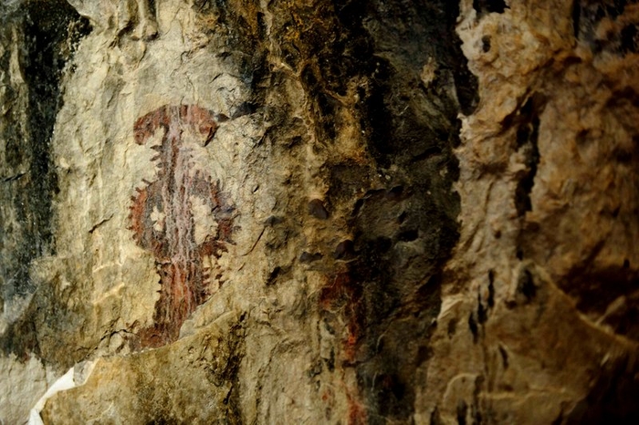 for prehistoric man, as well as having the added advantage of abundant fresh water supplies.
Archaeological evidence at the site dates first occupation back to the Lower and Middle Paleolithic eras, but with increased activity in the Epipaleolithic (the transition period between the Paleolithic and the Neolithic), around 9000 BC.
The 35-metre long Cueva de la Serreta in the Los Almadenes gorge is virtually inaccessible from the canyon itself, but has superb views over the valley and the water below from its interior. The cave is 16 metres below ground and is currently accessed from a hole in the ground on the left hand bank of the gorge with a convenient spiral staircase for modern-day visitors, although its former inhabitants would have probably gained entry via a rope or, as was the case during the last century, a tree growing up through the hole, and would have been given safe shelter from the elements. The cave is one of few sites containing prehistoric rock-art which can be visited by the public, and is opened for visits several times a year, as well as for group bookings by appointment. Archaeological remains excavated from the cave can be seen in the municipal archaeological museum, the Museo Siyâsa in Cieza itself.
Although the Cueva de la Serreta is the best-known cave in Cieza, the Cueva de la Barca (Cabezo del Asno) and the Barranco de los Grajos also hold valuable archaeological evidence, the latter being of particular interest to archaeologists, as it provides evidence that some Paleolithic practices were still taking place until as recently as the 3rd millennium BC.
The Neolithic Era
The Cueva de la Serreta is of particular interest as it provides valuable evidence of the Neolithic, in particular a period known as the Middle Neolithic, which dates to approximately 4000-5000 BC. This is an interesting 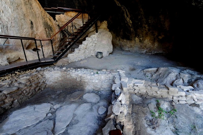 period as it marks the transition of early Man from hunter-gatherer to farmer, and there is evidence within the cave of both agricultural activity and the storage of foodstuffs in the form of two grain silos, as well as hunting tools.
This was a crucial period in the development of mankind, as the transition from hunting to farming enabled humans to produce and store regular food supplies, increasing life expectancy and leading to an increase in the population.
Agriculture and cattle-rearing developed, providing a more reliable source of meat proteins, and settlements became permanent rather than seasonal, as the old nomadic hunting existence was abandoned. This is also a time when mankind began to express himself through rock art and the cave contains 50 schematic and semi-naturalist cave paintings, some of them still clearly visible and definable. Exactly when this change occurred is difficult to pin down since it depends on the geographical area, and varies considerably in different climatic bands, but in the Iberian Peninsula (the landmass of modern Spain) it is generally held to have been during the 4th millennium BC.
As well as the Cueva de la Serreta there is also evidence of Neolithic settlement in the Barranco de los Grajos, which contains prehistoric rock art, albeit in a different style to those visible in the Serreta. While the art in the Serreta is schematic and semi-naturalist, the works of the Barranco de los Grajos are more typical of the style of Spain’s Mediterranean coastal regions, the most famous scene being a depiction of a fertility dance. The images show a wide range of gestures in the human figures, adding detail to the narratives portrayed, and they are among the most important cave paintings in the Region of Murcia. Los Grajos showed evidence of a long period of settlement and yielded a large number of remains including a number of Neolithic ceramics, showing the evolution of mankind and how his practices changed as he gradually developed.
The Copper, Bronze and Iron Ages in Cieza
The Copper Age began in the 3rd millennium BC, which is when communities first began to make tools using the metal alloy, marking another major step forward in human development. At the same time there was also 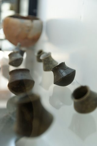 an increase in the complexity of social relationships and social hierarchy, and settlements moved out of the protection of caves to build residences in the open air. This marked a major change and was essentially the beginning of modern construction, and is a period represented in Cieza at the Los Realejos site.
During the 2nd millennium BC the settlements grew larger, more sophisticated and complex defences were devised and built, while at the same time the use of bronze became more widespread than copper technology. Most of the material found in Cieza from this time comes to us from the Argaric culture, which occupied large areas of Murcia and the eastern part of Almería from where the name originated at the first major Argaric settlement found, El Argar. There are also materials which were brought here from La Mancha and the Valencia region, which also contain Argaric sites.
The Argaric culture is particularly interesting as it shows a marked uniformity in its settlements, the same models and sizes of ceramics found again and again, the same patterns in burials, and what appears to be evidence of a hierarchical social structure, dating from 2200 to 1500 BC. The Argarics are somewhat of an enigma, as they appear to have possessed advanced technological knowledge unknown in Europe at this point of metallurgical development and as more sites emerge, archaeologists continue to learn more about the scale of Argaric settlement across the Murcia region and gain information about what appears to have been an administrative structure. Cieza, by all accounts, appears to have been of strategic importance in the organization of the land along the banks of the Segura at this point in history, and interesting finds from the Cabezo de las Beatas site can be seen in the archaeological museum. Argaric finds turn up in several areas of the region, but there are two major sites in the shape of La Bastida in Totana and Pliego, both significant settlements.
The Iberian Culture
The next definable culture to make its mark was the Iberian culture, a development from the Argarics which can be clearly set apart as a definably different culture between roughly 750BC and the 1st century BC. By 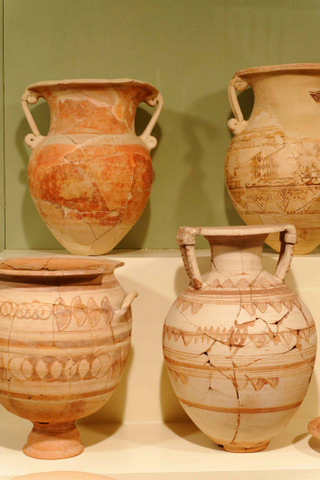 the first century BC the Iberians ceased to exist as a definable separate culture, having broadly adopted significant characteristics of the Roman invaders following the occupation of this area in 209BC and become “Romanised” .
During this period there was extensive trading and cultural influence from other areas of the Mediterranean, evidence of which can clearly be seen in Cieza on the sites of Bolvax and the Rambla del Judío.
At this point, in approximately the seventh century BC, it seems that human settlement in the area of Cieza was concentrated on the southern and south-western slopes of a small hill close to the River Segura. Here, where there is a natural route from the Upper Segura to the valley of Ricote, the town of Bolvax was established by the Contestani, one of many Iberian tribes which occupied different areas of the peninsula.
Some of the most important archaeological discoveries in the Region of Murcia have been made here, including a Greek coin from Lesbos dating back to approximately 500 BC. This is the oldest coin yet discovered in the whole of the south-east of Spain, and various other items of Greek and Phoenician origin, such as bronze bells, ceramic pots and iron arrowheads have also been unearthed inside and next to the remnants of primitive residential buildings showing clear evidence of inter-Mediterranean trading. These articles have been found alongside others dating from the period of Roman occupation, when the invaders referred to the settlement as Siesa.
The Romans in Cieza
By the third century BC the Punic wars between Rome and Carthage on the African coast ( Carthage having evolved after the Phoenicians were pushed out of their own homelands and established trading colonies around the Mediterranean basin, ) were in full swing, the Romans driving the Carthaginians down the 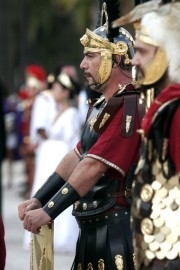 southern Spanish coast. The Carthaginians settled in what is now Cartagena (Carthago Nova), but fell to the Romans in 209 BC, after Hannibal first made the fatal error of attacking Sagunto and breaking the previous treaty established with Rome before setting off across the Alps with his army ( and legendary elephants) to attack Rome itself, and this of course changed the course of the development of all nearby areas, including Cieza.
Now part of the Roman province of Hispania, Bolvax was still the leading settlement in the area of modern-day Cieza, and by the century before the birth of Christ the Iberian nature of the town had been supplanted by Roman villas which administered the agriculture, not only here but throughout the Cuenca basin which occupies this part of south-eastern Spain.
It has to be assumed that this was an age of prosperity for the area of Cieza, a view which is supported by the lavish decoration which has been found in Roman buildings nearby and by the fact that the population appears to have grown significantly. This took place not briefly but over a period of hundreds of years, as Roman dominance in Spain lasted well beyond the 3rd century AD, but from that point on the Empire was on the wane.
This marked the beginning of the end for the town, as in the climate of instability and uncertainty inhabitants fled to the hills where they were able to keep a look-out for possible raiders. Indeed, some have speculated that a quite separate settlement developed in Cabezo de las Beatas as a result of this mini-migration. This is where the Cueva de la Serreta again enters the scene, having been occupied by a Roman farming family during the period at the end of Roman rule when the mighty Empire split apart and Hispania was a natural target for the waves of Barbarians, Goths and Visigoths who swept down through Spain.
The Visigoths in Cieza
Throughout most of Spain the power vacuum left by the withdrawal of the Romans was filled by the Visigoths, whose first invasions are dated at around 410 AD and who eventually consolidated their dominance in the sixth and seventh centuries.
During this period the area of Cieza was largely abandoned as it was bandit territory, and there is practically no sign of there having been any human habitation of the town or the surrounding countryside until the arrival of the first Muslim occupants in the tenth century or before, although the Visigoths occupied a major settlement at Begastri in the modern day Cehegín municipality in the North-west of Murcia.
Moorish Cieza in the Early Middle Ages
The Middle Ages is a term used by historians to refer to rather different periods in different parts of Europe, but in Cieza and the rest of southern Spain the era is generally held to have begun with the first incursions into the Iberian Peninsula by the Moslem Moors from northern Africa. These took place in the early 8th 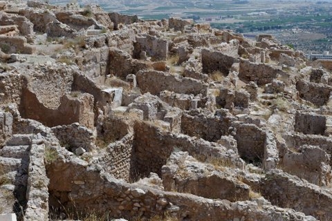 century, when internal power struggles amongst the Visigoth nobles resulted in a Moorish army being invited into Spain to help support the succession and culminated in the conquest of southern Spain between 711 and 713 AD, and from the 10th century onwards Cieza became a very important city under the name of Medina Siyâsa.
It is quite possible that undocumented occupation dates from the early days of the Moorish presence in Spain, but the first definite proof of habitation in Medina Siyâsa dates from the 10th century. At this time the inhabitants lived in “alquerías”, or small rural communities, rather than in the “madina” (or city) which later developed, and improved farming yields by the use of their networks of “acequias”, or irrigation ditches. Some of these acequias had been first set up by the old Roman villas centuries before: indeed, many can still be seen in various parts of the Region of Murcia, and are still used in the market gardening concerns which have always been of such vital importance to the regional economy.
As the farming community grew more populous, more prosperous and more stable, so the city of Medina Siyâsa became established on the Cerro del Castillo, in the mountains of the Sierra del Oro. This site is now one of the best preserved Moorish conurbations from the period of Arab rule in south-eastern Spain.
Despite its importance during the years of Moorish rule, though, there is a frustrating lack of documentary evidence concerning Medina Siyâsa: in general terms, it seems that when they were forced out of the area during the 13th century Reconquista the Moors either took their records with them or destroyed them, although another possibility is of course that the Christian forces were somewhat over-zealous in obliterating all evidence of Moorish occupation.
What is known is that the Christians of this period abbreviated the name of the town to Cieça, but the name of Madina Siyâsa in Arabic is far more illustrative of Cieza’s importance. It means something akin to “political capital”, reflecting the fact that Cieza at this point was a kind of city state within the province of Tudmir. It was governed by a military chief, and we know that the town clung to the hillside in a series of terraced buildings 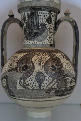 set on narrow labyrinthine streets.
Despite the sparse information provided by contemporary references, it has also been established that the city of Madina Siyâsa, at the peak of its importance in the 11th and 12th centuries, was a fortified town containing approximately 300 homes. These homes were divided into two separate areas, known as the “albacar” and the “celoquía”, which were linked by a main street running from north to south. The purpose of the albacar, lower down the slope, was to provide initial protection for the inhabitants from potential enemy attacks, while the higher celoquía was the main fortress. A cemetery, with tombstones pointing towards Mecca, existed within the city walls, and some of the items found at the site are now exhibited in the Museo de Siyâsa.
During this period Cieza became one of the leading towns in the Ricote valley, and its importance is reflected in the architecture. The arches over the doorways show its prestige, as does the quality of the ceramic items found here, and without doubt part of this prestige was due to the strategic advantages conferred on the town by its location on the Cerro del Castillo: from here it was possible to monitor comings and goings in the whole of the Upper Segura.
Christian Cieza in the Late Middle Ages
The Reconquista of the Region of Murcia by Christian forces took place in 1243, when Fernando III of Castile invaded, and was consolidated in the following decades by his son Alfonso X (“the Wise”). This was part of a gradual process which took centuries to complete, as the Christian forces of Castille y León and Aragón drove down into the south and retook the lands held for 500 years by the Moors. The process finally 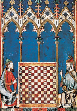 concluded in 1492 when the Kingdom of Granada fell to the Catholic Monarchs Isabella and Ferdinand.
In 1243 the Treaty of Alcaraz was signed, effectively a peaceful transfer of the Kingdom of Murcia to the sovereignty of Fernando III: this voluntary acceptance of the rule of Castile allowing the Moorish rulers of Cieza to maintain a certain degree of wealth and right to self-governance. At first life in the city changed little as a result of the Reconquista, but the failure by the Christians to respect all of the terms agreed in the treaty led to a Mudéjar uprising in 1266 which had to be quashed by the troops of Jaime I of Aragón. Although in theory the remaining Moors were to be treated fairly in terms of taxation and their religious beliefs were to be respected, under Alfonso X this was not always the case, and gradually the Muslims came to be regarded as second-class citizens. Many left and migrated to the Kingdom of Granada, which was still under the control of the Nazrid Dynasty and which carried out regular raids on border territories, including Cieza.
From this point onwards the importance of Siyâsa declined, and the focus of power and wealth shifted towards Christian Cieza further down in the valley, where the current town is located.
The initial growth of this settlement was due largely to the interest of Alfonso X, who recognized its strategic location at the head of the Ricote valley and in the centre of an area of fertile farmland, and repopulated it with immigrants from Castile, Catalunya and Aragón. The site on the lowlands was preferred due to the better access it gave to farmland in comparison to the hilly location of Siyâsa.
At the same time, in order to provide impetus to his repopulation program, Alfonso offered incentives to those coming to the area in the form of titles and privileges, and before long the neighbouring town of Siyâsa was little more than a sparsely inhabited fortress.
When Alfonso’s son and heir Fernando de la Cerda died in 1275 there was something of a power struggle 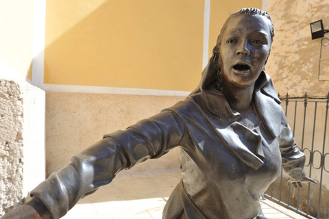 among the rest of his children to decide who would succeed him on the throne, and it was in this context that the future King Sancho IV promised to reward the support of the important military knights Order of Santiago by giving them the whole of the neighbouring Ricote valley if they took his side.
Along with other parts of the Region of Murcia, in 1281 Cieza was placed by Alfonso in the hands of the religious and military Order of Santiago, in return for which the Order gave Abanilla back to the Crown. The Christians now re-used the Moorish fortress above Medina Siyâsa, as has been demonstrated by the finding of various coins bearing the images of Alfonso X and Fernando IV.
Subsequently, two of the most significant events in the history of Cieza took place in 1422 and 1457. On the first occasion Moors from across the border in the Kingdom of Granada practically destroyed the town during one of their raids, capturing the women and children and taking them to the dungeons of Granada. Some of them were later rescued, but the cells in which they were kept are still known as “El Corral de Cieza”.
In 1457, Cieza was ransacked and destroyed during the conflict between Pedro Fajardo and his cousin Alonso Fajardo (“El Bravo”), and the castle was destroyed at the order of Enrique IV.
By 1468 the town of Cieza was reported to be home to 140 inhabitants, and the settlement on the flat land had become well established in what appeared to be a climate of peace. But in 1477 another episode of violence erupted, when Boabdil, the last Nazrid ruler of Granada, led a raid into the Kingdom of Murcia at the head of a force of 50,000 men. Entering via Caravaca, he attacked Cieza on 7th April, Easter Sunday, and in the resulting battle the Christian defence forces were annihilated. Some accounts state that 80 of the 140 inhabitants were killed, and the rest of the population of the town were taken prisoner by the bridge over the Segura and transported to Granada. This tragedy is still commemorated on the town’s coat of arms by the legend “Por pasar la puente nos dieron muerte” (we were killed so that they could cross the bridge).
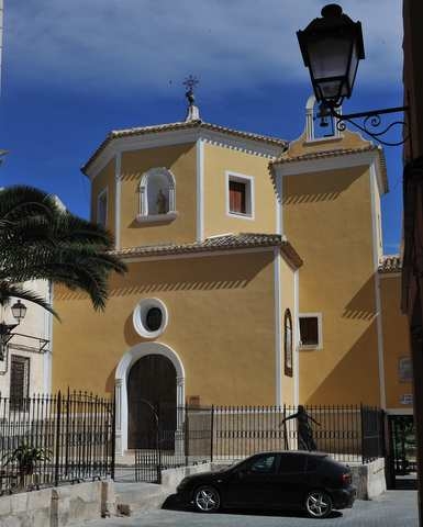
One legend related to this event concerns a mute woman, who was so terrified when she saw the attackers approaching that she ran to the church of San Bartolomé and shouted “Moros vienen!” (the Moors are coming). There is a sculpture recounting this legend outside the church today.
Cieza was not officially liberated until the fall of Granada in 1492, and it was only on 20th March 1494 that its prestige was restored and it was officially recognized by the Crown.
Cieza from the 16th century onwards
By the 16th century Cieza was on the road to recovery after the tragedy of 1477, and the population had once again reached 160 when a group of families belonging to the nobility considered it to be in their interests to purchase the main administrative posts in the town from the Crown. In this way they took control of the council, and part of the common land was governed by landowners.
One of the main policies of the Catholic Monarchs in the late 15th and early 16th centuries was to impose the Catholic religion on all those living in their kingdom, but in Cieza the situation remained both complicated and conflictive. The Jews were expelled from Spain, and the Mudéjars who wished to stay were obliged to convert to Christianity, being known from this point onwards as “Moriscos”.
A papal bull issued by Julius II in 1505 converted the mosques of the Ricote valley into Christian churches, and when it transpired that despite changing their religion the Moorish inhabitants were still treated as 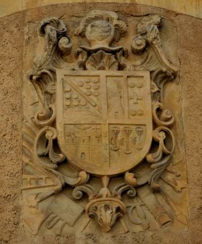 secondary citizens in terms of their rights and taxation, they staged a rebellion in 1517 which was not overcome until the following year.
There were numerous conflicts among the ruling families in Cieza throughout the seventeenth century until 1674, when Carlos III sent the Marqués de los Vélez to mediate in the disputes. He was aided in this mission by the Franciscan monks of the Convento de Santa Ana in Jumilla, who later founded the Convento de San Joaquín in Cieza in 1699.
Despite these altercations, the importance of Cieza was growing, and in 1673 it was officially named the main town in the Ricote valley, over which it governed from then on.
The church dedicated to La Asunción was built in the early 18th century, when the town was protected by four militias paid for by the inhabitants, and between 1701 and 1713 the residents supported the cause of Felipe V of Borbón in the War of the Spanish Succession. During this period fighters from Cieza took part in the Battle of Huerto de las Bombas on 4th September 1706 and the Battle of Zambrano. When victory was eventually achieved Felipe showed his gratitude for the support given to hundreds of towns and cities, and Cieza was no exception: it received the title of “Muy noble y muy leal” as well as favourable economic and financial treatment which spurred development and growth throughout the rest of the 18th century.
During this period other important monuments were built in Cieza, including the church of San Bartolomé next to the Casa de la Encomienda (which was occupied by the governors of the Order of Santiago) and the Convent and Church of the Real Orden de Madres Descalzas de la Regla de Santa Clara.
By the start of the 9th century the population of Cieza had risen to over five thousand, but the Peninsular War of 1807-14 against the occupying force sent by Napoleon brought disaster to the town. French troops ransacked and pillaged here for three whole days, initiating an economic depression which would last until the 1830s. The key to the reawakening of agriculture and the local economy is generally held to have been the introduction of water wheels for irrigation, which increased the amount of arable land by around 15% and thus encouraged growth and expansion. By the end of the century these water wheels were a common sight in the area around Cieza, with well over twenty of them known to have been in existence as the town approached the onset of the twentieth century – some of them still stand and can be visited in the 21st century, including the Noria de la Garulla.
The local economy no longer depended on silkworms, and at the same time, the demand for esparto grass ensured that small-scale industry grew up alongside the agricultural traditions of Cieza, and as the Order of Santiago was finally forced after over 500 years to relinquish control over the area, confidence grew. In 1873 the independent (and short-lived) Canton of Cieza was proclaimed, as a wave of federalism washed over Spain during the First Republic.
Throughout the late 19th and early 20th centuries political power in Cieza was held by the Conservative party, 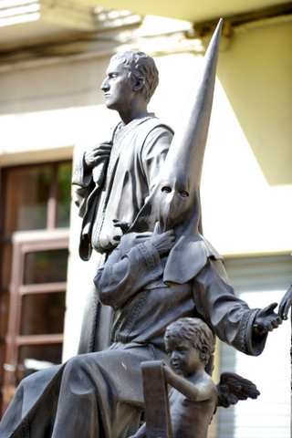 and their heavy taxation caused fervent opposition which sometimes resulted in revolts. One of these, in 1903, had to be stifled by the army, but the formation of trades unions resulted in the election of the first Socialist councillors in 1920.
By the 1930s the population had soared to almost 18,000, but the decline of the esparto grass industry led to hard times, strikes and protests in the period leading up to the Civil War. The demand for esparto grass increased markedly under Franco’s dictatorship and by 1940 there were around 24,000 people living in Cieza, but this figure stagnated over following decades as synthetic fibres sounded the death knell for esparto businesses. As happened in many parts of the Region of Murcia, those who were unable to find work emigrated to Catalunya and France in the 1950s and 60s, and it was not until the end of the dictatorship that the development of other industry and the opening of the Tajo-Segura water supply canal provided a solid basis for further growth.
Nowadays, industry and agriculture have combined to provide the main economic activity in Cieza: peaches. Both the natural product and canned peaches have flourished in the area, and this sector now provides the backbone for a local economy which first made the transition from a hunter-gatherer existence to agriculture approximately 7,000 years ago.
article_detail
Find more information by AREA, TOWN or URBANISATION .....
Cabo de Palos
Cartagena
El Carmoli
Islas Menores and Mar de Cristal
La Manga Club
La Manga del Mar Menor
La Puebla
La Torre Golf Resort
La Union
Los Alcazares
Los Belones
Los Nietos
Los Urrutias
Mar Menor Golf Resort
Pilar de la Horadada
Playa Honda / Playa Paraiso
Portman
Roldan and Lo Ferro
San Javier
San Pedro del Pinatar
Santa Rosalia Lake and Life resort
Terrazas de la Torre Golf Resort
Torre Pacheco
Aguilas
Aledo
Alhama de Murcia
Bolnuevo
Camposol
Condado de Alhama
Fuente Alamo
Hacienda del Alamo Golf Resort
Lorca
Mazarron
Puerto de Mazarron
Puerto Lumbreras
Sierra Espuna
Totana
Aledo
Alhama de Murcia
Bolnuevo
Camposol
Condado de Alhama
Fuente Alamo
Hacienda del Alamo Golf Resort
Lorca
Mazarron
Puerto de Mazarron
Puerto Lumbreras
Sierra Espuna
Totana
Abanilla
Abaran
Alcantarilla
Archena
Blanca
Corvera
El Valle Golf Resort
Hacienda Riquelme Golf Resort
Lorqui
Molina de Segura
Mosa Trajectum
Murcia City
Peraleja Golf Resort
Ricote
Sucina
Abaran
Alcantarilla
Archena
Blanca
Corvera
El Valle Golf Resort
Hacienda Riquelme Golf Resort
Lorqui
Molina de Segura
Mosa Trajectum
Murcia City
Peraleja Golf Resort
Ricote
Sucina
Urbanisations
CamposolCondado de Alhama
El Valle Golf Resort
Hacienda del Alamo Golf Resort
Hacienda Riquelme Golf Resort
Islas Menores and Mar de Cristal
La Manga Club
La Torre Golf Resort
Mar Menor Golf Resort
Mazarron Country Club
Mosa Trajectum
Peraleja Golf Resort
Santa Rosalia Lake and Life resort
Terrazas de la Torre Golf Resort
La Zenia
Lomas de Cabo Roig
Important Topics:
CAMPOSOL TODAY Whats OnCartagena SpainCoronavirusCorvera Airport MurciaMurcia Gota Fria 2019Murcia property news generic threadWeekly Bulletin
CAMPOSOL TODAY Whats OnCartagena SpainCoronavirusCorvera Airport MurciaMurcia Gota Fria 2019Murcia property news generic threadWeekly Bulletin
Contact Murcia Today: Editorial 966 260 896 /
Office 968 018 268

